| USEFUL INFORMATION Copyright: What you can and
cannot do.
I claim copyright for all parts of this website and paper
publications resulting from it.
Now let’s deal with the details. I have made extensive use of topo maps and
GPS tracks prepared by the US government, and specifically by the USDA Forest
Service. All of that material is in the
public domain, and while I can use it without further permissions, I cannot
restrict others from using it. However,
when I crop a topo map that I have downloaded from the Forest Service website,
and put it dashed lines to show trails and other symbols, that improved product
is subject to my copyright. Others can
use the underlying topo map, but they require my permission to use my
improvements. Similar arguments apply to
any text material, layout, etc.
I grant to all users, free of charge, the right to print any material on this
website except that they may not prepare a publication for distribution at a
profit.
YOU CAN
(1) You may
print out copies of the web pages to help you with a hike. You can print out multiple
copies of web pages
of web pages for you hiking/biking group, but you cannot make a profit
on it.
(2) You can
even print out a copy of the whole book, but you cannot make a profit on it.
(3) You can
download material from this website to your smartphone, tablet, what ever similar
device, subject to the
restrictions below.
(4) You can
link to this website.
YOU CANNOT
(1) Copy, move,
etc any copyrighted material from this website to publically accessible
media.
You cannot publish a newsletter
or book, copy material to another website, post material on
Facebook, etc.
(2) Make use
of short quotations – allowed under “Fair Use” – without including, in a way
that
the user will
easily know, the source of the material.
BUT
I am a reasonable person and you can contact me at LNFTG14@gmail.com if you would like to seek
permissions or discuss financial deals. Return to top
**********
Safety in the Forest
I have seen lists of what you must take with you to be
safe. Many times the lists lose
credibility because they prescribe more than is needed for a particular hike.
Let me put some basics before you, and we will work together
on the important topic of safety.
1. The National
Forest is a forest; it is not a city park.
You have to take responsibility for you own safety.
2. Plan A is “Everything
works fine, whether I worry about it or not”.
Plan B is “Something may go wrong with Plan A, and I want to get home to
my loved ones in good shape.”
Prudent folks live by Plan B. If you are hiking a well-defined trail, you probably need
only a basic map. If you are going cross
country, you need a good paper map and a compass (Not your phone or GPS unit –
batteries run down). I mean a decent “Boy
Scout” compass. You cannot reliably
follow a straight course in rough country without a compass.
How do you get home if you sprain an ankle or suffer some
similar injury? For me, I often hike
alone and I take the following precautions.
I tell someone what trail I am going to hike and when I expect to be
home. Hiking alone, I rarely go cross country
– if I do I tell someone where I generally expect to be. I tell my wife, but you might want to leave a
note on the dashboard of your car. I
carry a police whistle – three short blasts on the whistle repeated at
intervals of a few minutes can be heard a very long way.
I hike with a serious walking stick – I plan to be able to hobble back to
the car.
How much water do you need?
In the high desert of the Lincoln National Forest you can use a lot of
water. Unless you have hiked in this
area regularly, budget a gallon of water per person per day. It is tiring to carry the weight of that
water, but it is much worse to collapse from dehydration.
Is it going to rain or get cold? I don’t hike alone in the back country in
the winter months – the cost of a sprained ankle could be death in a cold
night. Your rain slicker can also be a
wind breaker! Lightning is especially common during July and
August, the summer rainy season. Stay away from fields and ridges, and lone
trees.
I hope you catch the idea.
No need to carry an explorer’s pack on an afternoon walk around the Osha
Trail. On the other hand, enough things can happen on a hike down long and
rocky Alamo Canyon that someone ought to know that you are there.
Think BIG --Brain
In Gear – and you can have wonderful experiences in the Lincoln
National Forest. Return to top
**********
Electronics and the Forest
Talk about the bad and the good – that describes electronics
and the forest.
First the risky part.
GPS units, smart phones, cell phones ---all those neat gadgets run on
batteries, and batteries run down. Cell
phone service is usually good near Cloudcroft and Ruidoso (but not High Rolls)
and falls to nothing a few miles away.
You cannot count on downloading maps or calling for help in remote
areas. You need the basic safety
precautions: paper maps, non-electronic compass, a police whistle, and good sense. Plan A is the dangerous assumption that nothing will happen. Plan B gets you home even if your electronics
fail you.
Now the really neat part.
GPS in the forest is lots of fun.
A friend sent me the GPS coordinates for two UGGS geodetic markers and I
hiked to within five meters of each and found them. Then, of course, I took measurement to see just how accurate
and precise my GPS really was. I have
downloaded GPS tracks for obscure trails and “tracked toward them” when I came
to unsigned road intersections. I have captured
tracks and waypoints so that I know just where I was when I took that wonderful
picture. The GeoCache folks think they
have most fun of anyone.
You can download a free topo map of New Mexico that can be
installed in the appropriate Garmin GPS units from the following source: http://www.gpsfiledepot.com/
And I have to share this:
In the Garmin manual that came with my GPS unit, it says something like: “If you see a cliff and the map in your GPS
unit says there is not a cliff, believe your eyes.”
Think about it: Make
sure that you have a non-electronic Plan B that gets you home safely, then
enhance your fun with the electronics! Return to top
**********
What can I ride on in the
forest? Where?
First, think about motorized versus non-motorized. Non-motorized – people on foot, horses, and bicycles – can go anywhere in the Lincoln
National Forest, except areas that are
specifically restricted such as habitat recovery areas. You do not have to stay on trails; it is OK
to go cross country. . Sometimes the Forest Service will close
established trails or roads to allow recovery from erosion or other damage. Note however, that some trails are closed to bicycles
and/or horses. One way to find out about
such restrictions is to check out the links on the right hand side of the
Recreation web page on the Forest Service website. The links labeled “All Trails for …. District”
not only list the trails but also list the allowed uses.
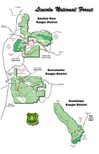
Links to copies of these files are provided below: Guadalupe Ranger District Sacramento Ranger District Smokey Bear Ranger District
NOTE: I will try to keep these up to date, but best idea is to check with material on the Forest Service website.
Motorized --motorcycles, ATVs, jeeps, etc --users need to obtain a current MVUM [Motor
Vehicle Users Map] free from a Forest Service office, and follow the
restrictions and permissions in that map.
In general motorized traffic is restricted to established routes and may
not go cross country. Return to top
*********
Can I make new trails?
Even though non-motorized users are not restricted to established
roads and trails, they may not “improve the path”, “move that brush”, etc. The creation of new trails requires
environmental assessment through the NEPA process, and that process should not be short-circuited by individuals. Return to top
**********
Forest Service Website and
Resources
I encourage you to visit the Lincoln National Forest website and learn about the many resources they
provide. Click on “Recreation” and go
from there. On the home page, over on the right hand side, click GIS resources
and check out the many kinds of information that are available for download,
including GIS files and topo maps. Hint:
Click on the GIS link, and scan down to the yellow “Softcopy Primary base
Series” bar. Return to top
*********
Using the New Version of the
Trail Guide: Lincoln National Forest
John Stockert worked and worked and produced a wonderful
paperback book, Trail Guide: Lincoln National Forest. My dog-eared copy is here beside me, and on
hikes it is a welcome companion. However,
the last update was in 2002, and trails have changed. New trails have been added, fire and flood
have destroyed some trails. The book,
ink on paper, cannot change to match these changes.
In bringing the Trail Guide up to date, I have created a web
site http://www.lincoln-nf-trails.org
Now I can regularly update the website and users will have
access to the changes on a timely basis.
The book is printed from an electronic files that I supply to a
print-on-demand publisher. As changes
occur, as the web site is updated, I will revise the electronic file, and new orders
for the book will get the up to date version.
The web site also takes advantage of links and downloads of
files. For each trail that appears on
the web site, the GPS track (as .gpx) can be downloaded. When looking for obscure or hard to find trailheads,
I routinely download the GPS track to my faithful Garmin handheld and follow my
progress as I encounter unsigned intersections and the like. The book can have only one size map. Many of the trail pages on the website
provide three maps: (1) a map at a size and resolution comparable to that in
the book, (2) a map of roughly the same area, but of much higher resolution so that
when the map is expanded electronically, fine details can be seen, and (3)
electronic copies of the Forest Service topo maps. Sometimes there a links to other sources of
information about the trails. The
website brings together many different types of information.
But we trail folk still need a paperback that we can stuff
in the knapsack and take with us. We are often beyond web access. Many areas in the Lincoln National Forest
have spotty or no cell phone signal.
Users still need to have basic information stored on paper – a book! The book is not as fancy as the web site – no
links, no colors, no downloads of maps and GPS tracks -- but in its basic way, it provides a steady
source of the core information.
Use them together and enjoy the Lincoln National Forest! Return to top
**********
What are GPX files?
Each manufacturer of GPS equipment has a preferred format
for saving GPS data. However, the GPX
format [GPS eXchange Format]
was developed so that users could read/exchange GPS data taken with other equipment. Return to top
*********
How can I make a profile of
the elevation changes along a trail?
The GPX files for data that I have taken myself (such as T10-LM.gpx) have the elevation data saved along with the coordinates. However the Forest Service GPX files (such as
T104-FS.gpx) do not have elevation data saved with the coordinates. For a long time I thought that users would
not be able to create trail profiles from the Forest Service GPX files. Not so—I found a neat website that takes any
GPX file, takes the coordinates to Google Earth, retrieves elevations, and
presents a trail profiles. Voila!
Here is the link: maplorer.com Click on the link and choose the “View GPX”
option. Click the “Browse” button, and browse to a
GPX file located on your computer.
If you don’t have one ready, you can download the Forest
Service GPX file for T10 Osha Trail from
the following link: T10-LM.gpx Just right click and download the file to a
convenient location on your computer. If
your browser is Firefox or Chrome, the download process will preserve the .gpx
file extension. If your browser is
Internet Explorer, it will insist on saving the file with an .xml file
extension , because GPX files are in XML format. Happily, the maplorer program does not care,
you can browse to GPX file with either a .gpx or an .xml extension, and it will
upload the file and display an elevation profile of the route defined by the
GPX file. Return to top
**********
What is UTM and why should I
care?
UTM stands for Universal Transverse Mercator
coordinate system, and that definition does not help you very much. The earth is close to spherical, and we all
have learned about latitude and longitude.
The latitude/longitude system works, but most users find it difficult to
translate differences in the latitude/longitude for two locations into a good
judgment of how to get from one location to the other and what the distance
between them is. In addition, as one
goes further from the equator, the distance associated with one degree of
longitude differs substantially from the distance associated with one degree of
latitude.
UTM divides the surface of the earth into 60 zones and
assumes that each zone is flat enough that it can be approximated by a
plane. Now we get back to those X-Y
graphs you hated in school.
In the description for T5005 Benson Canyon Trail you will
find the UTM coordinates for the lower trailhead lists as
13 S
433699
3633813
The “13 S” is the zone.
Don’t worry about it. All of the
Lincoln National Forest is in zone 13 S.
The next number is the “easting” in meters (not yards or
miles). If you will, it is the “X
coordinate”. The last number is the “northing”
in meters (not yards or miles). If you
will, it is the “Y coordinate”.
Now let’s do an example.
You may have read in the National Enquirer that the secret to long
life and good health is buried in a golden box at UTM 13 S 433649 3633883. The UTM coordinates of the T5005 trailhead
are 13 S 433699 3633813. What
do should you do to get the golden box? First drive to the T5005
trailhead. Once there, carry out the following calculation.
Easting: Target
X – Present X = 433649 – 433699 = -50
Northing: Target
Y – Present Y = 3633883 – 3633813 = +70
You will need to go 50 meters to the west in order to decrease your
easting. You will need to go 70 meters to the
north in order to increase your northing.
And, of course there is no need to do all of one before doing the other.
Note: If you and
meters do not get along very well, remember this. Distance in meters plus 10% of this
distance = distance in yards (close enough for trails). 50 meters is approximately 55 yards.
Take Home Message:
With UTM coordinates you can easily determine how far to go
Different devices have different ways to activate UTM. I can do it on my Garmin unit, and I am
pretty sure that you can delve down in the menus for your unit and choose to
have your location coordinates displayed as UTM.
On my Garmin, it does not matter which system I am using when
I take the data. When I change from lat/long to UTM the unit automatically changes
the display of the route coordinates. Return to top
**********
How can I buy the book?
First of all, Lynn Melton does not run a store, so don’t
even hope to buy one directly from me.
Right now the target date to have a revised version of the 6” x 9” book
out is between May 1 and May 15,
2014. When it comes out, you should be
able to buy it at any of the Forest Service offices in the Lincoln National
Forest. Matt Willett is likely to stock
it at High Altitude in Cloudcroft. Books
Etcetera in Ruidoso has stocked the Trail Guide in the past.
Vendors: If you want to stock the book and want your name
listed here, pop me an email : LNFTG14@gmail.com. Return to top
**********
About Lynn Melton
Lynn Melton taught chemistry and conducted nationally funded
research at the University of Texas at Dallas for 41 years before retiring in
2013. He also taught courses to help
middle school science teachers become better.
He still lives in Richardson, Texas, but between March and December he
tries to be at his cabin east of Cloudcroft for three week each month.
About 2005, he took advantage of the invitation in the
preface of John Stockert’s Trail Guide: Lincoln National Forest and got to know
John Stockert. There was a progression
from “I’ll help you get out a revised edition” to “I’ll take it on and you help
me” to John handing over all his original materials, with a devilish grin on
his face, as he realize how much space in his house
he would free up. Fortunately he has
been active in helping me put this new version together.
Lynn Melton has hiked all the official trails in the
Sacramento Ranger District of the Lincoln National Forest. In the Guadalupe Ranger District he has hiked
all but one of the trails near Sitting Bull Falls, all but one of the trails in
the south area, and few of the trails in The Cave Canyon area. He has relied on conversations with Tom
Rohrer, a longtime volunteer there, to fill him in. In the Smokey Bear Ranger District he has
hiked all of the trails in the Ruidoso area, and only few outside that area. He
has, however, driven to every trailhead in
the Smokey Bear Ranger District that is accessible by his high
clearance 4WD
vehicle. He has relied on the 2002 edition of the trail guide and
advice from individuals knowledgeable about various parts of the
Smokey Bear Ranger District to help him.
He has volunteered with New Mexico Rails to Trails and with
the Sacramento Mountains Historical Museum.
Return to top |