| Download T81 GPS Track (as .GPX) | Jicarilla/Carrizo Area Trails | ||||||||||||||||||||||||||
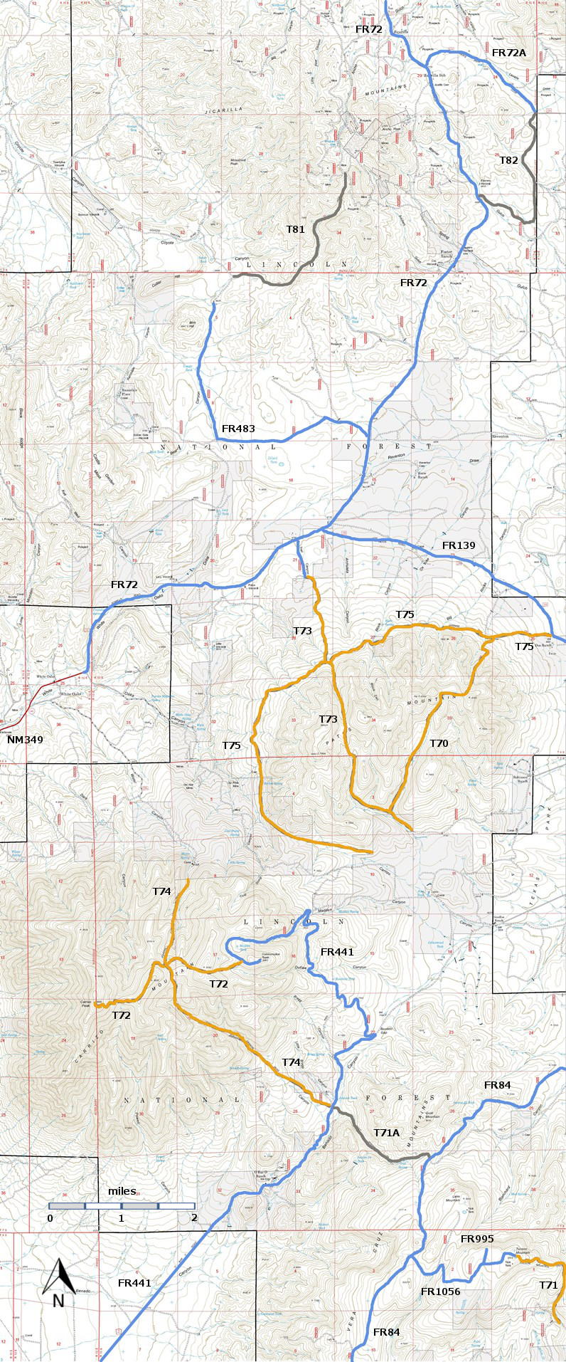
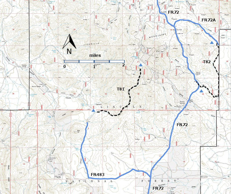
| T81 and T82 are shown as black dashed lines on the map. | ||||||||||||||||||||||||||||
 | ||||||||||||||||||||||||||||
| LENGTH: 2.5 miles | |||||||||||||||||||||||||||
|
ELEVATION: 6680 7560 ft 880 ft difference | ||||||||||||||||||||||||||||
| DIFFICULTY: Moderate | ||||||||||||||||||||||||||||
| SCENIC RATING: 1 | ||||||||||||||||||||||||||||
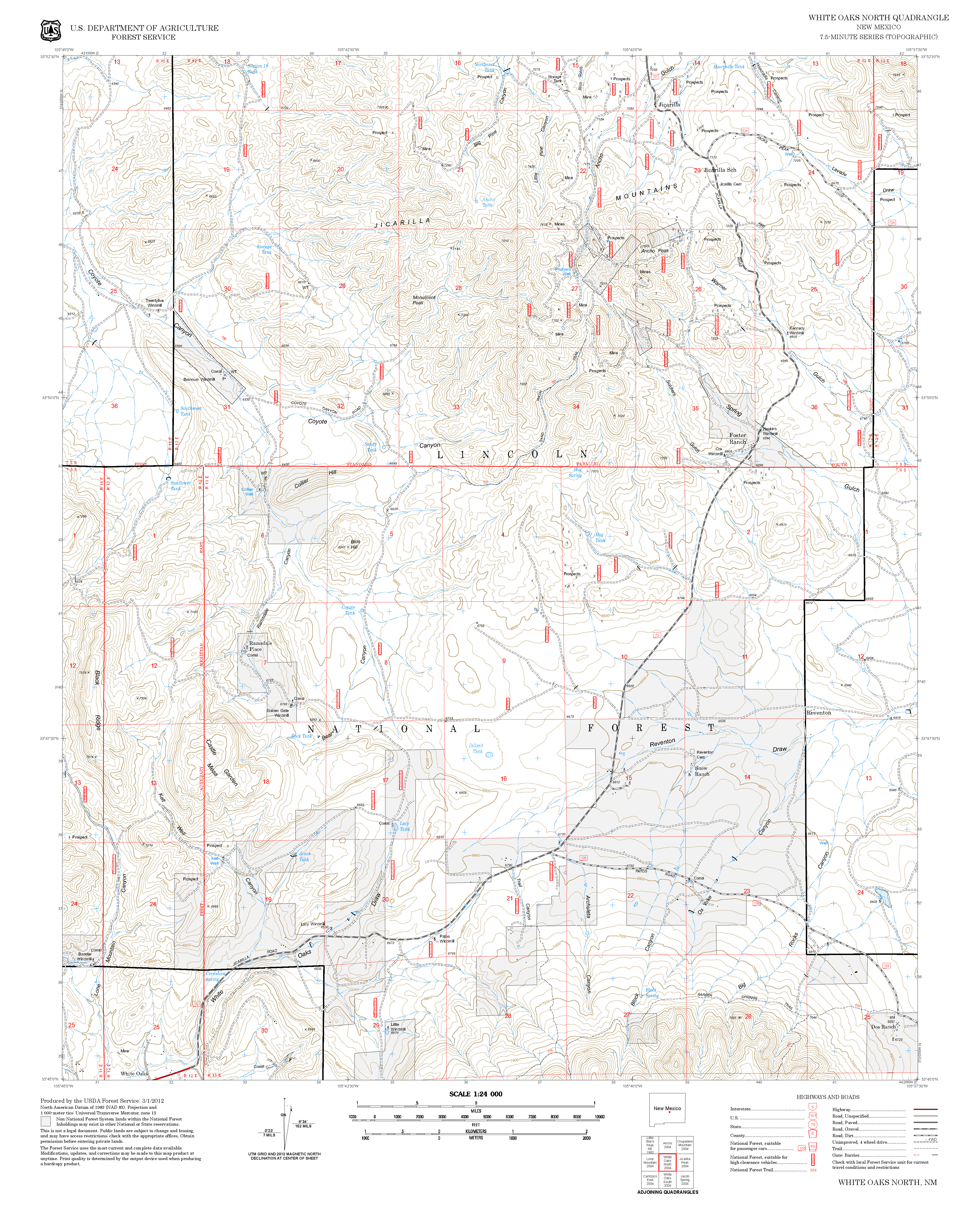
| Contour Interval: 40 feet Jicarilla/Carrizo Area Map (16MB) White Oaks North Topo Map | ||||||||||||||||||||||||||||
| ||||||||||||||||||||||||||||
DESCRIPTION: T81 runs near the bottom of Sand Wash, with an average
gradient of 7%. ACCESS: I met my match in trying to get to the trailheads for T81. To reach the south trailhead, start at the intersection of
US54 and US380 in Carrizozo, drive 3.3 miles north on US54 to paved County Road
349. Follow Co349 8.5 miles to the old
mining town of White Oaks. The road
continues as FR72, a well-maintained gravel road. Follow FR72, 5.4 miles to FR483. Turn left on FR483, a dirt road, and follow
it, opening and closing gates as necessary.
After 2.1 miles FR483 turns right. 1.8 miles further, I had to stop.
The road went into a sharp V-shaped draw, and I believed that my Jeep
would nose into the far side of the draw.
Later on I calculated that I was still 0.4 miles from the south T81
trailhead when I turned back. | ||||||||||||||||||||||||||||
| LOCATION(S) OF ACCESS POINT(S) | ||||||||||||||||||||||||||||
Table
| ||||||||||||||||||||||||||||
| ||||||||||||||||||||||||||||


