| Download T49 GPS Track (as .GPX) | White Mountain Wilderness Trails | ||||||||||||||||||||||||||
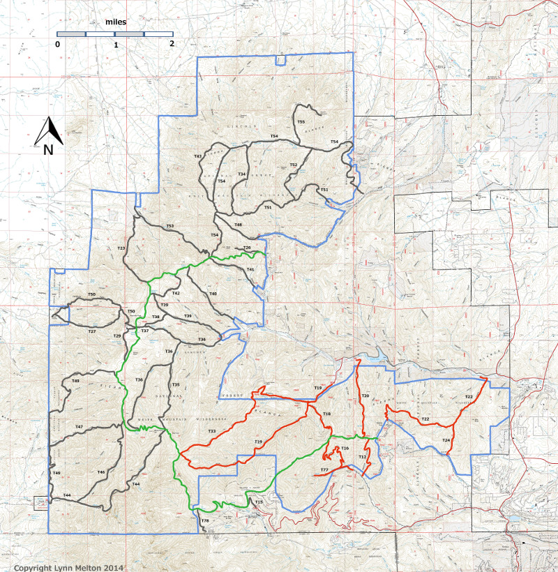
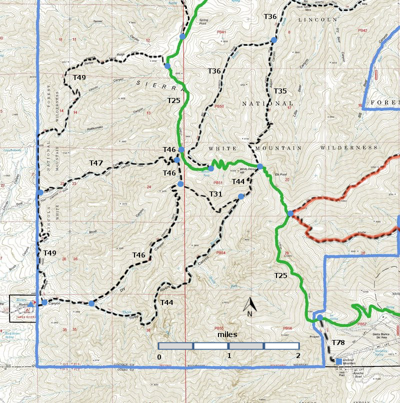
| T31, T35, T36 (partial), T44, T46, T47, and T49 are shown as black dashed lines on the map. The solid blue line is the border of the White Mountain Wilderness . The solid green line is T25 Crest Trail. The red over black dashes indicates that the trail is badly damaged and is closed to the public by Forest Service order. | ||||||||||||||||||||||||||||
 | ||||||||||||||||||||||||||||
| LENGTH: 5.8 miles | |||||||||||||||||||||||||||
|
ELEVATION: 6440 - 9000 ft 2560 ft difference | ||||||||||||||||||||||||||||
| DIFFICULTY: Difficult | ||||||||||||||||||||||||||||
| SCENIC RATING: 2 | ||||||||||||||||||||||||||||
| Download Forest Service Resource | ||||||||||||||||||||||||||||
| Contour Interval: 40 feet White Mountain Wilderness Trails (34 MB) Godfrey Peak Topo Map Nogal Peak Topo Map | ||||||||||||||||||||||||||||
| ||||||||||||||||||||||||||||
| T49 Barber Ridge Trail is not in the 2002 Edition of Trail: Guide: Lincoln National Forest, and I have not hiked it. | ||||||||||||||||||||||||||||
| The junction of T47 and T49 is 1.8 miles from the junction of T44 and
T49. A posting on the Lincoln National Forest website states t"Open
and available for use. Trail dead-ends at the Crest Trail (T25). No
access to the Crest Trail is currently allowed. " I have two judgments on T49. One source says the condition of T49 is "good". This description in this link is much more negative: http://www.ruidoso.net/visitors/outdoors/trailheads/threerivers.html. | ||||||||||||||||||||||||||||
| LOCATION(S) OF ACCESS POINT(S) | ||||||||||||||||||||||||||||
| ||||||||||||||||||||||||||||
| ||||||||||||||||||||||||||||


