| Download T37 GPS Track (as .GPX) | White Mountain Wilderness Trails | ||||||||||||||||||||||||||
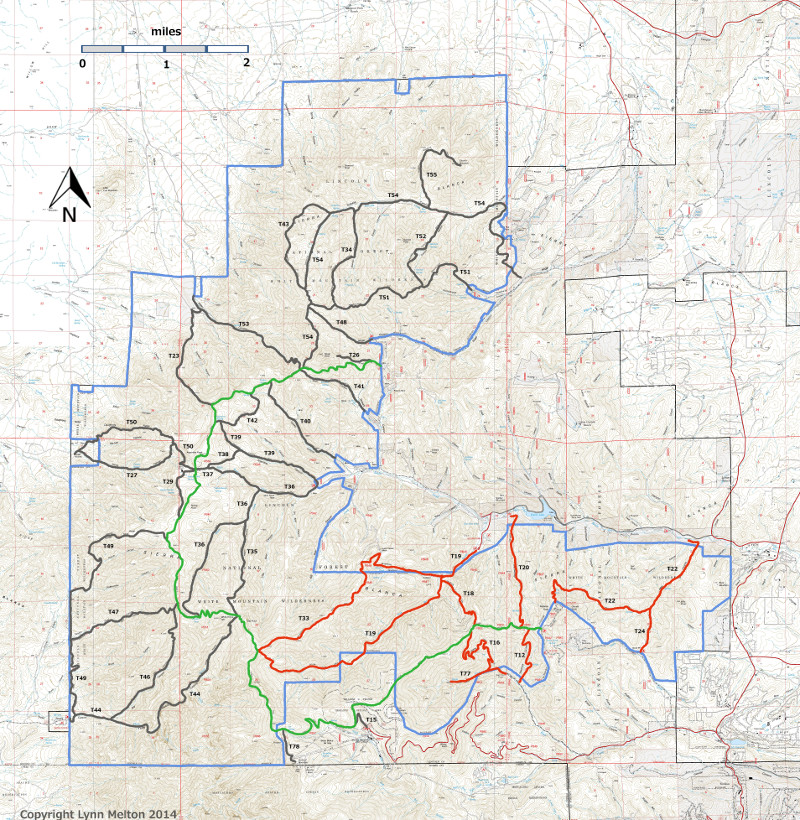
| T27, T29, T35, T36, T37, T38, T39, T40, T41 (partial), T42, and T50 are shown as labeled black dashed lines on the map. The solid blue line is the border of the White Mountain Wilderness . The solid green line is T25 Crest Trail. The red over black dashes indicates that the trail is badly damaged and is closed to the public by Forest Service order. | ||||||||||||||||||||||||||||
 | ||||||||||||||||||||||||||||
| LENGTH: 1.4 miles | |||||||||||||||||||||||||||
|
ELEVATION: 8060 - 8780 ft 720 ft difference | ||||||||||||||||||||||||||||
| DIFFICULTY: Moderate | ||||||||||||||||||||||||||||
| SCENIC RATING: 3 | ||||||||||||||||||||||||||||
| Download Forest Service Resource | ||||||||||||||||||||||||||||
| Contour Interval: 40 feet White Mountain Wilderness Trails (34 MB) Nogal Peak Topo Map | ||||||||||||||||||||||||||||
| ||||||||||||||||||||||||||||
DESCRIPTION: Check out the following link for more information: ACCESS: | ||||||||||||||||||||||||||||
| LOCATION(S) OF ACCESS POINT(S) | ||||||||||||||||||||||||||||
| ||||||||||||||||||||||||||||
| ||||||||||||||||||||||||||||


