| Download T226 GPS Track (as .GPX) | Guadalupe Ranger District Trails | ||||||||||||||||||||||||||
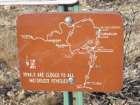
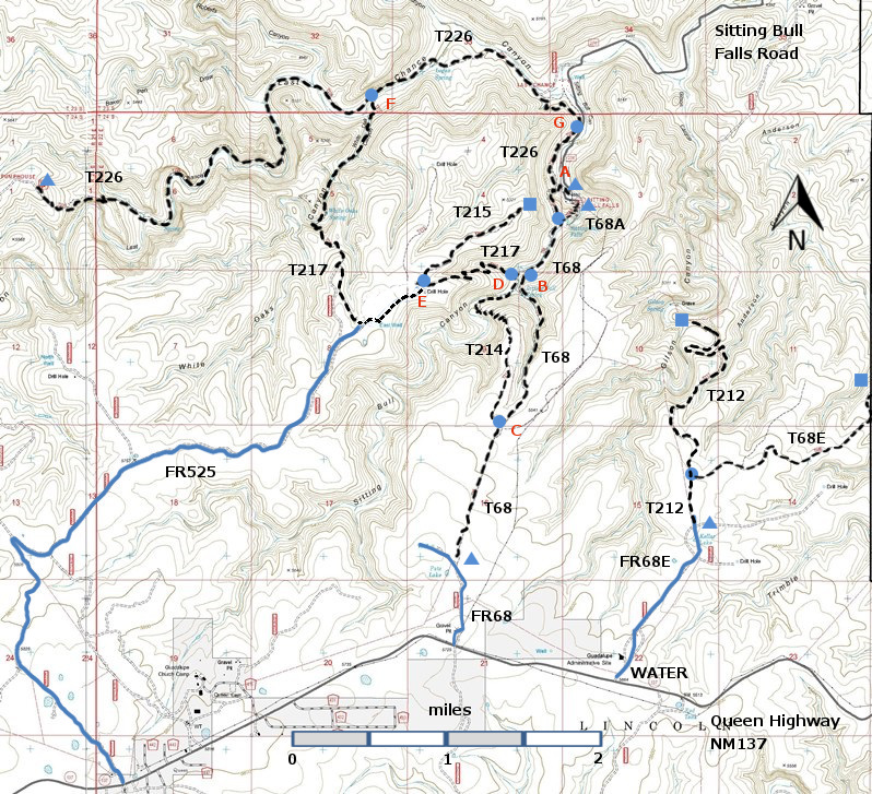
| T68, T68A, T68E, T212, T214, T215, T217, and T226 are shown as black dashed lines on the map below. The trail junctions in the Sitting Bull Falls Area are identified with a letter (A-G), red letters on the map. The photograph at the bottom right shows one such sign. | ||||||||||||||||||||||||||||
 | ||||||||||||||||||||||||||||
| LENGTH: 6.1 miles | |||||||||||||||||||||||||||
|
ELEVATION: 4700 - 5620 ft 920 ft difference | ||||||||||||||||||||||||||||
| DIFFICULTY: Most difficult | ||||||||||||||||||||||||||||
| SCENIC RATING: 5 | ||||||||||||||||||||||||||||
| Contour Interval: 40 feet Area Topo Map (36 MB) Six Topo Maps |
 | |||||||||||||||||||||||||||
|
NOTE: The Sitting Bull Falls Recreation Site, a
beautiful picnic and viewing site, was badly damaged by floods in Fall 2013 and
is closed, by Forest Service order, to public use until further notice. However,
there is a parking area just outside the gate to the Recreation Site, and
hikers should make use of this parking area. | ||||||||||||||||||||||||||||
CAUTION: The Sitting Bull Falls area was badly burned
in a fire in 2011. In
2012 I hiked up to Junction F, where T217 branches off. Forest
Service personnel have told me that the 2011 fire did not touch the
Last Chance Canyon bottom. Hopefully, the trail will soon be as lovely as John Stockert found
it in 2001. His description follows
(amended to include the Junctions). DESCRIPTION: Last Chance Canyon is an
unbelievable, natural gem that is as exceptional, rare and unusual, as nearby
Sitting Bull Falls. Resembling the
famous McKittrick Canyon in Guadalupe Mountains National Park to the south, the
canyon has sheer limestone cliffs several hundred feet high with two impressive
overhangs, and a deep canyon with distinctive riparian areas. A small portion
of the canyon floor includes clear pools and wide areas of flat, often step‑like,
slickrock up to 70 feet in width, with meandering streams and occasional small
waterfalls. As a result of the canyon's environmental diversity, an incredible
variety of vegetative species and wildlife make their homes here. Plan to spend a full day exploring this
magnificent hideaway of nature. For additional information about
Last Chance Canyon, see an excellent article in the June, 1996 issue of New
Mexico Magazine. ACCESS: To reach the lower trailhead, take
US285 northwest from Carlsbad (about 12 miles) to 0.6 mile beyond milepost 45
marking the junction with NM137, Queen Highway. Turn left and follow the paved
road 22 miles to milepost 32, the junction with FR276, Sitting Bull Falls
Highway (Also signed as County 409). Turn right and follow FR276 for 7 miles to the paved parking area, just prior
to entering the gated parking area at Sitting Bull Falls Recreation Site
(Junction G). The actual trailhead for
T226 is 0.6 miles south, toward the Sitting Bull Falls Recreation Site;
however, if one want to hike up Last Chance Canyon, Junction G is the starting point. | ||||||||||||||||||||||||||||
| LOCATION(S) OF ACCESS POINT(S) | ||||||||||||||||||||||||||||
| ||||||||||||||||||||||||||||
| ||||||||||||||||||||||||||||


