| Download T212 GPS Track (as .GPX) | Guadalupe Ranger District Trails | ||||||||||||||||||||||||||
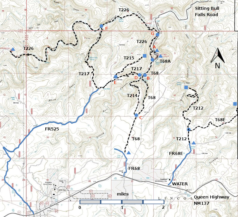
| T68, T68A, T68E, T212, T214, T215, T217, and T226 are shown as black dashed lines on the map below. The trail junctions in the Sitting Bull Falls Area are identified with a letter (A-G), red letters on the map. The photograph at the bottom right shows one such sign. | ||||||||||||||||||||||||||||
 | ||||||||||||||||||||||||||||
| LENGTH: 2.1 miles | |||||||||||||||||||||||||||
|
ELEVATION: 5020 - 5520 ft 500 ft difference | ||||||||||||||||||||||||||||
| DIFFICULTY: More Difficult | ||||||||||||||||||||||||||||
| SCENIC RATING: 2 | ||||||||||||||||||||||||||||
| Contour Interval: 40 feet Area Topo Map (36 MB) Six Topo Maps |
 | |||||||||||||||||||||||||||
|
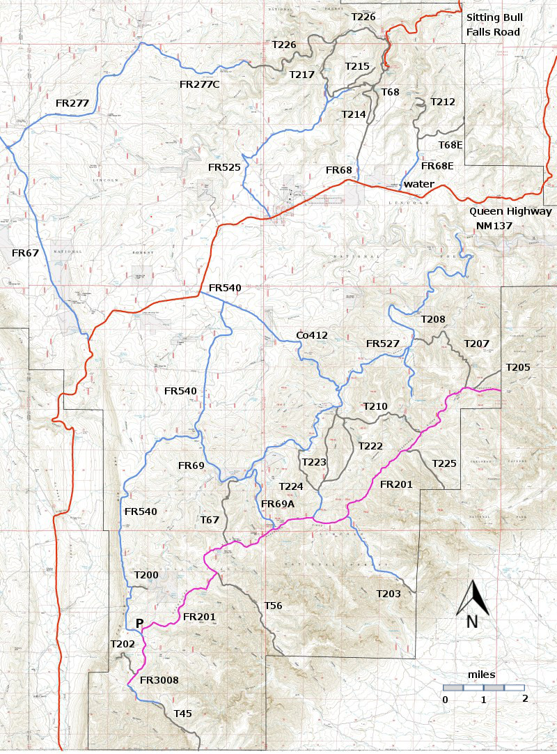
DESCRIPTION: T212 begins in the tableland just north of the Forest
Service Admin Center and descends into Gilson Canyon, where the ruins of the
old homestead are still present. For the
most part, T212 follows an old road, no bushwhacking and looking for faint
trails. The official trail runs 2.1
miles and ends short of the homestead.
One can hike 0.5 miles further, past the old corral, to the gravestone
of Henry Gilson, born in 1840 and killed in 1883. On the canyon wall opposite the homestead the
green streaks tell where the water for the vital spring emerges. ACCESS: | ||||||||||||||||||||||||||||
| LOCATION(S) OF ACCESS POINT(S) | ||||||||||||||||||||||||||||
| ||||||||||||||||||||||||||||
| ||||||||||||||||||||||||||||


