| Download T93 GPS Track (as .GPX) | Ruidoso Area Trails | ||||||||||||||||||||||||||
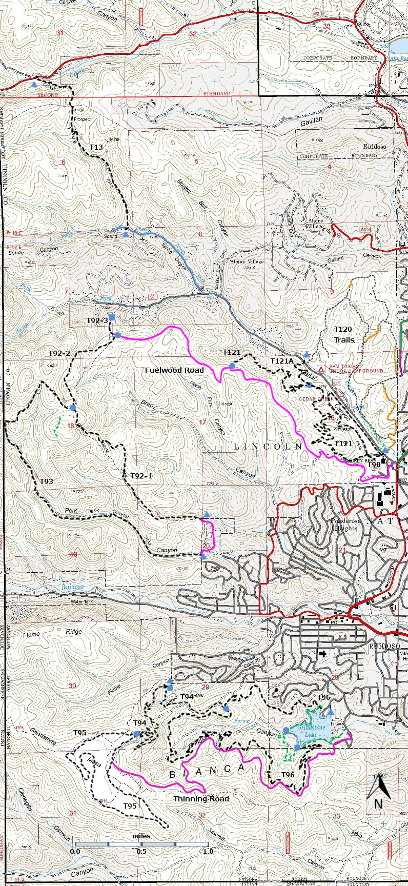
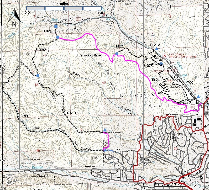
| T90, T92, T93, T121, and T121A are shown as black dashed lines on the map. There is no access across private land to Cedar Creek Road. | ||||||||||||||||||||||||||||
 | ||||||||||||||||||||||||||||
| LENGTH: 3.0 miles | |||||||||||||||||||||||||||
|
ELEVATION: 7040-7980 ft 940 ft difference | ||||||||||||||||||||||||||||
| DIFFICULTY: More difficult | ||||||||||||||||||||||||||||
| SCENIC RATING: 3 | ||||||||||||||||||||||||||||
| Download Forest Service Resource | ||||||||||||||||||||||||||||
| Contour Interval: 40 feet Ruidoso Area Map Full Topo Map | ||||||||||||||||||||||||||||
| ||||||||||||||||||||||||||||
|
DESCRIPTION: From its southeastern trailhead, T93
initially follows the bottom of Perk Canyon.
The trail crisscrosses a small stream and, in a small glen with maples,
there is a waterfall at mile 2.2 [18” high – but this is New Mexico – take what
you can get!]. The trail threads through a mostly mixed
conifer and oak corridor and climbs out of the canyon bottom to join T92 near
its high point. USE: Moderate SEASON:
Year-round, depending on the weather. ACCESS: The upper trail end cannot be
reached by car; but T93 can be part of a very nice loop hike as described
below. To access the lower trailhead, in
Ruidoso, go 1.3 miles south from Smokey Bear Ranger District Office along New
Mexico NM48 to where it turns left at a traffic light. This is the intersection
of Mechem and Sudderth Drive. Zero your trip odometer here. Turn right
and head west on Sudderth. At mile 0.2 from the traffic light, turn right at a
complicated intersection on unsigned Main Road, within view of a 1st National
Bank office. At mile 0.5, continue following Main Road as it angles right. At
mile 0.7, at the Story Book Cabins sign, turn right on signed, paved Ebarb
Drive. At mile 1.0, turn left on signed paved Perk Canyon Drive. At mile 1.5,
the road and pavement ends, and there is modest parking and the carsonite sign
for T93’ DISTANCES AND ALTITUDES: A very nice loop hike consists of starting
at the lower T93 trailhead (3.0 miles) and returning to the lower T93 trailhead
by taking T9 Perk Ridge Trail east to its end at the Forest boundary (1.7
miles) and Thunderbird Drive (0.4 miles) downhill to close the 5.1 mile loop. The altitude gain is 940 feet. Hikers who want a gentle, pleasant
hike may wish to hike up Perk Canyon and return by the same path. The gradient averages about 4% all the way to
the glen with maples at mile 2.2. | ||||||||||||||||||||||||||||
| LOCATION(S) OF ACCESS POINT(S) | ||||||||||||||||||||||||||||
| ||||||||||||||||||||||||||||
| ||||||||||||||||||||||||||||


