| Download T90 GPS Track (as .GPX) | Ruidoso Area Trails | ||||||||||||||||||||||||||
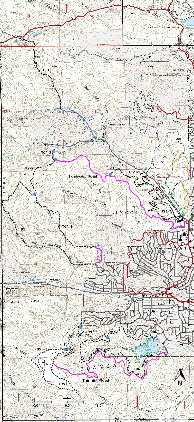
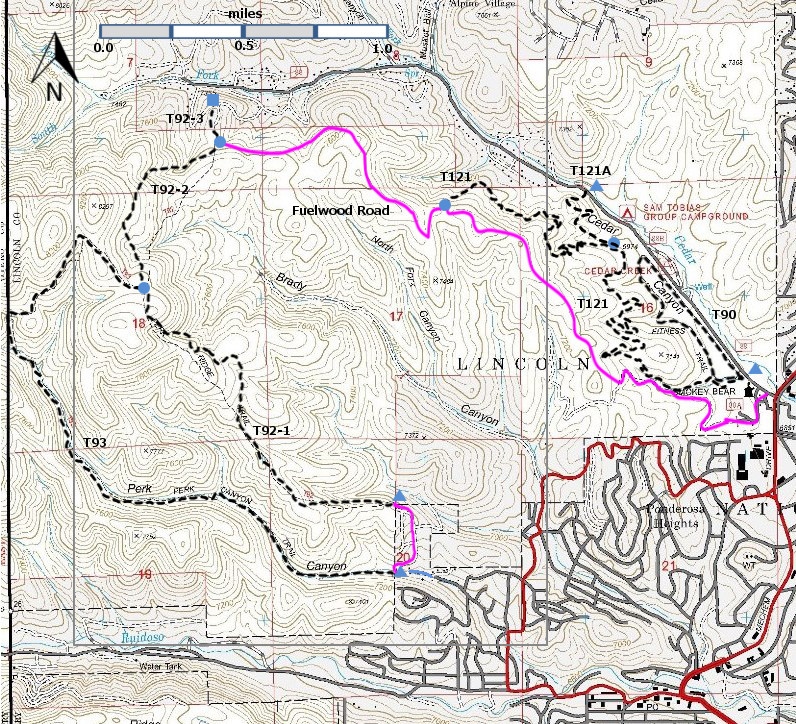
| T90, T92, T93, T121, and T121A are shown as black dashed lines on the map. There is no access across private land to Cedar Creek Road. | ||||||||||||||||||||||||||||
 | ||||||||||||||||||||||||||||
| LENGTH: 1.3 miles | |||||||||||||||||||||||||||
|
ELEVATION: 6880 ft little change | ||||||||||||||||||||||||||||
| DIFFICULTY: Easiest | ||||||||||||||||||||||||||||
| SCENIC RATING: 2 | ||||||||||||||||||||||||||||
| Download Forest Service Resource | ||||||||||||||||||||||||||||
| Contour Interval: 40 feet Ruidoso Area Map Full Topo Map | ||||||||||||||||||||||||||||
| ||||||||||||||||||||||||||||
NOTES: No vehicles of any kind are permitted,
including bicycles. Dogs are not
allowed. “The trail
offers a physical challenge regardless of age or conditioning and the chance to
improve fitness and health while having fun.
There are 14 exercise stations along a 0.25 mile jogging path. Jog on
the trail to strengthen heart, lungs, and legs. Build muscle strength by
performing the exercises, or do both for all around fitness...” ACCESS: In Ruidoso at Smokey Bear Ranger District Office, turn left off Mechem Drive ( NM48) onto Cedar Creek Road (FR88). The parking lot for the trail is on the left in 0.2 mile. There is also access at the northwest end of T90, 0.8 miles from the intersection of Mechem Drive and Cedar Creek Road, just across Cedar Creek Road from the Sam Tobias campground. | ||||||||||||||||||||||||||||
| LOCATION(S) OF ACCESS POINT(S) | ||||||||||||||||||||||||||||
| ||||||||||||||||||||||||||||
| ||||||||||||||||||||||||||||


