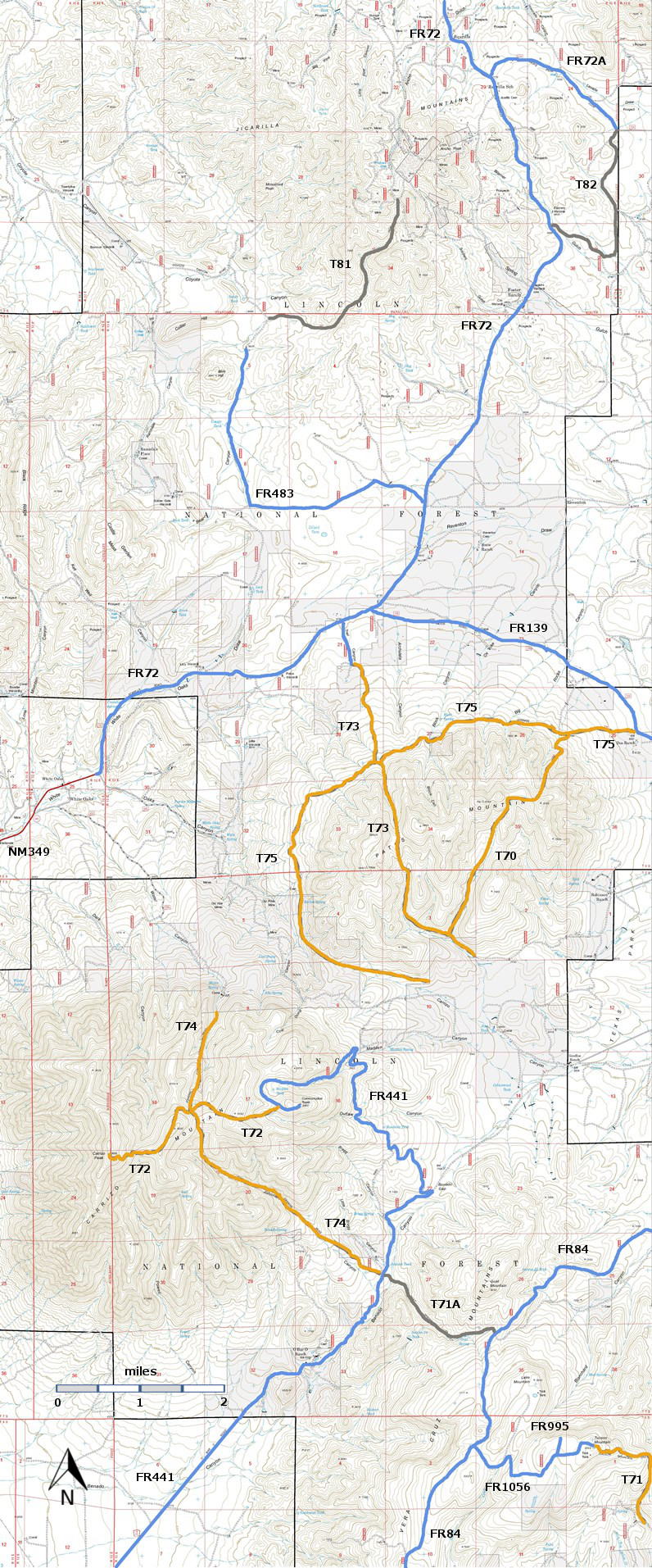
T82
Warner Gulch Trail


Smokey Bear Ranger District
TL-green-190.jpg
Download
T82
GPS Track
(as .GPX)
Jicarilla/Carrizo Area Trails
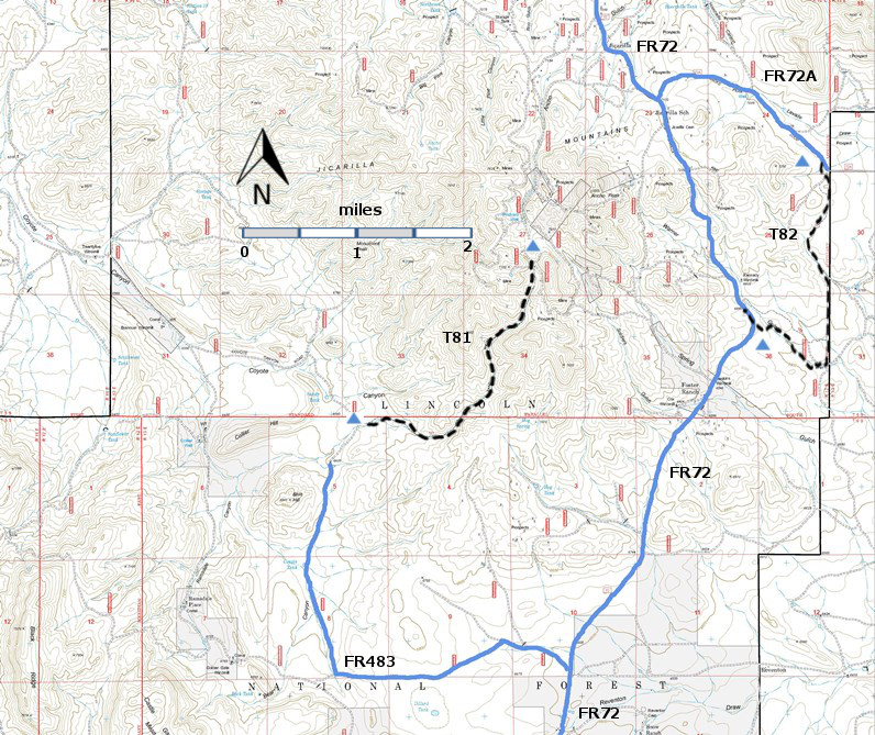
T81 and T82 are shown as black dashed lines on the map.
Jicarilla-mc-RTS-ir21.jpg

Jicarilla-mc-RiTS-n-r21f.jpg

LENGTH:
2.3 miles
ELEVATION:
6880 - 6980 ft
100 ft

difference
DIFFICULTY:Easiest
SCENIC
RATING:
1
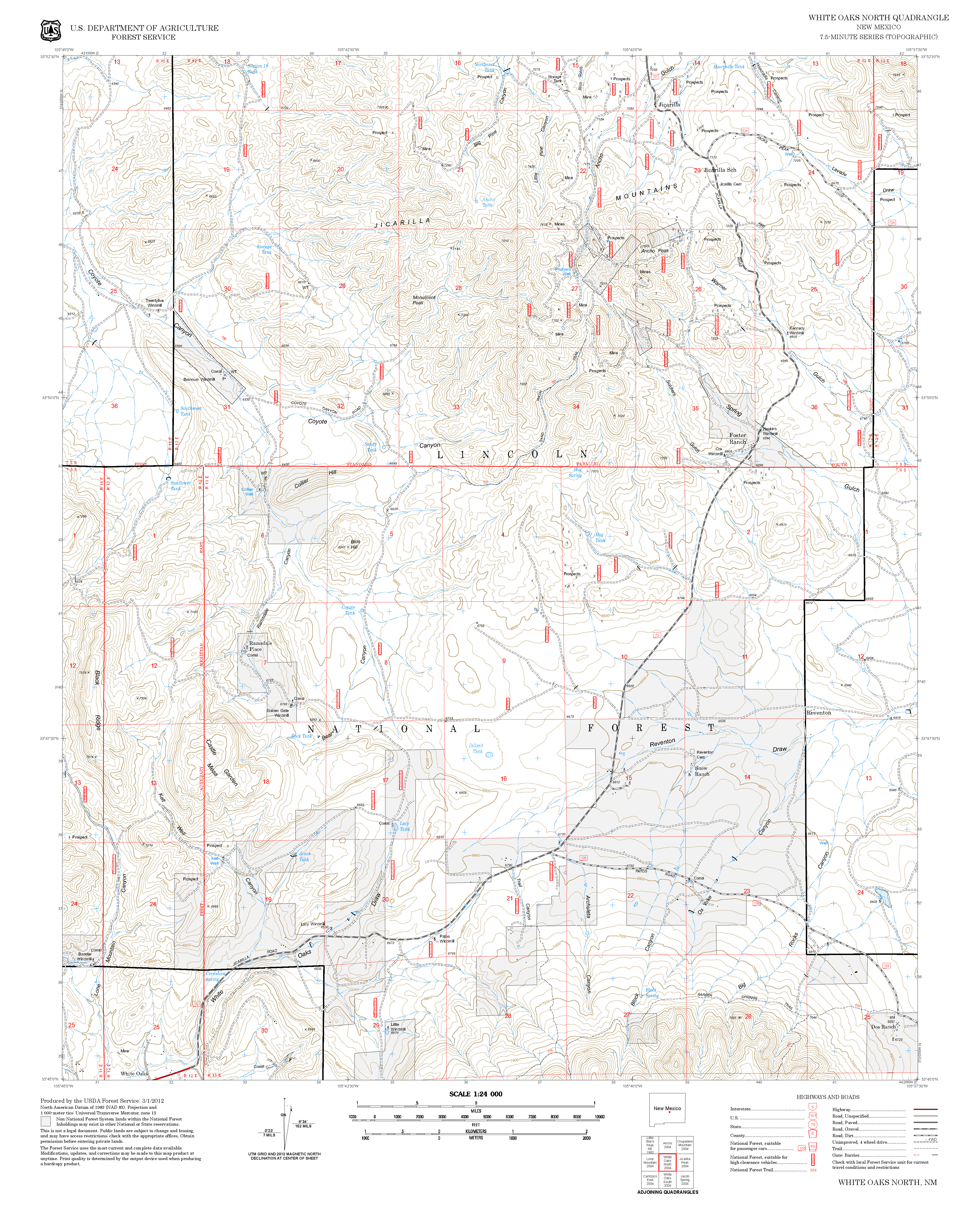
Contour Interval: 40 feet
Jicarilla/Carrizo Area Map (16MB)

White Oaks North Topo Map
Route Color Codespaved roads
(red)
FS roads, open
(blue)
FS roads, closed or impassable
(magenta)
main trail(s)
(black dashes)
---connector trail(s)
(green dashes)
---damaged or intermittent trail(s)
(orange over black dashes)
---closed trails(s)
(red over black dashes)
---
Symbolstrailhead
(blue triangle)
blue-triangle.jpgtrail junction
(blue dot)
blue-dot.jpgtrail end
(blue square)
blue-square.jpg

DESCRIPTION:

T82 is a road that has been designated as a trail. It has a very low gradient and runs, through the juniper woodland, near the boundary of the Lincoln National Forest.

ACCESS:

In an area with many bad roads, access to both trailheads of T82 is surprisingly easy.  From the intersection of US54 and US380 in Carrizozo, drive 3.3 miles north on US54 to paved County Road 349.  Follow Co349 8.5 miles to the old mining town of White Oaks.  The road continues as FR72, a well-maintained gravel road.  Follow FR72, 8.7  miles to the signed south trailhead for T82 on the right.  To reach the north trailhead for T82, continue on FR72 2.8 miles, through the old village of Jicarilla, to the signed junction with FR72A on the right. Follow FR72A, also a good gravel road, 1.9 miles to its end at private property.  FR9033 goes off to the right and a few yards further the carsonite sign for T82 will be found.
LOCATION(S) OF ACCESS POINT(S)
Lat/Lon hddd mm ss.sUTM/NAD83
North TrailheadN33 51 09.9
W105 37 57.4
13 S
441478
3746008
South TrailheadN33 50 20.4
W105 38 36.4
13 S
440467
3744491

Last Hiked:  Not HikedWeb Page Updated:February 19, 2014
Copyright Lynn Melton 2014Contact: LNFTG14@gmail.com