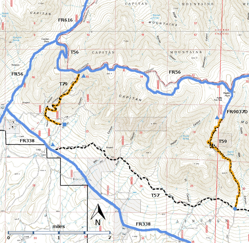
DESCRIPTION:
From
its upper trailhead, the wide path descends a steep, maximum 35% gradient, down
the mountainside with no switchbacks. It follows an old mining road with
somewhat unstable, small rocks, now grassing over, and goes through an abundance
of young Ponderosa pine mixed with pinyon. At mile 0.7 from the top, the trail
suddenly turns left at a somewhat hidden location and follows switchbacks with
great views, passing junctions to small, old mine diggings. Gradient is 25% or
less.
When
I asked a friend about T79, he said “The trailhead signs are there but it [the
trail] is gone.” The good news on this
hike is that, if you hike it downhill, you cannot really get lost. You may not have a trail, but you can aim for
the Bible Camp and eventually reach FR338.
ACCESS:
To access the upper trailhead,
a high clearance, 4‑wheel drive vehicle is necessary. Begin in Capitan at the
US380 and NM48 intersection. Drive US380
east 2.0 miles to FR56, Capitan Pass Road, also known as County Road C001. Turn
left and follow the route to the signed T79 trailhead at mile 8.5.
At
mile 5.4 from the junction of FR56 with US380, the maintained graveled road
turns right and becomes FR338, County Road C003. Do not turn right. Instead, proceed straight ahead on a rutty set
of tracks signed FR56. Do not attempt if wet. At mile 7.1 on Capitan
Pass, turn right and go another 1.4 miles, following the increasingly rocky and
steep road (up to 20% gradient) to the signed trailhead. For parking, seek a
wide spot along FR56.
To reach
the lower trailhead (former FR 9786), turn right at mile 5.4 on FR56
(discussed above) and follow FR338 just 0.3 mile east to a gate on the right to
Lone Tree Bible Camp. The turnoff to the trailhead for T79
would probably be on the left at this junction. Directions for reaching the lower
trailhead are currently not known. | 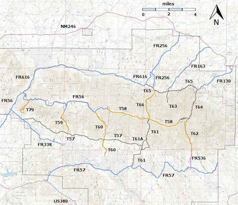


