| Download T74 GPS Track (as .GPX) | Jicarilla/Carrizo Area Trails | ||||||||||||||||||||||||||
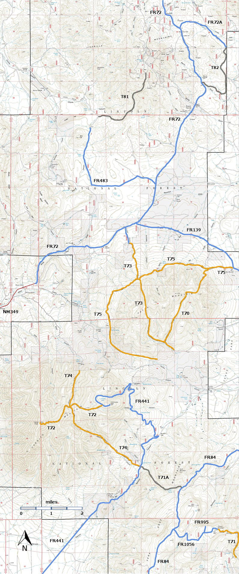
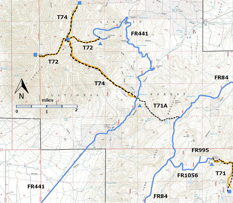
| T71, T71A, T72, and T74 are shown as black dashed lines on the map. | ||||||||||||||||||||||||||||
 | ||||||||||||||||||||||||||||
| LENGTH: 4.3 miles | |||||||||||||||||||||||||||
|
ELEVATION: 6900 - 8800 ft 1700 ft difference | ||||||||||||||||||||||||||||
| DIFFICULTY: Difficulty | ||||||||||||||||||||||||||||
| SCENIC RATING: 2 | ||||||||||||||||||||||||||||
| Contour Interval: 40 feet Jicarilla/Carrizo Area Map (16MB) White Oaks South Topo Map | ||||||||||||||||||||||||||||
| ||||||||||||||||||||||||||||
| NOTE: If T74 is used to reach Carrizo Peak, it is 4.4 miles one way, including 1.4 miles along a portion of T72, Carrizo Peak Trail. It is only 2.5 miles if Carrizo Peak is accessed directly from the T72 trailhead near the upper end of FR441, Carrizo Mountain Road. In other words, it is nearly four extra miles round trip, if Carrizo Peak is reached by hiking T74, in contrast to hiking all of T 72. However, the longer mileage route requires just a high clearance vehicle to access the T74 southeastern trailhead, whereas a 4‑wheel drive, high clearance vehicle is mandatory to follow FR 441 to the T72 trailhead! | ||||||||||||||||||||||||||||
|
DESCRIPTION: ACCESS: to
access the southeastern trailhead of T74, begin in Carrizozo at the
US380 and US54 intersection. Drive US380 east 8.7 miles to the
turnoff for signed County Road A010, also signed FR441. Turn left
and pass through a metal archway. At mile 4.9 from US380, angle
right at the O Bar O headquarters area. AT mile 5.3, drive through
the gate (leaving it open/closed as you find it), and proceed to mile
6.4 over rough road to the signed trailhead on the left. There is
no public access to the T74 trailhead on the northwestern side of
Carrizo Peak, near White Oaks. | ||||||||||||||||||||||||||||
| LOCATION(S) OF ACCESS POINT(S) | ||||||||||||||||||||||||||||
| ||||||||||||||||||||||||||||
| ||||||||||||||||||||||||||||


