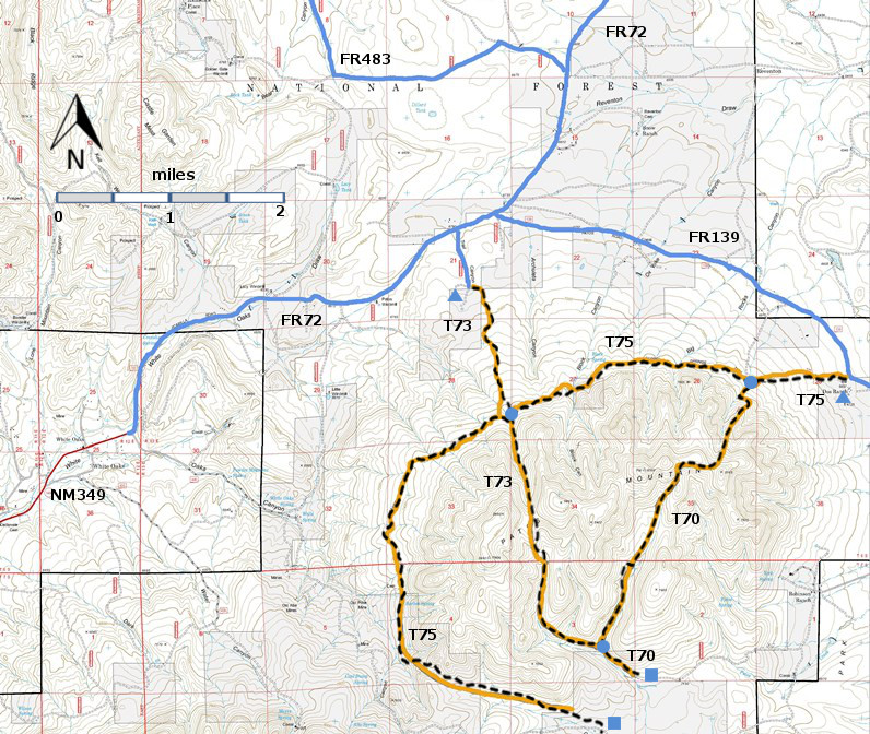
DESCRIPTION:
Note: In 2002 when John Stockert wrote the
description of T73 in the following paragraph, T73 began at its junction with T75
and ascended to the saddle. Currently, T73
begins 1.3 miles from its junction with T75 and extends 1.6 miles past the
saddle.
T73 is the
only trail of the three trails (T70, T73, and T75) not affected by the 1994
Patos Mountain Fire. It threads its way through unburned, treed areas; then
traverses nice meadows for 0.3 mile, beginning at mile 0.5 after leaving T75. Soon it arrives at a high, burned-over saddle
with good views. For the purpose of this book and mileage given, the trail ends
on this saddle, since it fades out just beyond.
Maximum
gradient along T73 is 40% for 0.2 mile, but averages 20% or less for the
remainder of the route. This path is worth the hike because it provides a
contrast between live canyon vegetation and the T70 area where everything was
burned in 1994.
ACCESS:
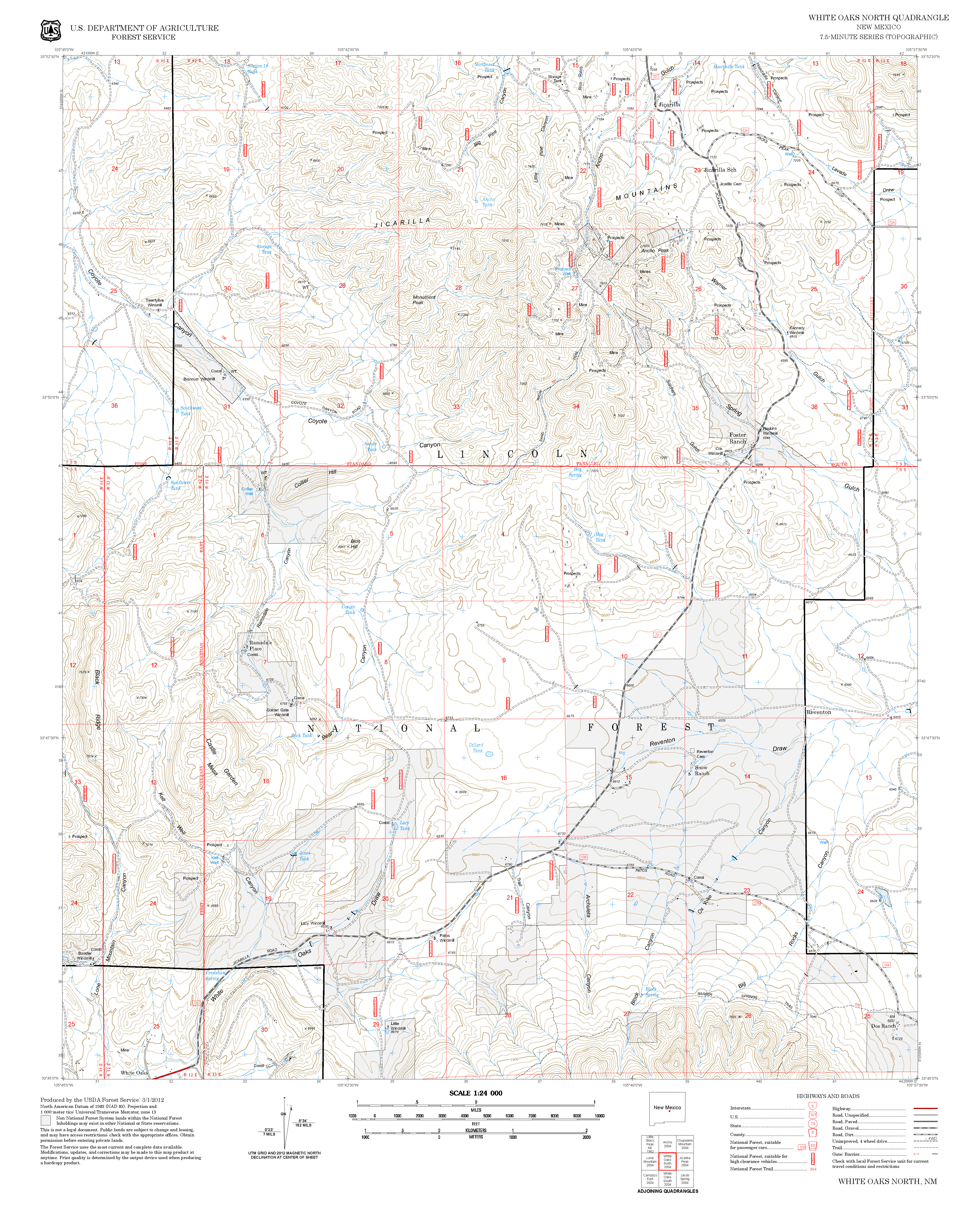
In an area with many bad roads, access
to the north trailhead of T73 is surprisingly easy. From the intersection of US54 and US380 in
Carrizozo, drive 3.3 miles north on US54 to paved County Road 349. Follow Co349 8.5 miles to the old mining town
of White Oaks. The road continues as
FR72, a well-maintained gravel road.
Follow FR72 3.6 miles to the intersection with FR9813 on the right. Leave the gate open or closed, as you find
it. Follow FR9813 0.5 miles to the
signed T73 trailhead. | 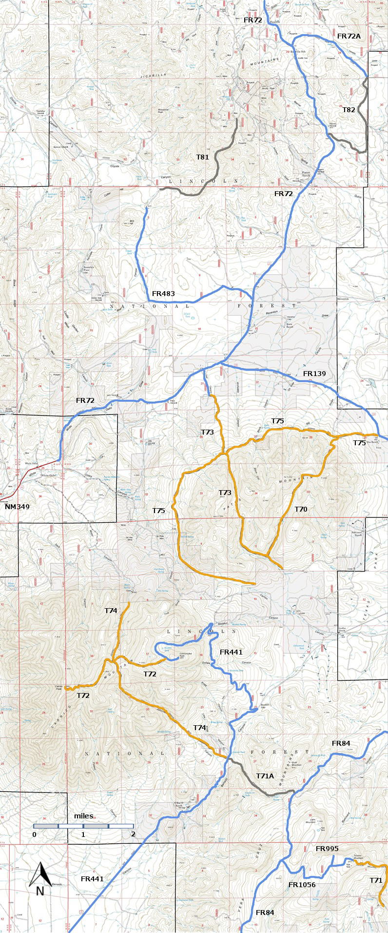


