| Download T72 GPS Track (as .GPX) | Jicarilla/Carrizo Area Trails | ||||||||||||||||||||||||||
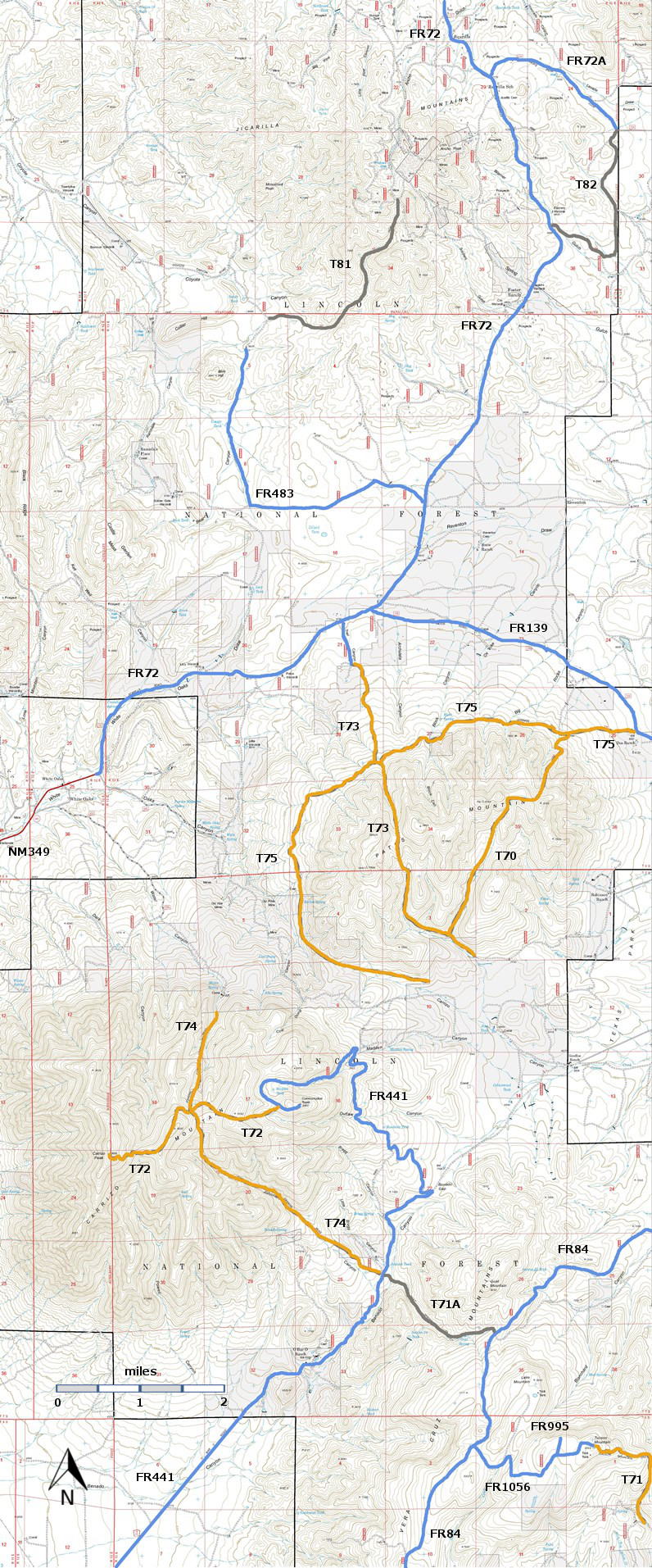
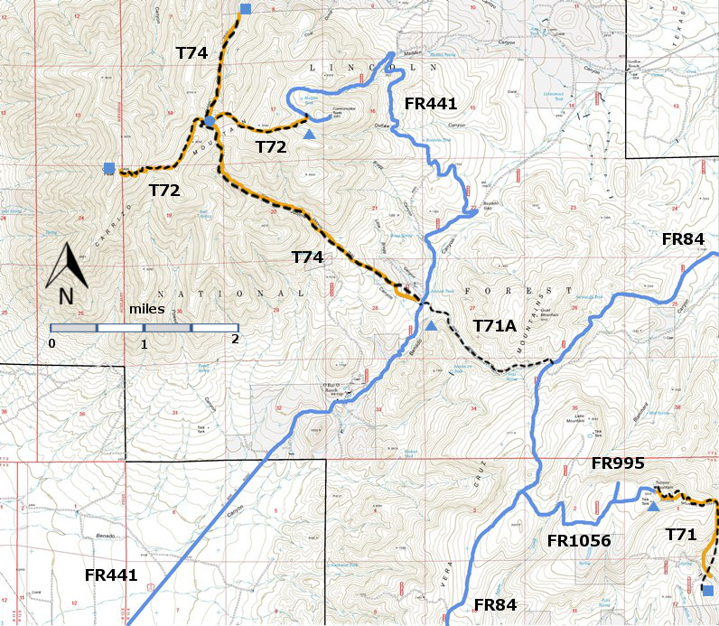
| T71, T71A, T72, and T74 are shown as black dashed lines on the map. | ||||||||||||||||||||||||||||
 | ||||||||||||||||||||||||||||
| LENGTH: 2.5 miles | |||||||||||||||||||||||||||
|
ELEVATION: 8720 - 9600 ft 880 ft difference | ||||||||||||||||||||||||||||
| DIFFICULTY: Most Difficult | ||||||||||||||||||||||||||||
| SCENIC RATING: 4 | ||||||||||||||||||||||||||||
| Contour Interval: 40 feet Jicarilla/Carrizo Area Map (16MB) White Oaks South Topo Map | ||||||||||||||||||||||||||||
| ||||||||||||||||||||||||||||
| NOTE: If T74 is used to reach Carrizo Peak, it is 4.4 miles one way, including 1.4 miles along a portion of T72, Carrizo Peak Trail. It is only 2.5 miles if Carrizo Peak is accessed directly from the T72 trailhead near the upper end of FR441, Carrizo Mountain Road. In other words, it is nearly four extra miles round trip, if Carrizo Peak is reached by hiking T74, in contrast to hiking all of T 72. However, the longer mileage route requires just a high clearance vehicle to access the T74 southeastern trailhead, whereas a 4‑wheel drive, high clearance vehicle is mandatory to follow FR 441 to the T72 trailhead! | ||||||||||||||||||||||||||||
DESCRIPTION: The first 1.1 miles of T72 (between FR 441 and the T74 intersection)
is a primitive track and sometimes unclear, except for many cairns and trail
blazes that delineate the route. Between the T74 intersection and Carrizo Peak, a well-constructed
trail exists much of the way. It threads through several small meadows, oak
thickets and stands of young Douglas‑fir, Ponderosa pine, and spruce, and into
a magnificent virgin forest. Due to frequent steep grades, hiking very slowly
along parts of the trail is paramount, if the hike is to be enjoyed. | ||||||||||||||||||||||||||||
| LOCATION(S) OF ACCESS POINT(S) | ||||||||||||||||||||||||||||
| ||||||||||||||||||||||||||||
| ||||||||||||||||||||||||||||


