| Download T71A GPS Track (as .GPX) | Jicarilla/Carrizo Area Trails | ||||||||||||||||||||||||||
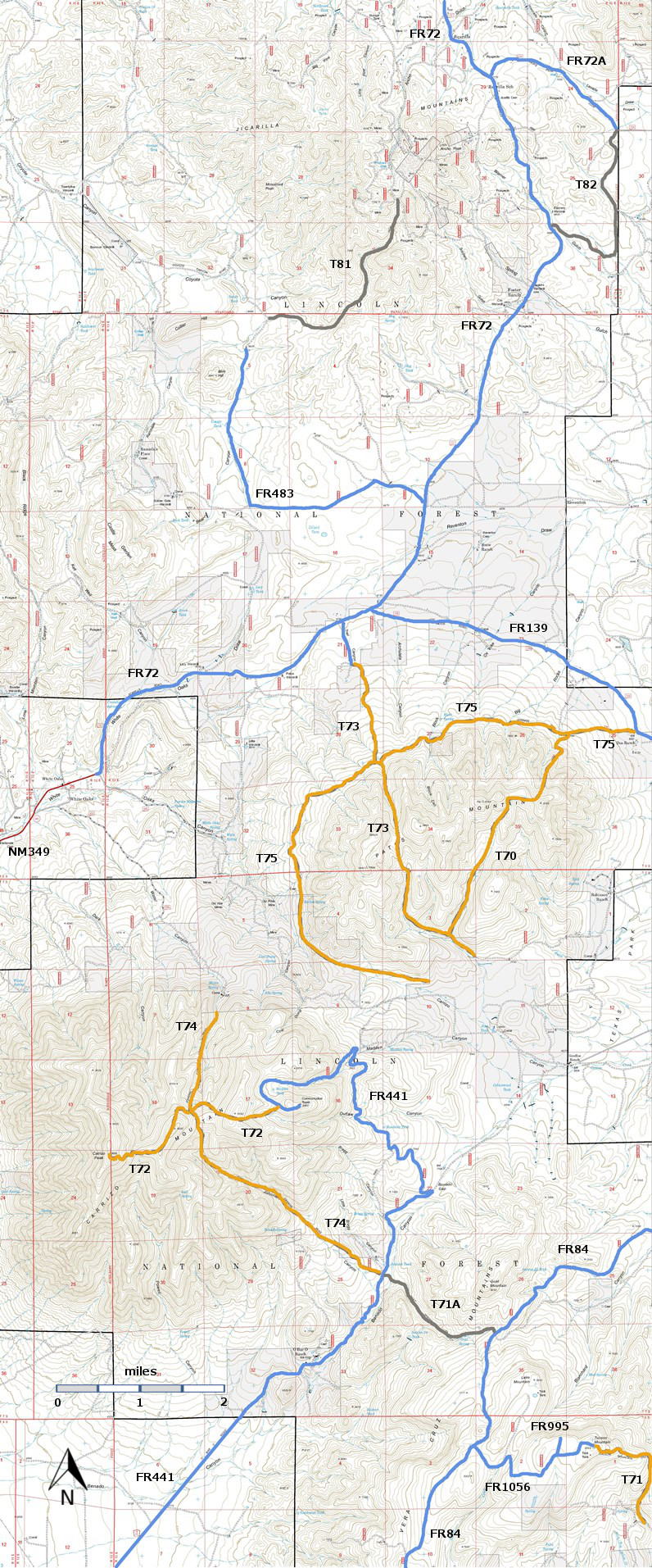
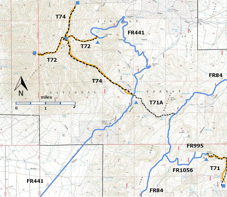
| T71, T71A, T72, and T74 are shown as black dashed lines on the map. | ||||||||||||||||||||||||||||
 | ||||||||||||||||||||||||||||
| LENGTH: 1.7 miles | |||||||||||||||||||||||||||
|
ELEVATION: 6900 - 7480 ft 580 ft difference | ||||||||||||||||||||||||||||
| DIFFICULTY: Easiest | ||||||||||||||||||||||||||||
| SCENIC RATING: 2 | ||||||||||||||||||||||||||||
| Contour Interval: 40 feet Jicarilla/Carrizo Area Map (16MB) White Oaks South Topo Map | ||||||||||||||||||||||||||||
| ||||||||||||||||||||||||||||
|
NOTE: Many years ago, a seven
mile long trail, Tucson Mountain trail ran from FR441 across Tucson Mountain
and down its eastern slope. That trail
was numbered T71. Only two segments of
that trail are now in use. T71A connects
FR441 and FR84, and T71 begins at the summit of Tucson Mountain and runs down
its eastern slope. However, the signage
at both ends of the the present T71A still says “T71 Tucson Mountain Trail”. To add to the confusion, at the time of the
2002 edition of the Trail Guide: Lincoln National Forest, the present T71A was
numbered T71. | ||||||||||||||||||||||||||||
|
DESCRIPTION: ACCESS: A high clearance vehicle, preferably 4‑wheel drive, is needed to reach
the eastern trailhead. From the US380 and US54 intersection in Carrizozo, drive
US380 east 13.6 miles to milepost 79. Just beyond milepost 79 turn left on
County Road C011 and follow it. At mile 1.6 from US380, C011 ends and FR84
begins as a very rough and rutty primitive road [Lynn Melton: “This is the
roughest road I have been on, lots of basketball sized rocks.”]. At mile 4.6,
continue beyond the earthen tank on the left along FR84 to mile 6.2. The
trailhead on the left is in a meadow on the downhill side, marked by a sign. | ||||||||||||||||||||||||||||
| LOCATION(S) OF ACCESS POINT(S) | ||||||||||||||||||||||||||||
| ||||||||||||||||||||||||||||
| ||||||||||||||||||||||||||||


