T70
Patos Mountain Trail


Smokey Bear Ranger District
TL-yellow-190.jpg
Download
T70
GPS Track
(as .GPX)
Jicarilla/Carrizo Area Trails
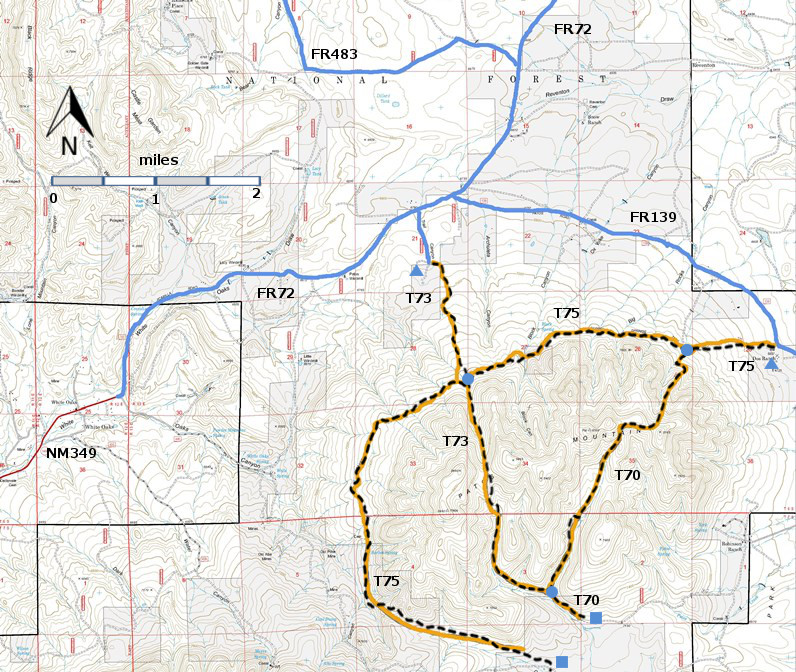
T70, T73, and T75 are shown as black dashed lines on the map.
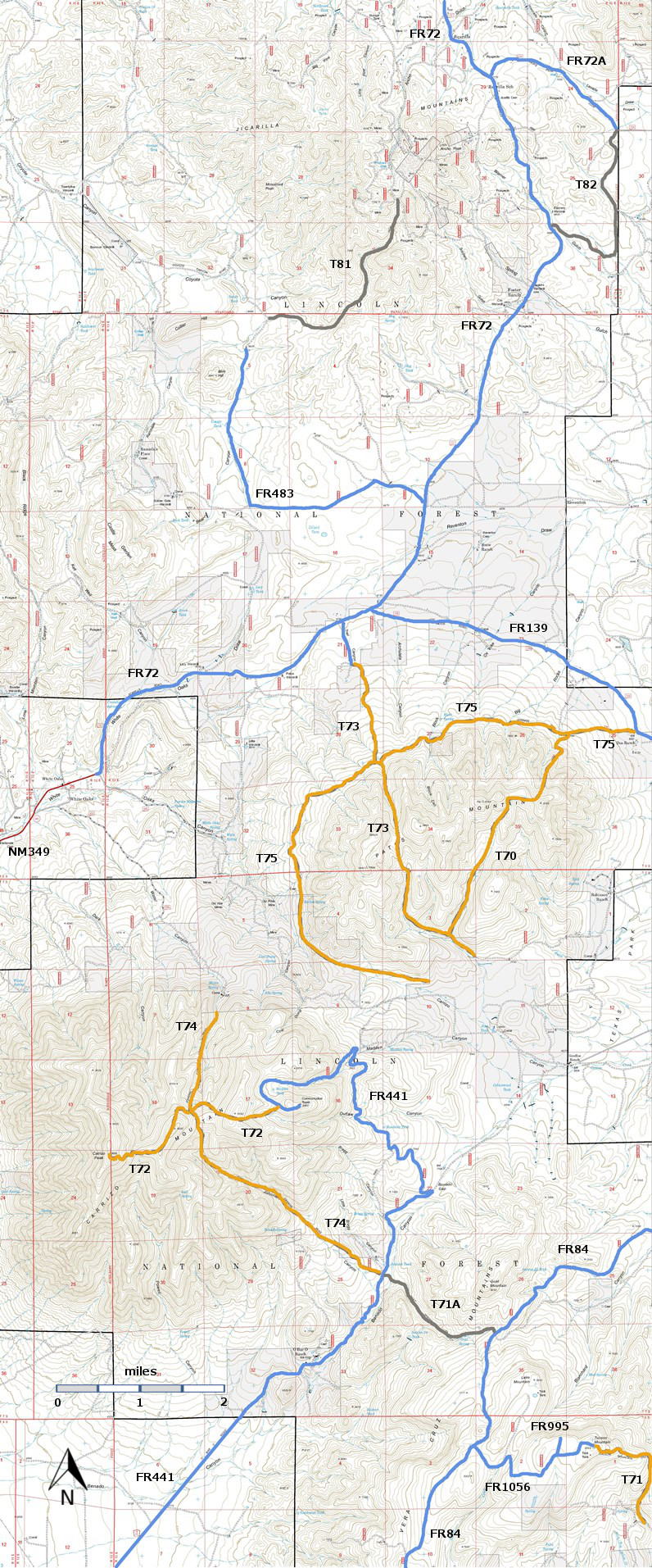
Jicarilla-mc-RTS-ir21.jpg

Jicarilla-mc-RiTS-p-r21f.jpg

LENGTH:
3.4 miles
ELEVATION:
7040 - 8000 ft
960 ft

difference
DIFFICULTY:
Most Difficult
SCENIC
RATING:
2
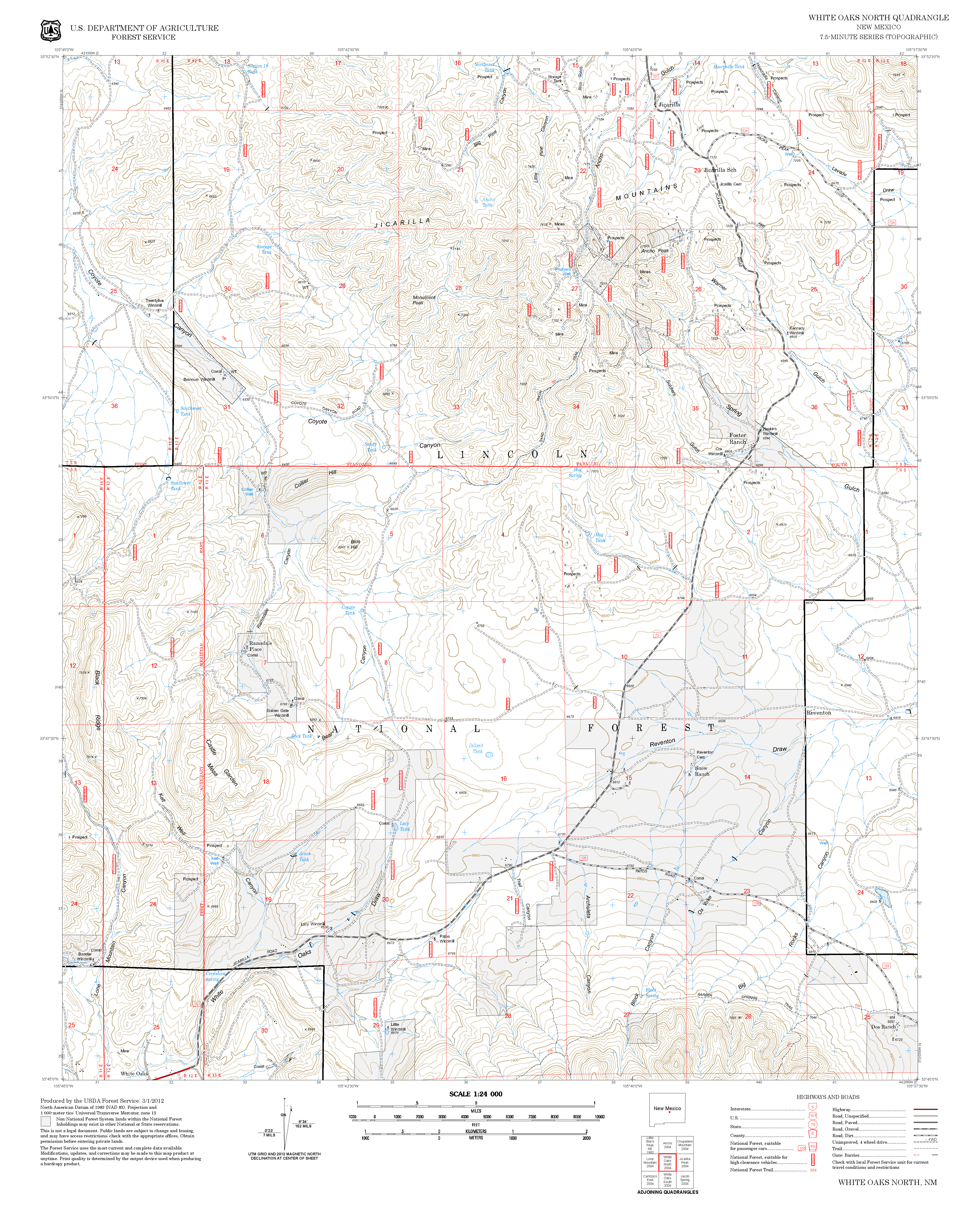
Contour Interval: 40 feet
Jicarilla/Carrizo Area Map (16MB)


White Oaks South Topo Map  White Oaks North Topo Map
Route Color Codespaved roads
(red)
FS roads, open
(blue)
FS roads, closed or impassable
(magenta)
main trail(s)
(black dashes)
---connector trail(s)
(green dashes)
---damaged or intermittent trail(s)
(orange over black dashes)
---closed trails(s)
(red over black dashes)
---
Symbolstrailhead
(blue triangle)
blue-triangle.jpgtrail junction
(blue dot)
blue-dot.jpgtrail end
(blue square)
blue-square.jpg
NOTE:  In early 2002 John Stockert found that, due to the 1994 Patos Mountain Fire, it was extremely difficult to follow T75 more than a mile from its lower trailhead.  Except for the lower T75 trailhead markers, no signs had been replaced since the fire.  Several unsigned, unofficial standard vehicle routes intersected the trail, making it difficult to stay on the correct path. The lower section of T70 was found to be nonexistent.  Before hiking these trails, contact Smokey Bear Ranger District Office to see if trail work has been performed and trail signs replaced. 

DESCRIPTION:

 The following description reflects trail conditions in 1994, shortly after the Patos Mountain fire.

 T70 passes through burned areas for its entire length.  The first 0.2 mile of the official route, (before reaching the first switchback that goes left) is currently unrecognizable, and must be cleared of fire debris.   Beyond here, average maximum, but infrequent gradients are 30%. At mile 1.2, the trail passes through a picturesque, semi-open area near an umbrella-type tank. The tops of the few surviving trees along this trail are quite conspicuous.  At mile 1.5, the route reaches a high, narrow saddle with distant views. For the purpose of this book and mileage given, this scenic spot is considered the end of the trail; the path fades out after another 0.2 mile at a lower ridge. Note: In 2002 the length of T70 was 1.7 miles; currently it is 3.4 miles long, and it intersects T73.

 ACCESS:

 In an area with many bad roads, access to the northeast trailhead of T75 is surprisingly easy.  From the intersection of US54 and US380 in Carrizozo, drive 3.3 miles north on US54 to paved County Road 349.  Follow Co349 8.5 miles to the old mining town of White Oaks.  The road continues as FR72, a well-maintained gravel road.  Follow FR72 4.1 miles to the intersection with FR139 (Patos Road).  Turn right and follow FR139 3.5 miles.  The T75 trailhead is just west of the cattle guard.  The sign is old and is several yards south of FR139.  The most visible part is a Forest Service “hiker sign”.  Hike T75 west 0.8 mile to the T70 junction, marked by charred signposts in a heavily burned area.

LOCATION(S) OF ACCESS POINT(S)
Lat/Lon hddd mm ss.sUTM/NAD83
Junction of T70 and T75N33 45 28.3
W105 38 26.8
13 S
440657
3735494
Junction of T70 and T73N33 43 29.7
W105 39 45.2
13 S
438618
3731852
South End of T70N33 43 19.1
W105 39 24.5
13 S
439147
3731524

Last Hiked:  2002Web Page Updated:February 19. 2014
Copyright Lynn Melton 2014Contact: LNFTG14@gmail.com