| Download T66 GPS Track (as .GPX) | Capitan Mountains Trails | ||||||||||||||||||||||||||
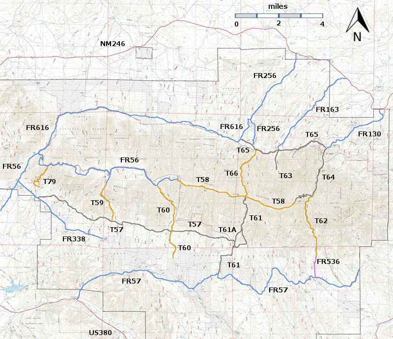
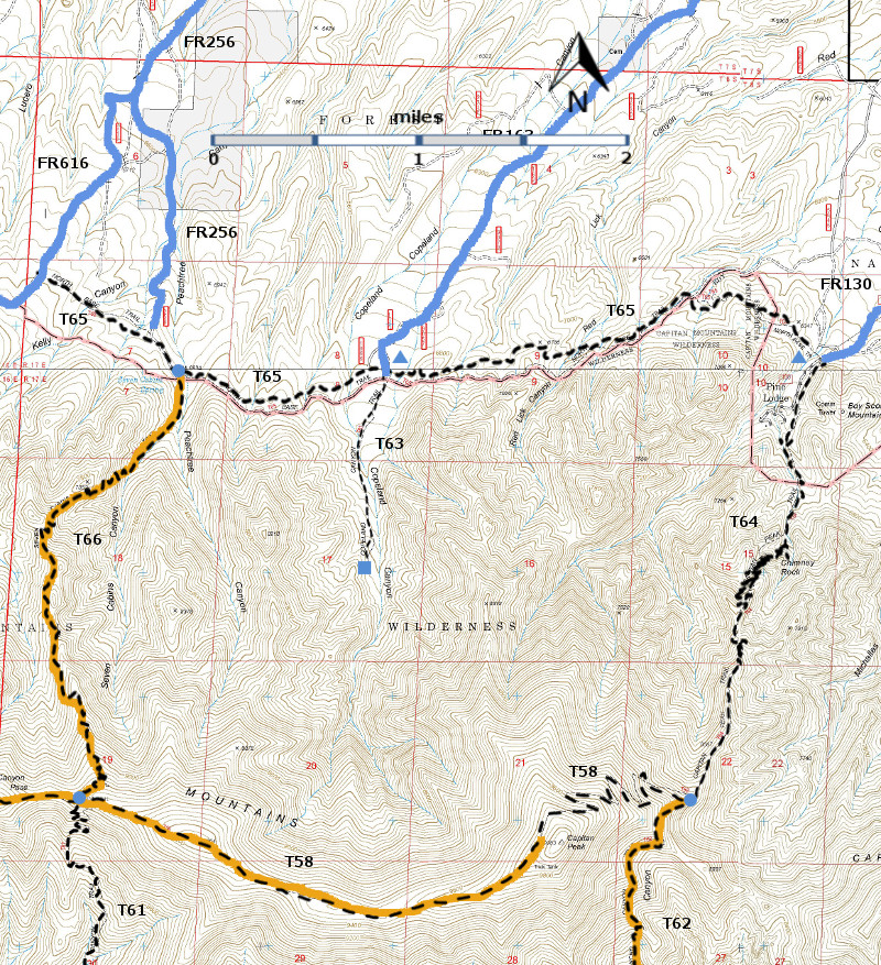
| T58 (partial),T61 (partial), T62 (partial), T63, T64, T65, and T66 are shown as black dashed lines on the map. As part of the Capitan Mountains Wilderness Area trail system, these trails allow only hiking and pack animal activities. | ||||||||||||||||||||||||||||
 | ||||||||||||||||||||||||||||
| LENGTH: 3.7 miles | |||||||||||||||||||||||||||
|
ELEVATION: 6960 - 9240 ft 2280 ft difference | ||||||||||||||||||||||||||||
| DIFFICULTY: More Difficult | ||||||||||||||||||||||||||||
| SCENIC RATING: 4 | ||||||||||||||||||||||||||||
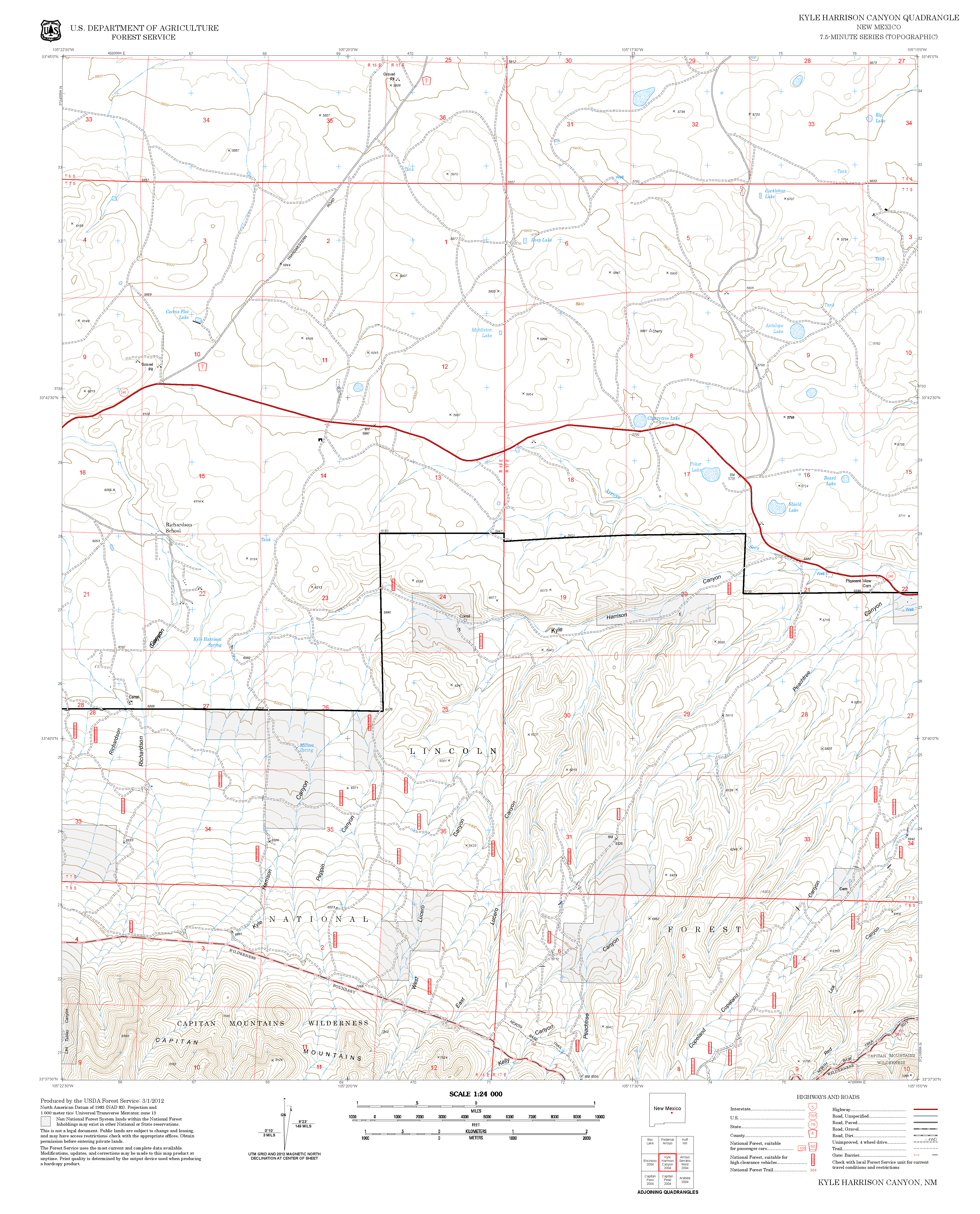
| Contour Interval: 40 feet Capitan Mountains Area (37 MB) Capitan Peak Topo Map Kyle Harrison Topo Map | ||||||||||||||||||||||||||||
| ||||||||||||||||||||||||||||
| Note: The 2004 Peppin Fire Burned parts of T63, T65, and T66. The descriptions given below are based on John Stockert’s 2001 observations. Click on this link for a 2013 picture of the area near the junction of T65 and T66. | ||||||||||||||||||||||||||||
DESCRIPTION: The
canyon name, Seven Cabins, extends back to the 1850s when pioneers moved into
the area and noted the foundations of seven burned cabins. To
reach the lower T66 trailhead, a high clearance vehicle is mandatory; 4‑wheel
drive is preferable. Start in Capitan at the NM246 and US380 intersection and
drive NM 246 north and east 27 miles to milepost 27. Go another 0.2 mile and
turn right on signed Seven Cabins Road, also signed FR256 after making the
turn. The worst section of road is along the first 0.1 mile. Beyond here, it continues to be a primitive,
unmaintained, dry weather, rutty road.
At mile 3.9, FR 256 angles left; follow it to its end at mile 5.5 at the
signed and interesting Seven Cabins Spring area, trailhead for T66. This is a
nice place to camp. | ||||||||||||||||||||||||||||
| LOCATION(S) OF ACCESS POINT(S) | ||||||||||||||||||||||||||||
| ||||||||||||||||||||||||||||
| ||||||||||||||||||||||||||||


