|
DESCRIPTION:
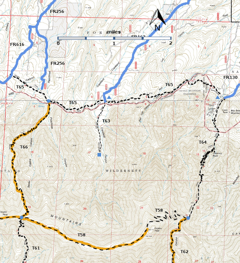
The
two sections of T65 are connected by the last 0.2 mile of Forest Road FR256
that leads to Seven Cabins Spring. The
western section of T65 is 0.9 mile long.
It branches off FR256 north 0.2 mile from Seven Cabins Spring at a
signed beginning. The eastern segment of T65 is 4.4 miles in length. It starts at a signed location for T66 Seven
Cabins Trail, 270 feet from the beginning of T66, Seven Cabins Trail, at Seven
Cabins Spring.
T65
connects the Boy Scout Mountain/Pine Lodge Community summer home area with FR616,
North Base Road. The trail is just outside the Capitan Mountains Wilderness,
closely paralleling its northern boundary. It crosses several major canyons, a
few of which have small streams. Generally, gradients vary up to 15%; trail
conditions range between average and excellent. As a result of various sun
exposures, a considerable variety of vegetation thrives along the route,
ranging from the typical Pinyon-Juniper Woodlands, to an abundance of Ponderosa
pine and Douglas‑fir, to thick stands of young white fir. There are seven nice
views, mainly toward the north and east.
ACCESS:
Four
vehicular routes access T65:
(1)
To reach the eastern trailhead of T65 in the Boy Scout Mountain/Pine Lodge
Community area, begin in Capitan at the US380 and NM246 intersection; drive
paved NM246 north and east 32 miles to milepost 32. Go another 0.2 mile; turn
right on the signed Boy Scout Mountain Road, also FR130. Follow a maintained, but sometimes rough,
dirt road 3.5 miles, angling slightly right at a confusing, unsigned
intersection. 0.3 miles further on the
right is a large sign for “North Base Trail, No. 65” and a carsonite sign for FR5645.
Turn right, and follow a rough road through
a primitive RV/camping area, and park before crossing a stream.
(2) To reach the other
trailheads, a high clearance vehicle is mandatory, and a 4-wheel drive is
preferable. These are dry weather roads, and are often highly rutted and
rough. For accessing T65, in Capitan
take NM246 north and east 29 miles to milepost 29. Drive another 0.8 mile, and
just beyond a Copeland Canyon sign, turn right (south) on signed FR163, a dirt
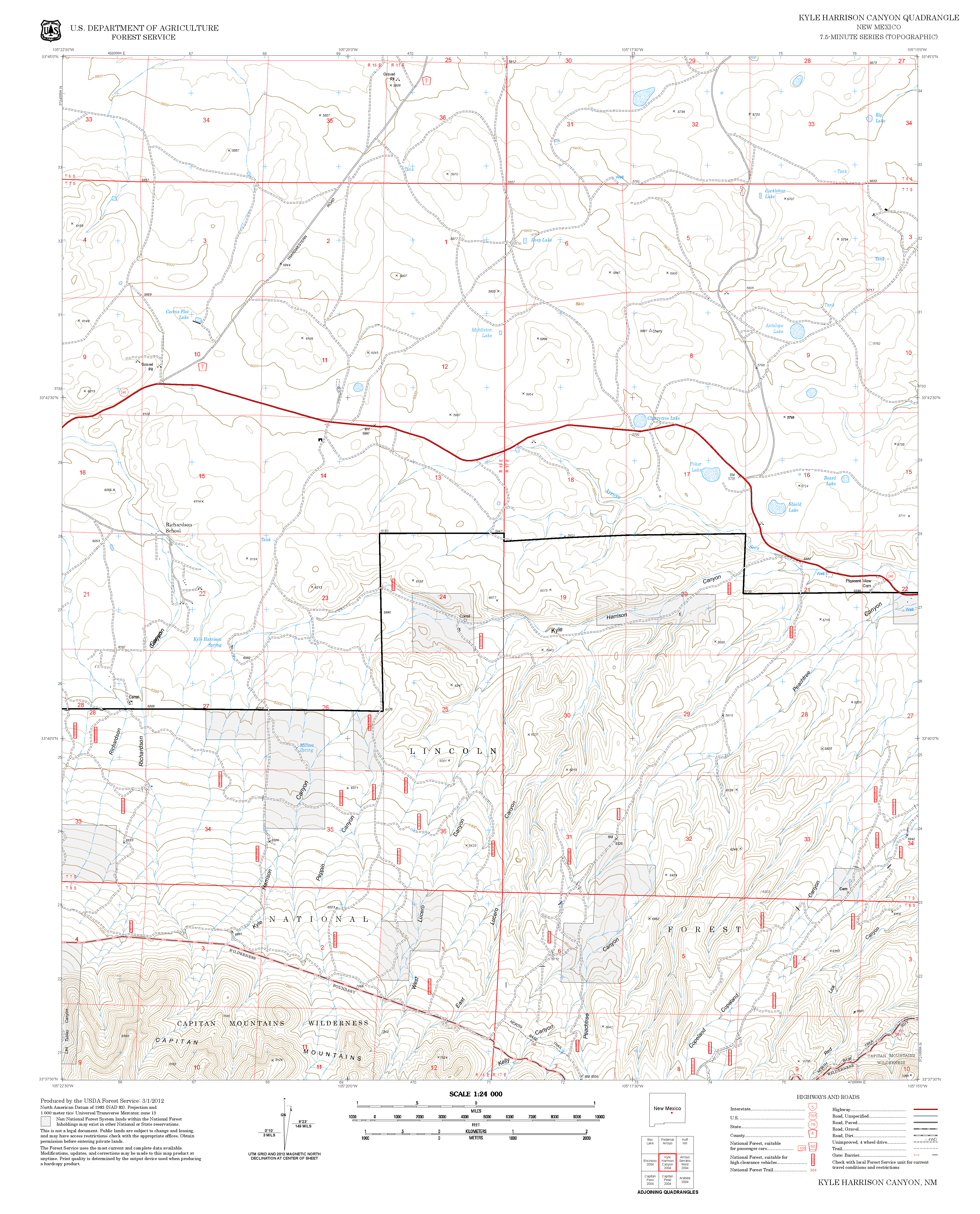
road. After 5.2 miles of very poor driving conditions, the road joins T65.
(3)
To access a section of T65 that connects to T66, begin in Capitan and drive NM246
27 miles north and east to milepost 27. Go another 0.2 mile and turn right on
the signed Seven Cabins Road, also signed FR256 after the turn. The worst
section of road is in the first 0.1 mile. At mile 3.9, FR256 angles
left. Atop a small rise, and on the
right, at mile 5.3 is the junction with the signed western segment of T65.
Drive another 0.2 mile to the end of FR256 at Seven Cabins Spring where T66,
Seven Cabins Trail, begins. The eastern segment of T65 meets T66 just
270 feet south of the spring.
(4)
To access the western trailhead of T65, go to mile 3.9 along FR256 from its
beginning off NM246, mentioned just above, and proceed straight south (instead
of angling left). The road immediately
becomes FR616, North Base Road; drive 1.3 miles. The signed trailhead is on the
left. The trail may be hard to find;
look for small cairns on top of big rocks. | 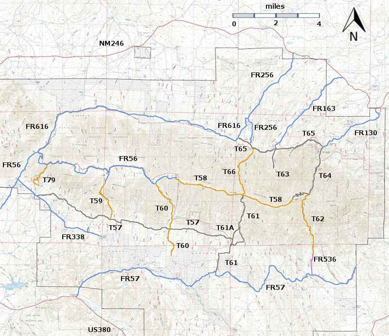


