T61A
Pierce Canyon Alternate Trail


Smokey Bear Ranger District
TL-green-190.jpg
Download
T61A
GPS Track
(as .GPX)
Capitan Mountains Trails
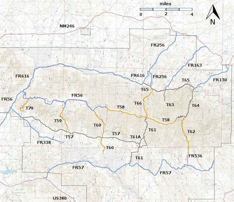
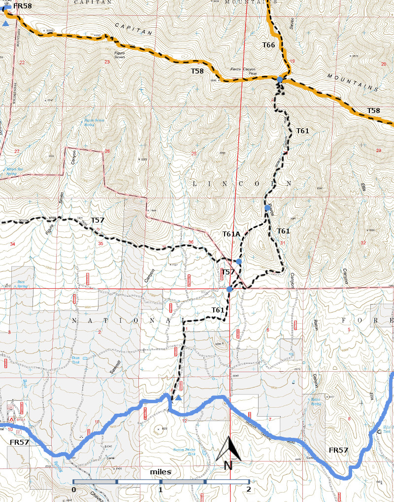
T57 (partial), T58 (partial), T61, T61A, and T66 (partial) are shown as black dashed lines on the map.  As part of the Capitan Mountains Wilderness Area trail system, these trails allow only hiking and pack animal activities.
Capitan-mc-RTS-r8p5.jpg

Capitan-mc-RTS-cb3a-rf.jpg

LENGTH:
0.8 miles
ELEVATION:
7160 - 7520 ft
360 ft

difference
DIFFICULTY:
Most Difficult
SCENIC
RATING:
1
Contour Interval: 40 feet
Capitan Mountains Area  (37 MB)

Capitan Peak Topo Map
Route Color Codespaved roads
(red)
FS roads, open
(blue)
FS roads, closed or impassable
(magenta)
main trail(s)
(black dashes)
---connector trail(s)
(green dashes)
---damaged or intermittent trail(s)
(orange over black dashes)
---closed trails(s)
(red over black dashes)
---
Symbolstrailhead
(blue triangle)
blue-triangle.jpgtrail junction
(blue dot)
blue-dot.jpgtrail end
(blue square)
blue-square.jpg

DESCRIPTION:

 T61A is unsigned and somewhat difficult to follow from its upper end. After 0.5 mile, a narrow valley floor, extremely rocky for about 0.1 mile, is reached. The trail takes on the appearance of a primitive road during its last 0.2 mile before ending at a signed 90 degree turn on T57, South Base Trail. Frankly, the only reason for taking T61A is to cut off 0.4 mile when a loop trip is made on T 61, or if one wants to proceed along T57.

 ACCESS:

 To reach the lower end of T61A, hike T57 west 0.4 mile from its eastern trailhead at T61.  Where T57 makes a left turn at a signed location, continue straight ahead on unsigned, rugged T61A.  Reaching the upper end of T61A is kind of automatic for anyone hiking down T61. However, giving directions for those coming up T61 without in‑place signing is difficult, except to mention that the unsigned junction is somewhere within about 100 feet before reaching a very poor Pierce Canyon sign at mile 3.6.  The GPS coordinates for these junctions are given below.
LOCATION(S) OF ACCESS POINT(S)
Lat/Lon hddd mm ss.sUTM/NAD83
Junction of T57 and T61AN33 33 49.8
 W105 18 53.3
13 S
470782
3713841
Junction of T61 and T61AN33 34 24.4
W105 18 36.0
13 S
471230
3714906

Last Hiked:  2001Web Page Updated:February 21, 2014
Copyright Lynn Melton 2014Contact: LNFTG14@gmail.com