DESCRIPTION:
Note:
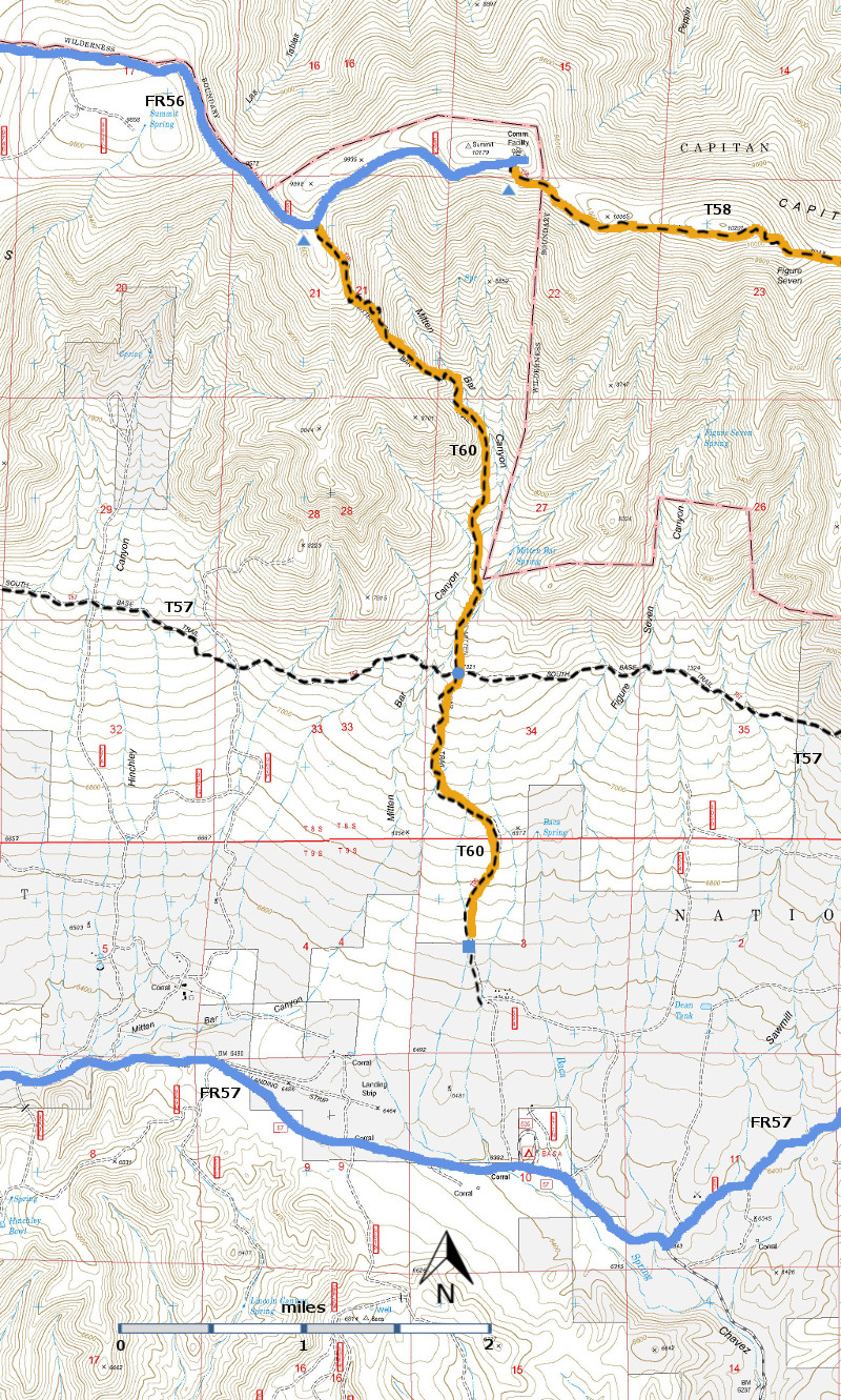
The Forest Service GPS track for the segment of T60 between FR56 and T57 gives
a length of 2.7 miles. John Stockert’s
work gives a length of 3.2 miles. The
distances in the following paragraphs are based on John Stockert’s work.
This
rugged trail passes through a great diversity of vegetation. It may take more time
to access its lower trailhead than to hike T60 itself! From its upper terminus, the path is well
constructed with stone, and is discernible along its first mile as it passes
moss‑covered rocks and threads through a splendid, thick, mixed conifer forest
with a variety of trees from young saplings to those fully mature. The gradient
is no more than 20%, and usually 15% or less, along this exquisite path. At
mile 1.0 from the upper end is an old helipad, a small open area with great
views.
Immediately
beyond, the trail takes on a totally different character and becomes
steep (up to more than 40%) and very poor.
At mile 1.7 is the incorrectly signed Mitt Bar Spring, a nice scenic
spot. Actually, this spring is not officially named and is shown as an unnamed
spring on the Capitan Mountains Wilderness Map. Used by a local rancher, the water
comes from a small concrete spring box.
Beautiful moss‑covered rocks line the sides of the small, rocky, stream
channel. Just 0.1 mile downstream are
conifers upwards of 100 feet high, and the trunk of one Douglas‑fir is 4.5 feet
in diameter!
At mile
2.7, a fallen, deteriorated sign indicates "Mitten Bar Spring" at the
beginning of a vague spur trail to the east. The spring is reached in about 800
feet by taking a diminishing path, which eventually fades out. The spring
consists of a series of stagnant puddles in a stream bed (1994). Upon returning
to T60, the trail soon takes on the appearance of an old road for its last 0.5
mile to the signed, lower trailhead.
It
is worth the effort to hike down from the upper trailhead to the old helipad
and then return. For the well-seasoned hiker, visiting the unnamed spring and
tall tree area just beyond is also worthwhile.
However, access to this area is very difficult, even if one hikes from
the upper trailhead and plans to walk on through. It is not recommended to go
from the lower trailhead to the upper end unless the hiker is experienced, in
excellent health and conditioning, and plans to spend more than a day.
The
Forest Service description of T60 includes a 1.8 mile segment south from the
junction of T57 and T60. No access is
available from this segment to FR338 because private property in between is
closed to trail users. For this reason,
the GPS track that can be downloaded from this web page is for the segment
between FR56 and T57 only.
ACCESS: A high clearance vehicle is required to
access both trailheads; 4‑wheel drive is strongly
recommended for FR56. To reach the upper trailhead, begin in Capitan at the New
Mexico NM48 and US380 intersection. Drive US380 east 2.0 miles to FR56, Capitan
Pass Road, also known as County Road C001. Turn left and follow FR56 14.9 miles
to the signed upper T60 trailhead. An acceptable place to park must be sought
along the narrow, exposed FR56.
At
mile 5.4, the maintained FR56 turns right and becomes FR338, also known as
County Road C003. Do not turn right. Instead, proceed straight ahead over a rutty
set of tracks signed as FR56 that gives way to a rough route. Do not attempt
if wet. At mile 7.1 (on Capitan
Pass), turn right to continue following FR56 that becomes steep and rocky until
a ridge is reached at mile 9.3. Beyond
here the road to the trailhead is periodically rocky and rough.
Reaching the lower trailhead is
long and difficult. No access is
available directly south from this trailhead to FR338 because private property
in between is closed to trail users.
However, there are three other ways for access: See the T59 ACCESS directions for locating
two of those ways from that trail’s lower terminus. After finding the lower T59 trailhead, follow
T57 east 3.3 miles to the signed T60 junction. | 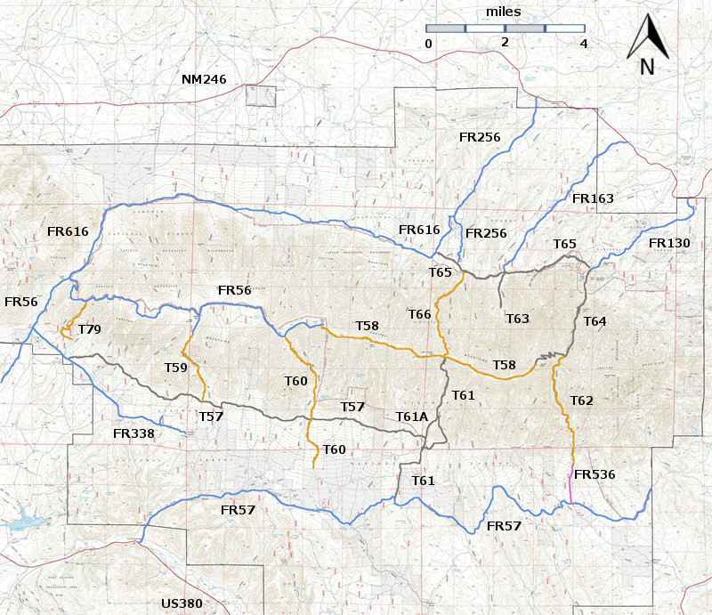


