| Download T46 GPS Track (as .GPX) | White Mountain Wilderness Trails | ||||||||||||||||||||||||||
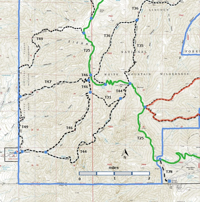
| T31, T35, T36 (partial), T44, T46, T47, and T49 are shown as black dashed lines on the map. The solid blue line is the border of the White Mountain Wilderness . The solid green line is T25 Crest Trail. The red over black dashes indicates that the trail is badly damaged and is closed to the public by Forest Service order. | ||||||||||||||||||||||||||||
 | ||||||||||||||||||||||||||||
| LENGTH: 3.3 miles | |||||||||||||||||||||||||||
|
ELEVATION: 6760 - 9280 ft 2520 ft difference | ||||||||||||||||||||||||||||
| DIFFICULTY: Difficult | ||||||||||||||||||||||||||||
| SCENIC RATING: 3 | ||||||||||||||||||||||||||||
| Download Forest Service Resource | ||||||||||||||||||||||||||||
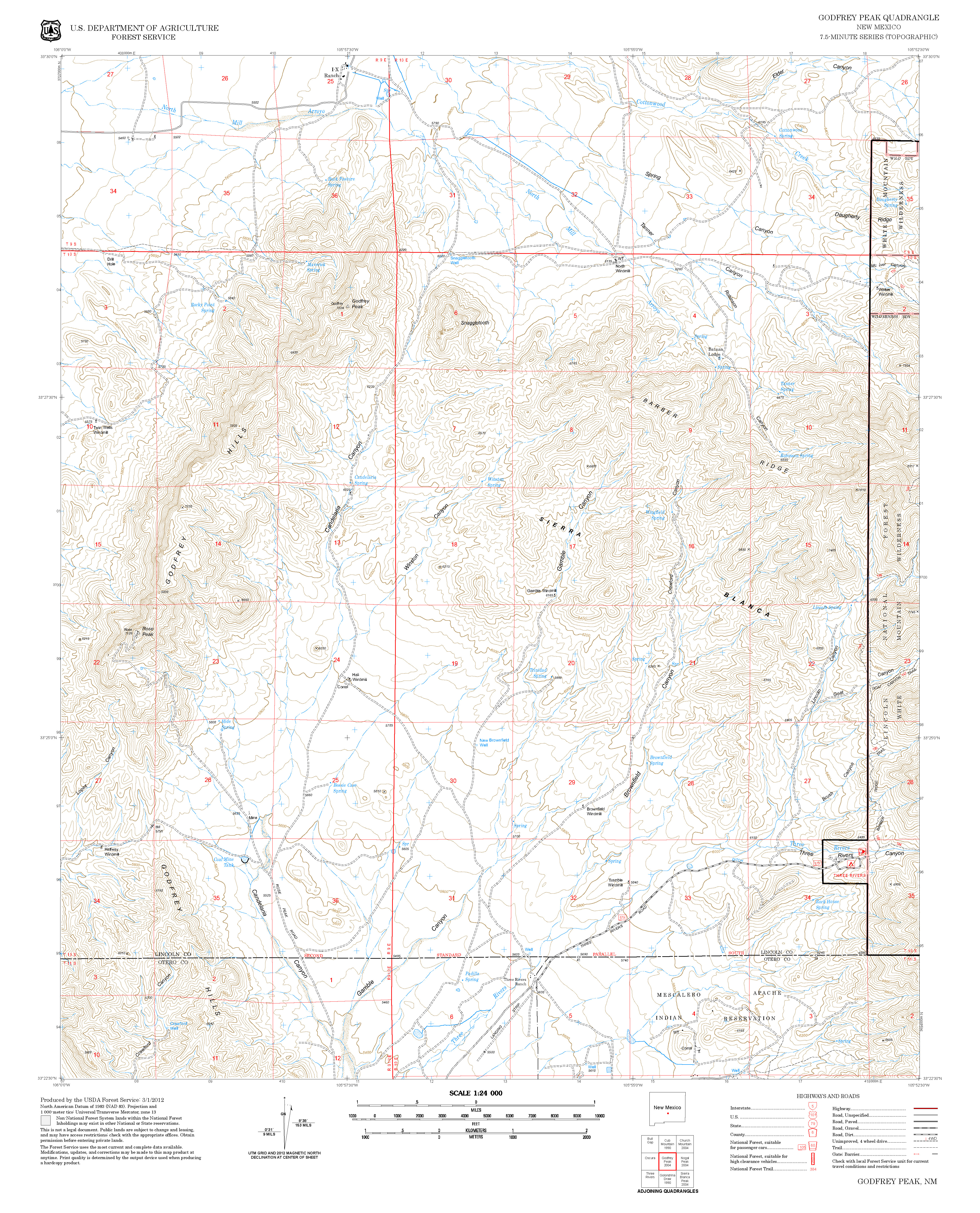
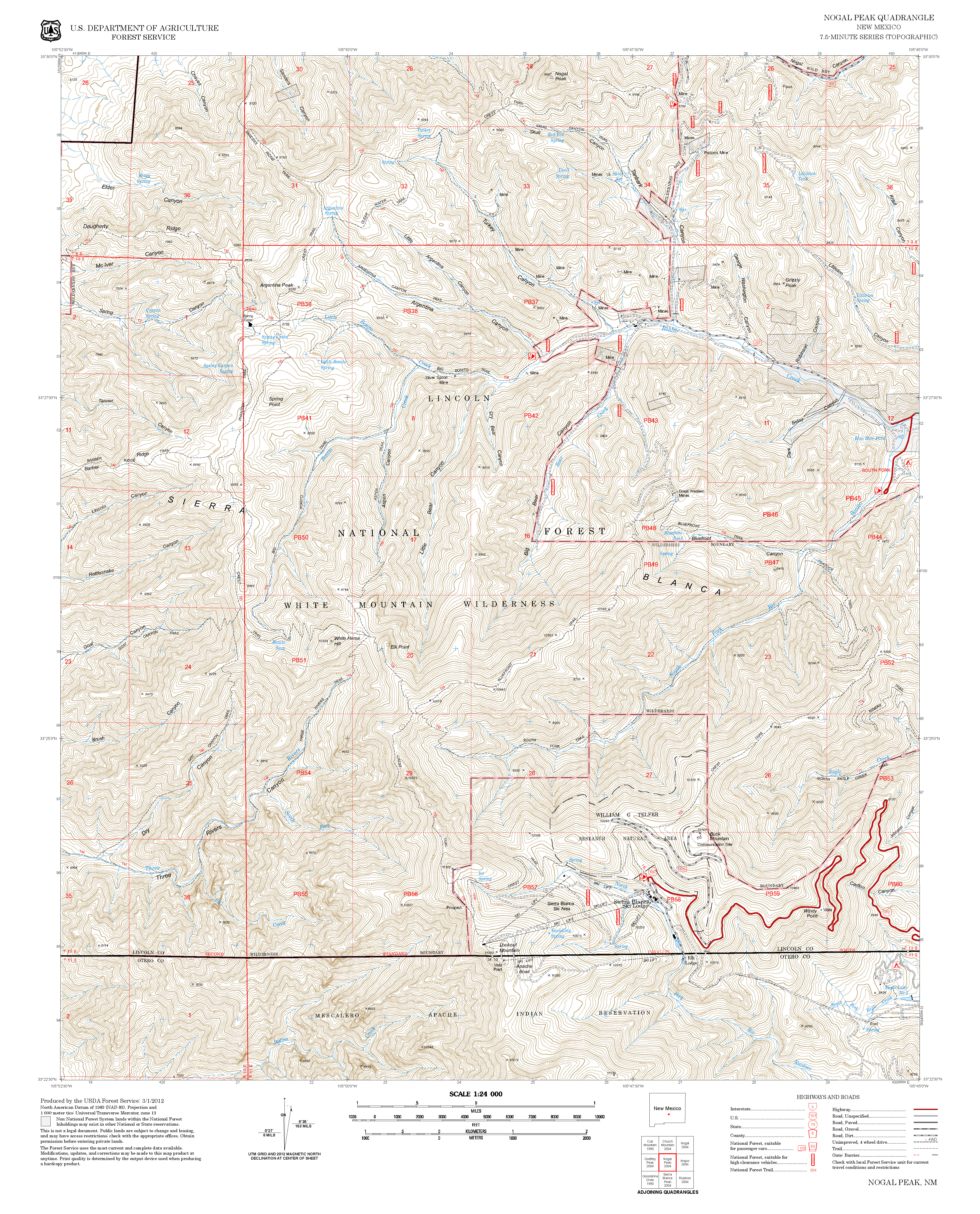
| Contour Interval: 40 feet White Mountain Wilderness Trails (34 MB) Godfrey Peak Topo Map Nogal Peak Topo Map | ||||||||||||||||||||||||||||
| ||||||||||||||||||||||||||||
| T46 Dry Canyon Trail is not in the 2002 Edition of Trail Guide: Lincoln National Forest, and I have not hiked it. | ||||||||||||||||||||||||||||
| A
friend in the Forest Service described T46 as being "in good
shape " in late 2013. A posting on the Lincoln National Forest
website states "No access to the Crest Trail (T25) is currently allowed
due to the Little Bear Fire. Check with the Smokey Bear Ranger
District office to get current information. The junction of T44 and T46 is 0.8 miles up T44 from its lower trailhead. The junction of T46 and T47 is 0.2 miles down from the junction of T25 and T46. This trail is in poor condition. This link contains a lot of useful information: http://www.ruidoso.net/visitors/outdoors/trailheads/threerivers.html. | ||||||||||||||||||||||||||||
| LOCATION(S) OF ACCESS POINT(S) | ||||||||||||||||||||||||||||
| ||||||||||||||||||||||||||||
| ||||||||||||||||||||||||||||


