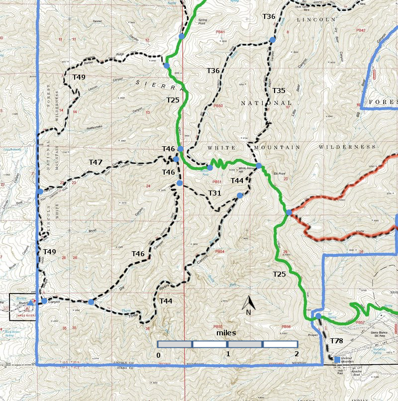
DESCRIPTION:
T44 (T46, T47, T49 accessible from T44)) and T53 (T23 accessible from T53)) are the only routes accessible from the
west side of the White Wilderness Wilderness.. T44 is one of the most varied trails in Lincoln National Forest.
From the lower trailhead, good trail extends about 1.6 miles up canyon and is
sporadic beyond that. The variety of vegetation and landforms is considerable.
Several natural camping sites are scattered along the canyon bottom, including
a significant, primitive campground at mile 3.7 from the lower trailhead. Here
also is the mouth of Fall Creek that provides about a third of the water for
Three Rivers during part of the year. Mature, stately, mixed conifers are
abundant along the lower two-thirds of the path. There are at least 15 switchbacks
and about 24 stream crossings (no bridges) along T 44.
If
accessed from the upper trailhead,
the highest portions of this route are often steep, rough, and hard to
follow.
Open vistas are available until about one mile down canyon, near the
beginning
of Three Rivers stream (if moisture conditions are right). A
hiker friend reported that , in Fall 2013, T44 was in good shape.
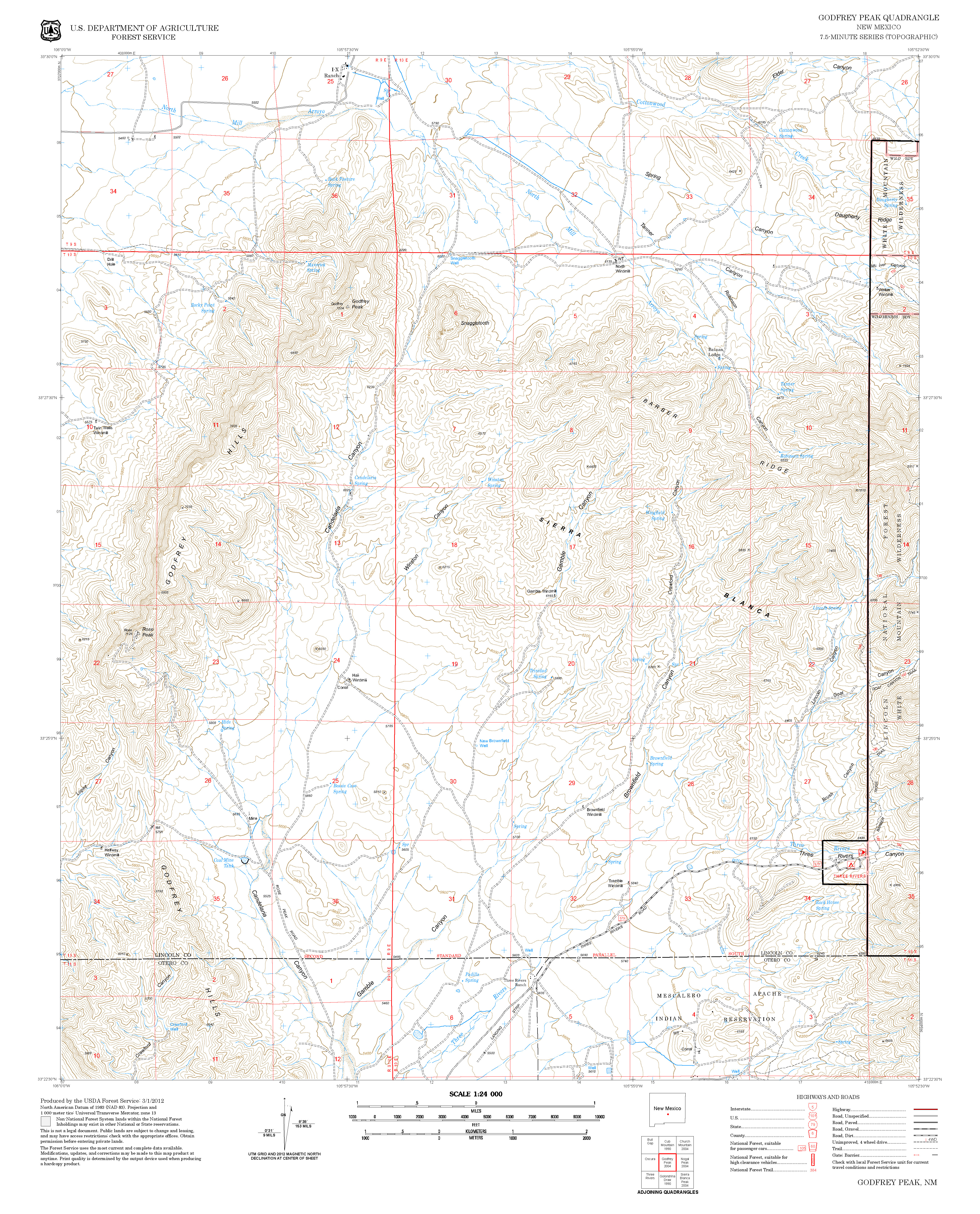
ACCESS:
To reach the lower trailhead for T44, begin
in Tularosa where US54 separates from US70.
Drive US54 north 16 miles to milepost 96. Go 0.6 mile more, and note a large Forest
Service sign on the left indicating Petroglyphs Picnic Ground, White Mountain
Wilderness and Three Rivers Campground. Turn right and follow County Road B030
(leads into County Road B036; also known as FR579), east 13.4
miles to its end in Three Rivers Campground at the T 44 trailhead.
For those wishing to hike down T44, two access routes are suggested:
(1)
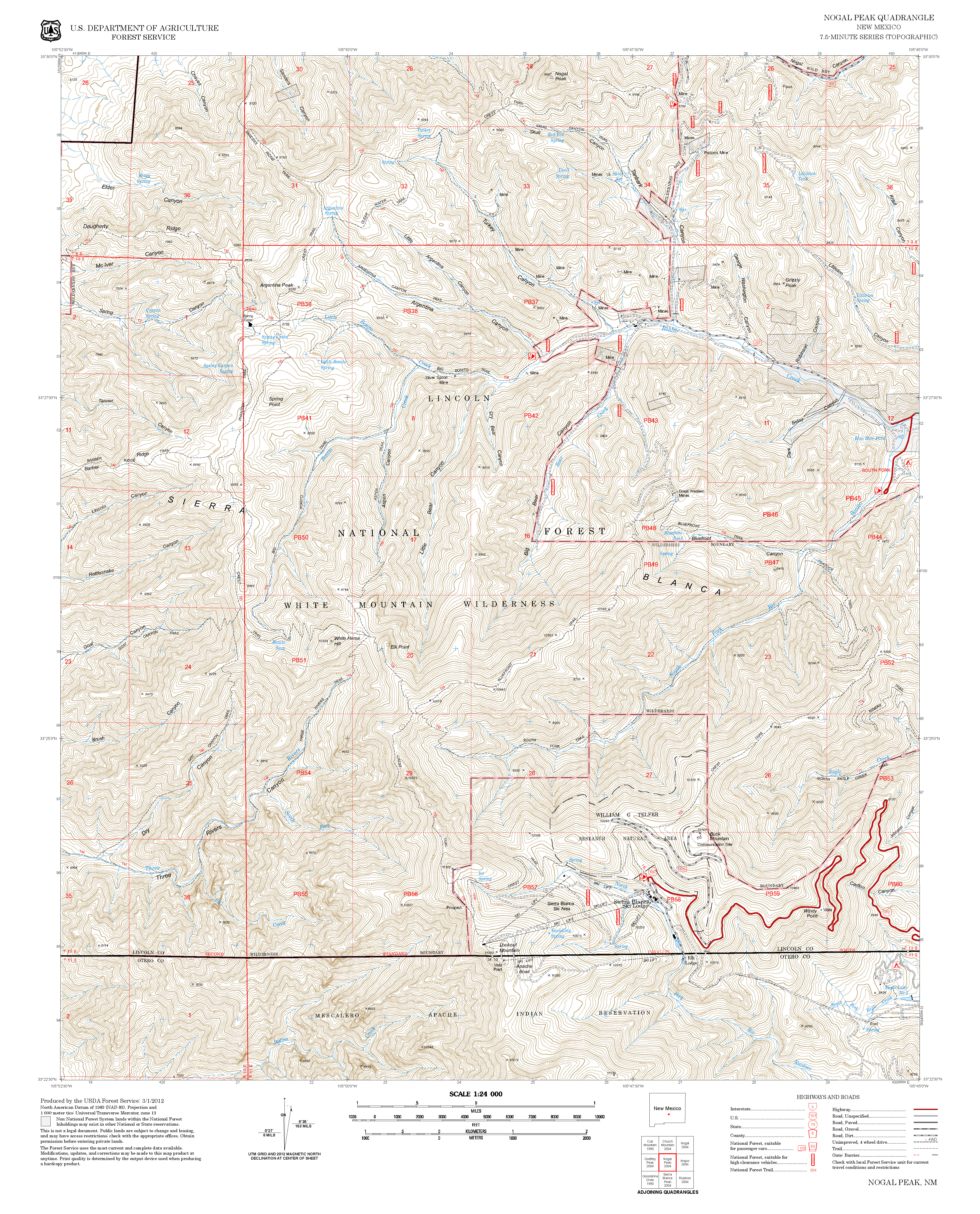
The upper T44 trailhead can be reached most quickly by hiking up from the end
of FR107, Rio Bonito Road, via T36 for the first 1.5 miles. Take T35 for the
next 2.4 miles to its common trailhead with T44 at T 25; it is 6.1 miles down
T 44 to Three Rivers Campground. Total walking distance is 10.0 miles one
way. For those who plan to have someone
pick them up at Three Rivers Campground, it is an 87 mile, one way drive from
the upper end of FR107, via FR107, NM37, NM48, US70, US54, and FR579, to
that campground! To find T36, consult
that trail write-up.
(2) An alternative, yet more
spectacular route for reaching the upper end of T44, is to begin from the
lower T15 trailhead at the U‑curve on NM532, at the gate to Ski Apache Ski
Area. Take T15 0.6 mile to T25; turn
left on T25 and hike 5.3 miles to the T44 trailhead. The route crosses the
highest elevation point of T25 at 11,200 feet, and passes along the least commonly
used portion of the trail, yet provides some of the most splendid vistas found
anywhere in Lincoln National Forest. Be
careful; it is easy to lose the trail in a few locations. Grass may be tall
enough to obscure the trail by lying over it. To stay on the trail, shuffle
your feet to "feel" where the trail goes. To find T15, consult that
trail write-up. Total hiking distance,
including descent of T44, is 12.0 miles. Total driving distance between the T
15 trailhead and the beginning of T44 at Three Rivers Campground is 85 miles
via NM532, NM48, US70, US54, and FR579!
This link contains a lot of useful information: http://www.ruidoso.net/visitors/outdoors/trailheads/threerivers.html | |


