| Download T43 GPS Track (as .GPX) | White Mountain Wilderness Trails | ||||||||||||||||||||||||||
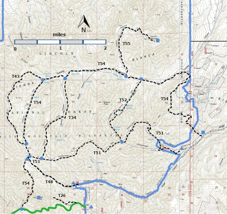
| T26, T34, T43, T48, T51, T52, T54, and T55 are shown as labeled black
dashed lines on the
map. The solid blue line is the border of the White Mountain
Wilderness . The solid green line is T25 Crest Trail. | ||||||||||||||||||||||||||||
 | ||||||||||||||||||||||||||||
| LENGTH: 2.5 miles | |||||||||||||||||||||||||||
|
ELEVATION: 7780 - 8950 ft 830 ft difference | ||||||||||||||||||||||||||||
| DIFFICULTY: Moderate | ||||||||||||||||||||||||||||
| SCENIC RATING: 2 | ||||||||||||||||||||||||||||
| Download Forest Service Resource | ||||||||||||||||||||||||||||
| Contour Interval: 40 feet White Mountain Wilderness Trails (34 MB) Church Mountain Topo Map | ||||||||||||||||||||||||||||
| ||||||||||||||||||||||||||||
| T43 is not in the 2002 Edition of Trail Guide: Lincoln National Forest, and I have not hiked it. | ||||||||||||||||||||||||||||
| DESCRIPTION: T43 is a side loop off of the initial portion of T54, as it goes north. Because T43 is on a ridge, the view to the west are likely to be better than those on the corresponding segment of T54. It is likely to be intermittent. ACCESS: From T54. Use T51 to reach T54. | ||||||||||||||||||||||||||||
| LOCATION(S) OF ACCESS POINT(S) | ||||||||||||||||||||||||||||
Table
| ||||||||||||||||||||||||||||
| ||||||||||||||||||||||||||||


