| Download T42 GPS Track (as .GPX) | White Mountain Wilderness Trails | ||||||||||||||||||||||||||
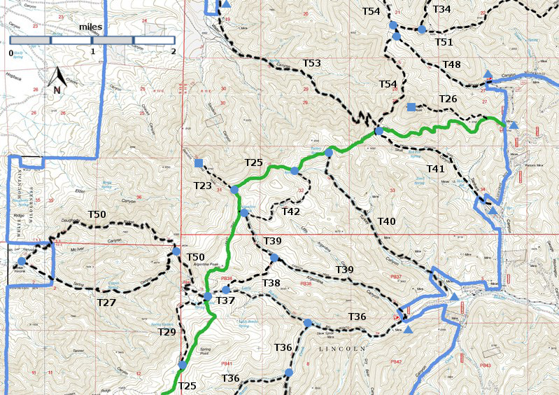
| T23, T26, T27, T29, T34 (partial), T36 (partial), T37, T38, T39, T40, T41, T42, T48, T50, T51 (partial), T53, and T54 (partial) are shown as labeled black dashed lines on the map. The solid blue line is the border of the White Mountain Wilderness . The solid green line is T25 Crest Trail. | ||||||||||||||||||||||||||||
 | ||||||||||||||||||||||||||||
| LENGTH: 1.3 miles | |||||||||||||||||||||||||||
|
ELEVATION: 8920 - 9160 ft 240 ft difference | ||||||||||||||||||||||||||||
| DIFFICULTY: Easy | ||||||||||||||||||||||||||||
| SCENIC RATING: 3 | ||||||||||||||||||||||||||||
| Download Forest Service Resource | ||||||||||||||||||||||||||||
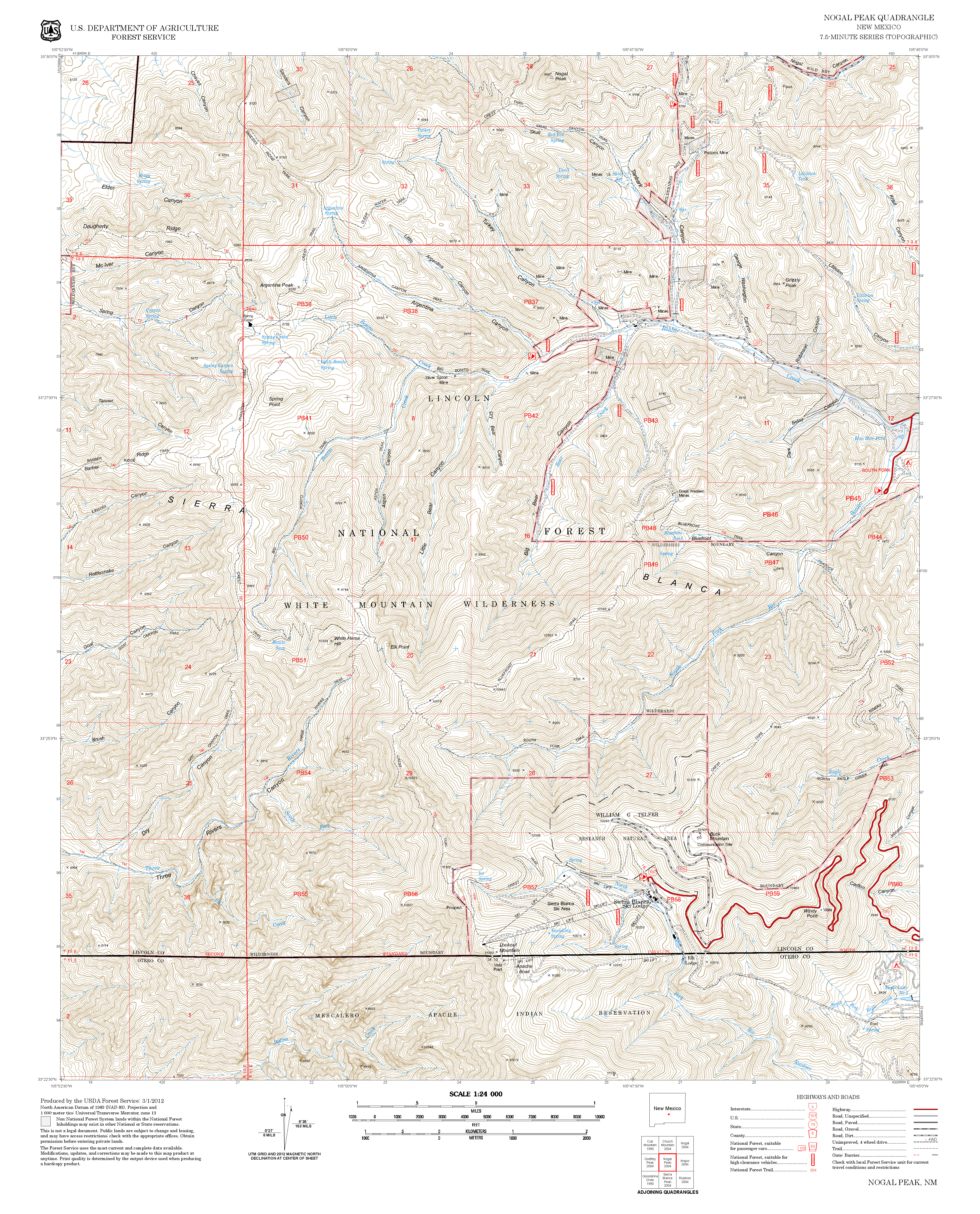
| Contour Interval: 40 feet White Mountain Wilderness Trails (34 MB) Nogal Peak Topo Map | ||||||||||||||||||||||||||||
| ||||||||||||||||||||||||||||
| T42 is not in the 2002 Edition of Trail Guide: Lincoln National Forest, and I have not hiked it. | ||||||||||||||||||||||||||||
| DESCRIPTION: T25 is along the west side of a small peak; T42 is side loop off T25 along the east side of the same peak. The difference is that T42 crosses a substantial flat area that is good for camping. Check out the following link for more information: http://www.ruidoso.net/visitors/outdoors/trailheads/argentina.html ACCESS: Hike T39 2.5 miles to its junction with T42. | ||||||||||||||||||||||||||||
| LOCATION(S) OF ACCESS POINT(S) | ||||||||||||||||||||||||||||
| ||||||||||||||||||||||||||||
| ||||||||||||||||||||||||||||


