| Download T40 GPS Track (as .GPX) | White Mountain Wilderness Trails | ||||||||||||||||||||||||||
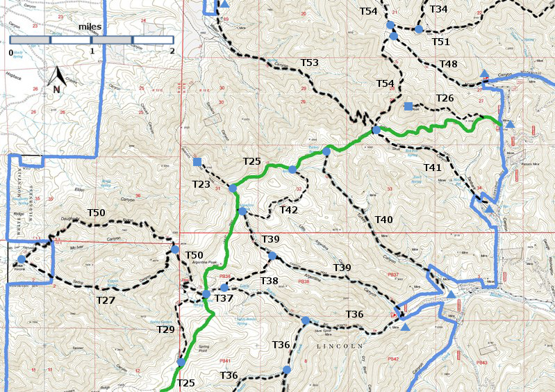
| T23, T26, T27, T29, T34 (partial), T36 (partial), T37, T38, T39, T40, T41, T42, T48, T50, T51 (partial), T53, and T54 (partial) are shown as labeled black dashed lines on the map. The solid blue line is the border of the White Mountain Wilderness . The solid green line is T25 Crest Trail. | ||||||||||||||||||||||||||||
 | ||||||||||||||||||||||||||||
| LENGTH: 2.5 miles | |||||||||||||||||||||||||||
|
ELEVATION: 7740 - 8940 ft 1200 ft difference | ||||||||||||||||||||||||||||
| DIFFICULTY: Moderate | ||||||||||||||||||||||||||||
| SCENIC RATING: 3 | ||||||||||||||||||||||||||||
| Download Forest Service Resource | ||||||||||||||||||||||||||||
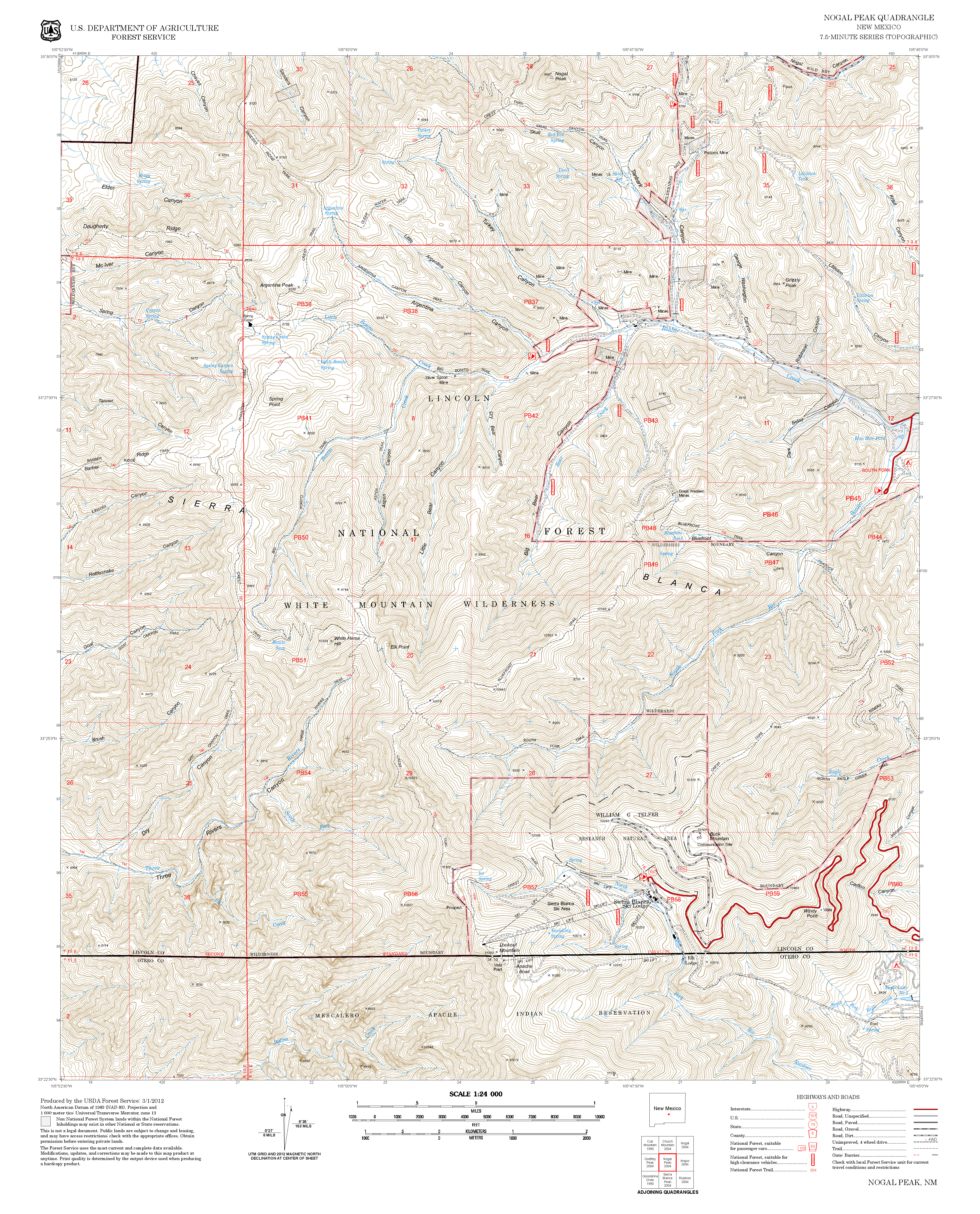
| Contour Interval: 40 feet White Mountain Wilderness Trails (34 MB) Nogal Peak Topo Map | ||||||||||||||||||||||||||||
| ||||||||||||||||||||||||||||
| For T 40, the White Mountain Wilderness Map shows a trail junction with two short forking trails near the upper trailhead. The right fork, north to Turkey Spring, is the correct route. | ||||||||||||||||||||||||||||
DESCRIPTION: Named for the large number of turkeys
originally found here, the lower end of T40 follows an old, easy grade road to
about mile 1.5. It provided access to
gold mines many decades ago. At mile 0.4 from the lower end is a very large
Douglas‑fir, five feet in diameter and estimated to be 300 years old. The tree
is just 0.1 mile beyond a nice primitive camping spot at a stream crossing. The
route passes through mainly forested areas with open under story and a few open
areas. After mile 2.2, the trail steepens to about 30% gradient for its last
0.3 mile as the upper trailhead is approached. Turkey Canyon Creek flows
intermittently for over two miles, through the lower end of the canyon. A few
small springs are near the trail. T40 and T41, including a
portion of T 25 that connects their upper termini, plus 1.6 miles of road, make
an ideal loop route of 6.4 miles. The
easiest way to make this hike is to park off the road at the junction of FR107
and FR108. Hike up FR107 0.3 mile,
passing through a riding stable area; continue another 0.2 mile to the signed T40
trailhead on the right. After taking T40 and reaching T25 in 2.5 miles, turn right at Turkey Springs and proceed 0.7
mile along T25 to the upper terminus of T41. Up to this point from the T40
trailhead, T 25 passes through oak and locust thickets and crosses the crest of
the White Mountains twice (highest elevation about 9,200 feet). Distant views are
possible at a few locations. Follow T41 to its lower trailhead, in 1.6 miles,
and then hike the 0.3 mile access road, FR108A, to its junction with FR108.
Turn right and hike down canyon 0.8 mile to FR107, the parking site. ACCESS: To reach T40 from Smokey Bear Ranger District Office in Ruidoso, drive NM48 north 8.3 miles to NM37. Turn left and travel NM37 1.3 miles to FR107, Rio Bonito Road, signed Bonito Lake. Turn left and follow the narrow, paved, sometimes rough route past Bonito Lake and beyond the end of the pavement beyond the junction with FR108 at mile 7.1, through the riding stable in 0.3 miles, to the T 40 junction just 0.2 mile beyond the stables. Park along FR107. | ||||||||||||||||||||||||||||
| LOCATION(S) OF ACCESS POINT(S) | ||||||||||||||||||||||||||||
| ||||||||||||||||||||||||||||
| ||||||||||||||||||||||||||||


