| Download T39 GPS Track (as .GPX) | White Mountain Wilderness Trails | ||||||||||||||||||||||||||
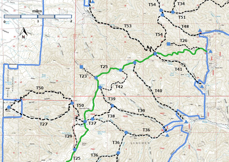
| T23, T26, T27, T29, T34 (partial), T36 (partial), T37, T38, T39, T40, T41, T42, T48, T50, T51 (partial), T53, and T54 (partial) are shown as labeled black dashed lines on the map. The solid blue line is the border of the White Mountain Wilderness . The solid green line is T25 Crest Trail. | ||||||||||||||||||||||||||||
 | ||||||||||||||||||||||||||||
| LENGTH: 2.5 miles | |||||||||||||||||||||||||||
|
ELEVATION: 7820 - 8950 ft 1130 ft difference | ||||||||||||||||||||||||||||
| DIFFICULTY: Moderate | ||||||||||||||||||||||||||||
| SCENIC RATING: 3 | ||||||||||||||||||||||||||||
| Download Forest Service Resource | ||||||||||||||||||||||||||||
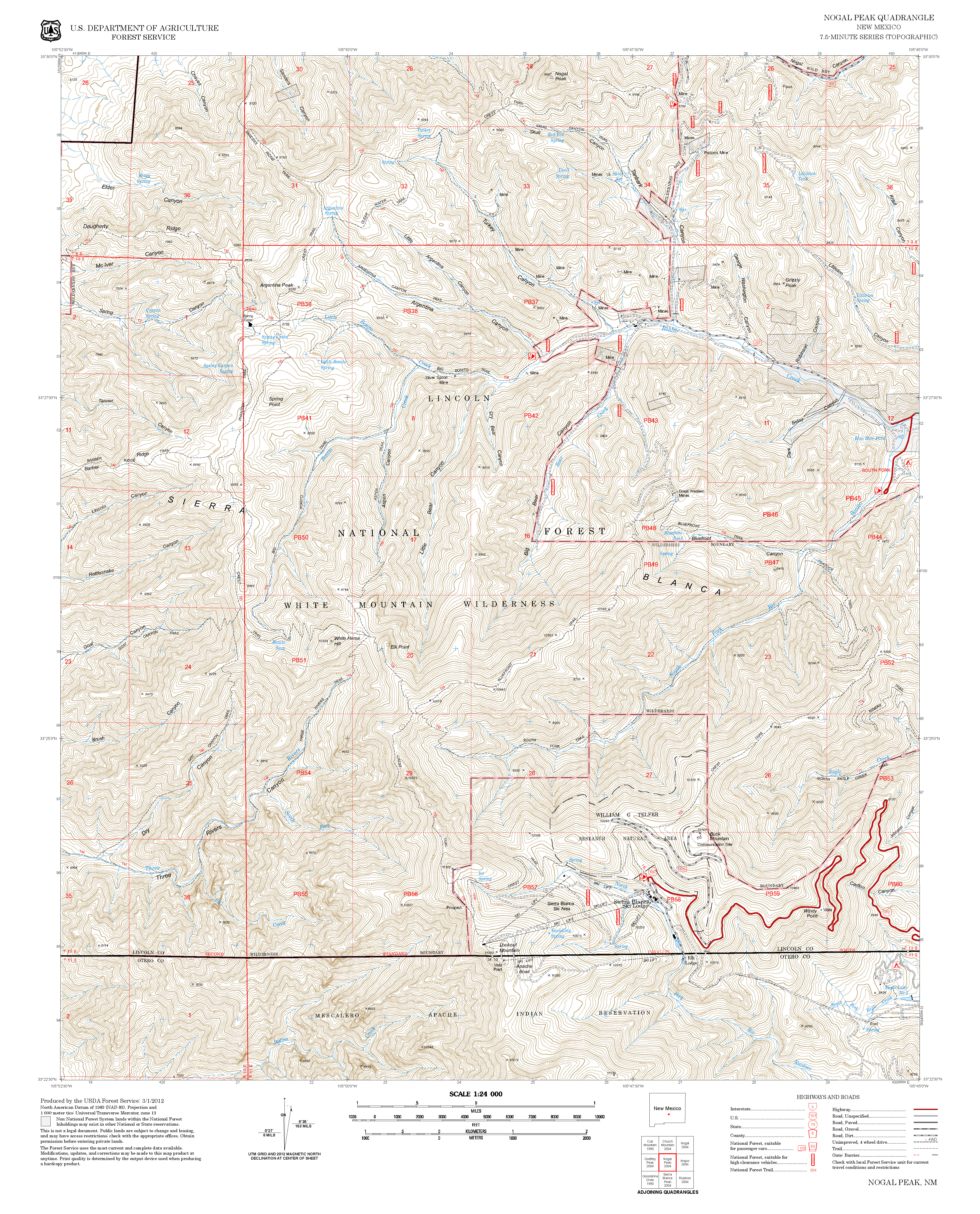
| Contour Interval: 40 feet White Mountain Wilderness Trails (34 MB) Nogal Peak Topo Map | ||||||||||||||||||||||||||||
| ||||||||||||||||||||||||||||
DESCRIPTION: http://www.ruidoso.net/visitors/outdoors/trailheads/argentina.html ACCESS: To reach T39 from Smokey Bear Ranger District Office in Ruidoso, drive NM48 north 8.3 miles to NM37. Turn left and follow NM37 1.3 miles to FR107, Rio Bonito Road, signed Bonito Lake. Turn left and follow the narrow, paved, sometimes rough road past Bonito Lake, beyond the end of the pavement, through the riding stable area, and to the end of the road at mile 8.3. Corrals are available here for those who bring horses. The corral area is open for camping. T36 and T39 have a common lower trail head, but the signage can be confusing. The big yellow and brown sign for T36 is at the end of FR107, where is should be. The big yellow and brown sign for T39 is about 0.2 miles prior to the T36 sign, where it should not be. You may want to park in the open area near the T39 sign and walk to the T36 sign, where there is less room for parking. To add to the confusion, between the T39 sign and the T36 sign, along FR107, there is a small sign on the right for the T39 trailhead -- a case of providing signage for an informal trail. Ignore it. | ||||||||||||||||||||||||||||
| LOCATION(S) OF ACCESS POINT(S) | ||||||||||||||||||||||||||||
| ||||||||||||||||||||||||||||
| ||||||||||||||||||||||||||||


