| Download T25 GPS Track (as .GPX) | |||||||||||||||||||||||||||
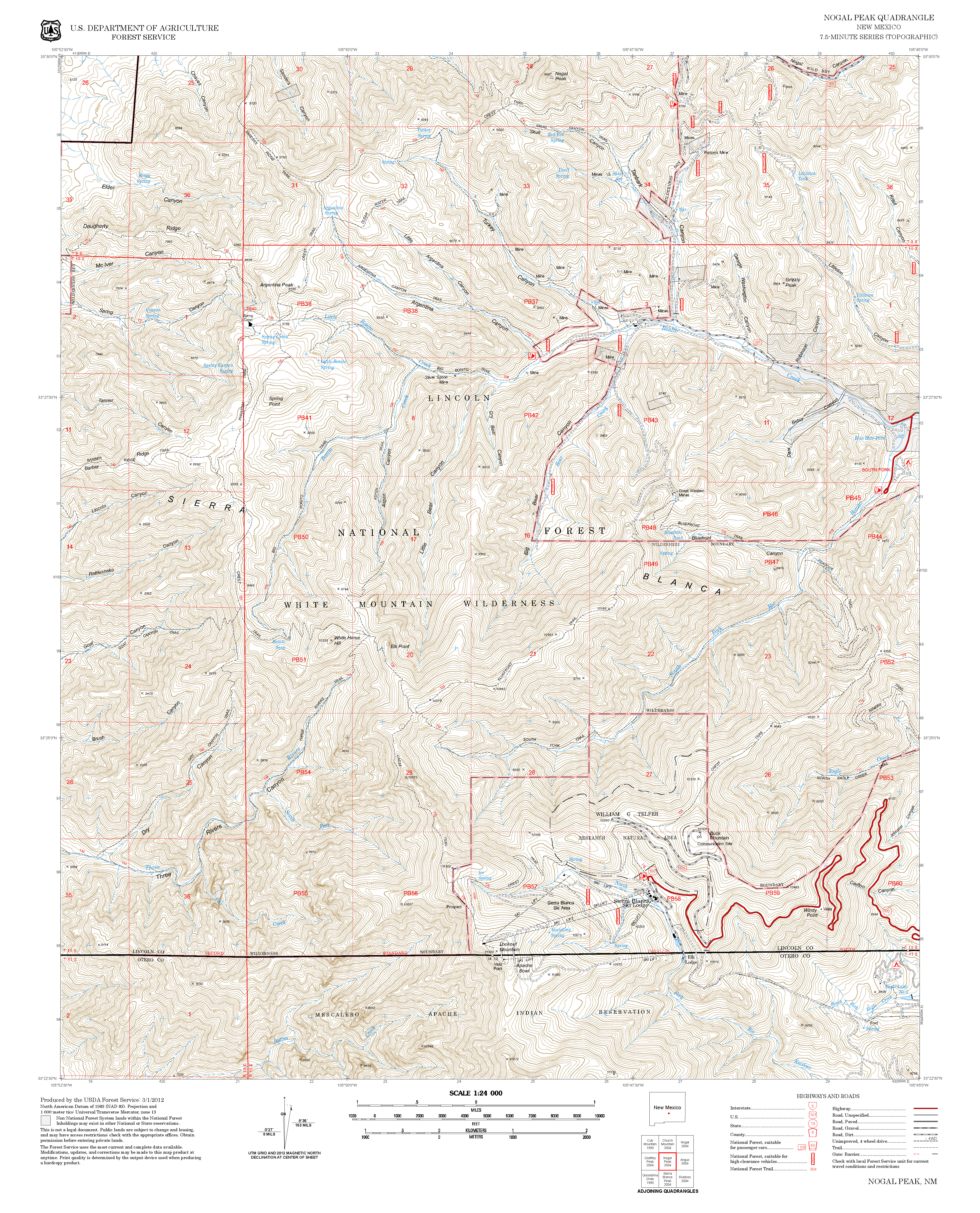
| In the map below, T25 Crest Trail is shown as a solid green line. Open trails are shown as dark gray lines, and closed trails are shown as red lines. The solid blue line is the border of the White Mountain Wilderness. | ||||||||||||||||||||||||||||
 | ||||||||||||||||||||||||||||
| LENGTH: 20.1 miles | |||||||||||||||||||||||||||
|
ELEVATION: 8700 - 11200 ft 2500 ft difference | ||||||||||||||||||||||||||||
| DIFFICULTY: Difficult | ||||||||||||||||||||||||||||
| SCENIC RATING: 5 | ||||||||||||||||||||||||||||
| Download Forest Service Resource | ||||||||||||||||||||||||||||
| Contour Interval: 40 feet White Mountain Wilderness Trails (34 MB) Nogal Peak Topo Map Angus Topo Map | ||||||||||||||||||||||||||||
| ||||||||||||||||||||||||||||
| The
following links are likely to useful in planning hikes involving T25.
They suggest camping places and describe the availability of water
along T25. http://www.ruidoso.net/visitors/outdoors/trailheads/crest-monjeau.html http://www.ruidoso.net/visitors/outdoors/trailheads/crest-nogal.html | ||||||||||||||||||||||||||||
DESCRIPTION: T 25 is the most scenic trail in Smokey Bear
Ranger District. Forming the backbone of
the White Mountain Wilderness Trail System, the lengthy, somewhat winding, yet
broad U‑shaped trail generally hugs or parallels a series of three connected
ridges. It provides scores of possibilities for incredible panoramic vistas of
the White Mountain Wilderness, Capitan Mountains, Tularosa Basin, Organ
Mountains, White Sands, Malpais Lava Beds, and the High Plains, plus
spectacular views down numerous side canyons.
Indeed, distant views could
include the Aldo Leopold Wilderness 110 miles to the west in Gila National
Forest, and the Santa Fe Mountains, over 150 miles to the north. However, haze or smog normally blocks these
views except on rare, very clear days. In addition to steep subalpine meadows,
the trail passes through mixed conifer and aspen stands, and grassy oak savannas.
Excellent wilderness camping possibilities exist at many locations. Side trails allow access to segments of T25, and thus hikers can have access to the marvelous views without hiking the entire trail. Those who wish to hike the entire length of T25 should allot three days for the hike, be in excellent physical condition, and plan not only for food and water but also for bad weather such as cold and thunder storms. ACCESS: To reach the southeastern T25 trailhead from Smokey Bear Ranger District Office in Ruidoso, drive NM48 north 4.2 miles to NM532, Ski Run Highway. Turn left on NM532 and follow the pavement 0.9 mile to Forest Road FR117, Monjeau Lookout Road. Turn right on FR117 and drive this partly graveled route 5.0 miles to a signed junction on the left for a short road leading to the T25 trailhead. | ||||||||||||||||||||||||||||
| LOCATION(S) OF ACCESS POINT(S) | ||||||||||||||||||||||||||||
| ||||||||||||||||||||||||||||
| ||||||||||||||||||||||||||||


