| Download T13 GPS Track (as .GPX) | Ruidoso Area Trails | ||||||||||||||||||||||||||
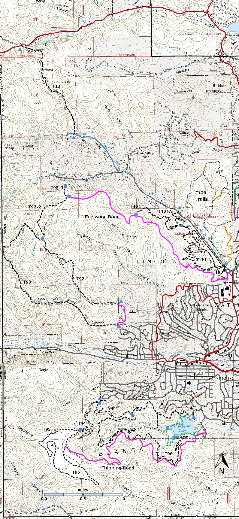
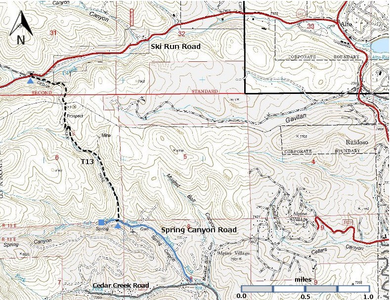
| T13 is shown as a black dashed line on the map. | ||||||||||||||||||||||||||||
 | ||||||||||||||||||||||||||||
| LENGTH: 1.7 miles | |||||||||||||||||||||||||||
|
ELEVATION: 7360 -7970 ft 610 ft difference | ||||||||||||||||||||||||||||
| DIFFICULTY: More Difficult | ||||||||||||||||||||||||||||
| SCENIC RATING: 2 | ||||||||||||||||||||||||||||
| Download Forest Service Resource | ||||||||||||||||||||||||||||
| Contour Interval: 40 feet Ruidoso Area Map Full Topo Map | ||||||||||||||||||||||||||||
| ||||||||||||||||||||||||||||
| DESCRIPTION: T13 is away from the developed portions of Ruidoso. Beginning at its lower, southern trailhead, the path follows a small, intermittent stream for the first 0.8 mile. At mile 0.5 from the trailhead, the official route makes a left turn at a trail junction; an unofficial path continues straight ahead into a narrow canyon with several closed mine entrances. After the left turn, T 13 eventually crosses a ridge and power line maintenance road at mile 1.2. The path is easy to follow and passes, in part, through a forest of white fir and southwestern white pine. Trail gradient is no higher than 25%, usually much lower. ACCESS: The southern T13 trailhead is reached from the intersection of Mechem Drive (NM48) and Cedar Creek Road (FR88) the location of Smokey Bear Ranger District Office in Ruidoso, by driving Cedar Creek Road 2.0 miles to the signed Spring Canyon Road. Turn right and follow the graveled road 0.8 mile to the signed Cedar Creek Trailhead on the right. Parking is available about 300 ft further along Spring Canyon Road. USE: Low. DISTANCE AND ALTITUDE: From the southern trailhead (7360 ft) the trail ascends 510 ft in 1.2 miles (8% gradient) to the ridge (7970 ft). It then descends 350 ft in 0.5 miles (13% gradient) to the northern trailhead (7620 ft). | ||||||||||||||||||||||||||||
| LOCATION(S) OF ACCESS POINT(S) | ||||||||||||||||||||||||||||
| ||||||||||||||||||||||||||||
| ||||||||||||||||||||||||||||


