|
DESCRIPTION:
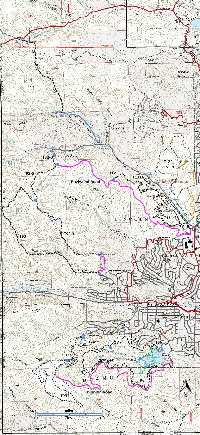
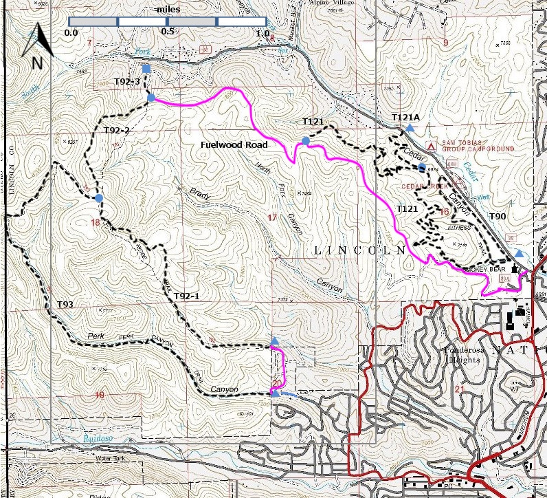
T121 Lower Cedar Creek Trail provides a serpentine, low-gradient trail –
popular with mountain bikers – that is easily accessible in Ruidoso. It begins just off Cedar Creek Road and, with
multiple switchbacks, ascends through canyons with very nice stands of
Ponderosa pines. As one reaches the
upper part of the trail there are nice views of Ruidoso and Sierra Blanca. One can hike up T121 (3.2 miles) and return east
along Fuelwood Road (2.2 miles) for a 6.5 mile loop hike. It is also possible to proceed west along
Fuelwood Road to trails T92 and T93.
USE: Moderate SEASON: Year-round, depending
on the weather
ACCESS:
To access the lower trailhead, begin at the intersection of NM48
(Mechem Drive) and Cedar Creek Road (FR88), the location of the Smokey Bear
Ranger District office in Ruidoso.
Drive 0.2 miles along Cedar Creek Road to a parking lot on the
left. Trail T90 Fitness Trail also
starts at this parking lot, and there are visible signs directing users to T90. Users of T121 Lower Cedar Creek Trail do not
fare so well. At the left side of the
parking lot – SE corner – there is a barbed wire gate. There is no sign saying T121, but there are
blue diamond signs on tree to indicate that the trail is open for biking. This is the lower trailhead for T121. Go through the gate and close it behind you.
You may want to spend some time at the hiker kiosk at the start of T90. There is a nice map showing the trails in the
area.
It is not possible to drive to the upper trailhead. Immediately behind the Smokey Bear Ranger
District office, there is an unlabeled service road, shown on some maps as
Fuelwood Road. It is closed to non-FS
vehicles, but it is okay to hike 2.2 miles up Fuelwood Road to its junction
with T121. There are no signs at the
junction of T121 and Fuelwood Road, but there is a cairn on the north
side of Fuelwood Road. The saving grace
is that there are no other trails leading to the north off of Fuelwood Road in
this vicinity. By this time, you are
probably thinking that you should hike up T121 and return by Fuelwood Road!
DISTANCE AND ALTITUDE:
T121 ascends 520 feet in 3.2 miles, with an average gradient of 3%.
| 


