| Download T120A GPS Track (as .GPX) | Ruidoso Area Trails | ||||||||||||||||||||||||||
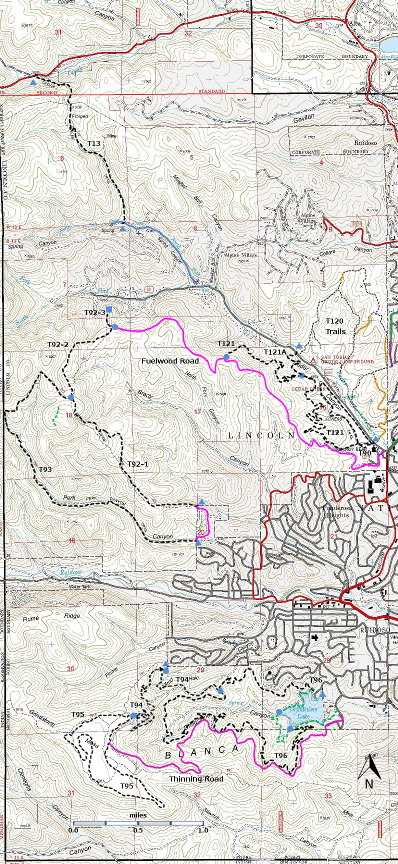
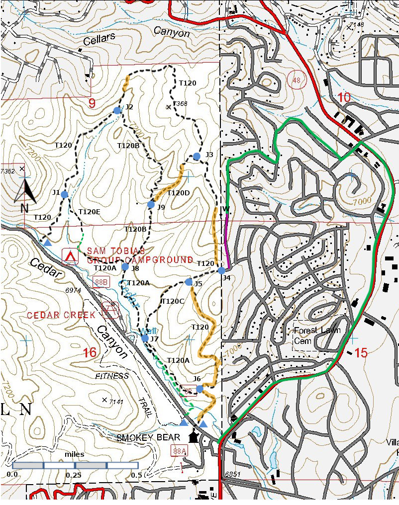
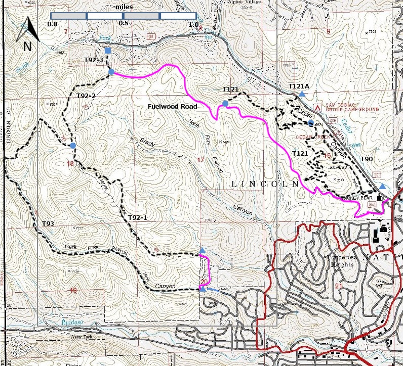
| T120, T120A, T120B, T120C, T120D, and T120E are shown as black dashed lines on the map. | ||||||||||||||||||||||||||||
 | ||||||||||||||||||||||||||||
| LENGTH: 0.9 miles | |||||||||||||||||||||||||||
|
ELEVATION: 6930 -7020 ft 90 ft difference | ||||||||||||||||||||||||||||
| DIFFICULTY: Easiest | ||||||||||||||||||||||||||||
| SCENIC RATING: 1 | ||||||||||||||||||||||||||||
| Download Forest Service Resource | ||||||||||||||||||||||||||||
| Contour Interval: 40 feet Ruidoso Area Map Full Topo Map | ||||||||||||||||||||||||||||
| ||||||||||||||||||||||||||||
| Note:
The Spaghetti Bowl trails are between the north side of the Sam
Tobias Campground and the surrounding built up areas of Ruidoso.
They may have begun as informal trails, some following old
logging roads. Since about 2100, there has been intensive
thinning of the forest in this area in order to minimize fire danger to
the surrounding areas. As of the end of 2013 the thinning seems
to be ending. There is a lot of forest debris, which will decay
in the next few years. It is likely that , with the thinning
ending, the Forest Service will work on improving the trails and
providing signage. Even without signage, you should not get seriously lost. Head downhill and you will come to the Sam Tobias campground along Cedar Creek Road. | ||||||||||||||||||||||||||||
| LOCATION(S) OF ACCESS POINT(S) | ||||||||||||||||||||||||||||
| ||||||||||||||||||||||||||||
| ||||||||||||||||||||||||||||


