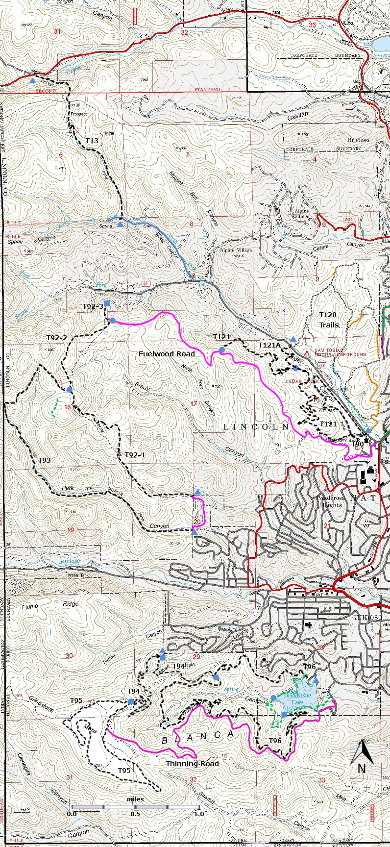
DESCRIPTION:
T120A is the near-to-campground, gentle, walk-along the edge of the
campground trail. In contrast, T120 is the get-to-the-ridge and see
wonderful views of the Ruidoso area and Sierra Blanca trail. Right now it is good, but when it is fully
improved and the signage is in place, it will be a very nice hike.
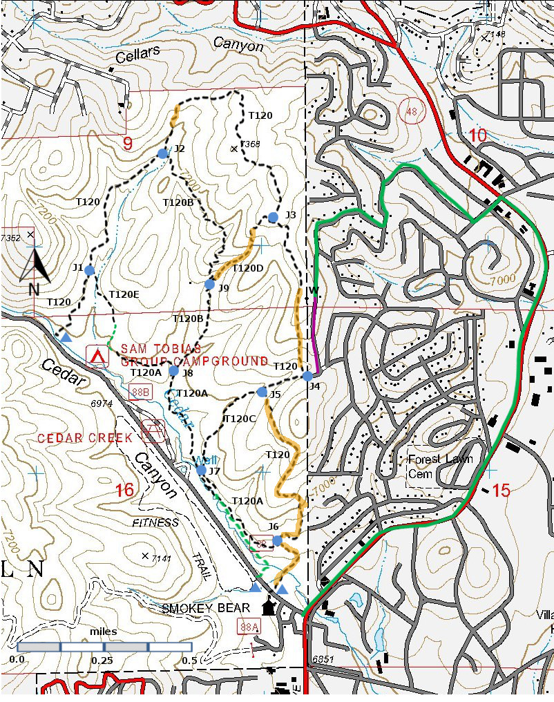
CLOCKWISE: T120 starts near the northwestern end of the Sam Tobias campground,
and the initial path around the campground merges into an old road. At mile 0.7 from the trailhead there is a
junction with T120B [J2]. Continue
straight on 0.1 mile. The old road bends
to the left, but the trail (no path) continues straight ahead. Scramble up the hill and in approximately 50
yards, you will find a foot path. Turn
right and follow the path which ascends to a ridge with a Ponderosa forest and
many beautiful views of Ruidoso and Sierra Blanca. There are side trails in this area, so keep
your course toward the large tan water tank [W]. At mile 1.7 you should reach a house with a
green chain link fence. At this point,
you should make a choice. The official trail continues straight ahead,
and leads to a tempting trail downhill to the right. Ignore this trail and work slightly to the
left in order to find the official trail due south of the middle of the water
tank. This trail is rough and leads
straight down the ridge. The better
choice, at the green chain link fence, is to work to the left onto Catron Road
and follow it past the water tank and downhill to the saddle where it bends
left [J4]. Turn right on an old road.
and you are soon back on the official trail.
After 0.1 miles along this road, the official trail bends up hill [J5] – don’t worry about not finding it – there is
not a well-defined path. The better plan
is to follow the old road, now T120C, back to the campground area.
From [J5] back to Cedar Creek Road, T120 is difficult to follow. Hopefully, the Forest Service will improve
this route, but for now, that portion of T120 is a task with few rewards.
COUNTERCLOCKWISE: If you have a “designated
(trail) driver” -- someone who drives but does not hike -- there is a better
way to enjoy T120. Look for the solid
green line on the map. This route
enables the driver to drop you off at the water tower [W], the high point (almost)
on T120. If you walk T120 counterclockwise,
past the green chain link fence and along the ridge, you get all the fine
views. When you come to the point where
T120 goes downhill to the old road, just look down to the road and pick a
route. This is a much easier hike (1.7 miles), and
this way avoids the frustrations of the poorly-defined eastern portion of
T120. See the ACCESS section for
instructions on how to drive to the water tower.
ACCESS:
Southeastern Trailhead: From the
intersection of Mechem Drive (NM48) and Cedar Creek Road (FR88) drive along
Cedar Creek Road 0.1 miles to a small parking lot on the right. T120 starts at the back of this parking lot.
Caution: At present, there is not
a well- defined path. Look for other
ways to hike T120.
Northwestern Trailhead: From the intersection of Mechem Drive (NM48)
and Cedar Creek Road (FR88) drive along Cedar Creek Road 1.0 miles to the
northwestern end of the Sam Tobias campground.
T120 starts just north of the entrance.
Water Tower: From the
intersection of Mechem Drive (NM48) and Cedar Creek Road (FR88) drive north along
Mechem Drive 1.5 miles and turn left onto White Mountain Road. Drive two blocks and turn right onto Skylane
Road. Follow Skylane Road as it bends
left. At the intersection with Coconino
Lane, turn left. At the intersection
with Angeles Drive, turn right. At the
intersection with Catron Road, turn left, and follow Catron Road straight to
the water tank.
| |


