DESCRIPTION:
T68E makes its way across the tableland and descends gradually toward
the east. T68E follows part of the old Seven Rivers wagon road that provided access to the
tableland in Guadalupe Ranger District prior to the construction of NM137, and
that wagon road – now very faint or disappeared – would have continued east
to the current US 285.
The old road crosses pinyon-juniper woodland and road
bends slightly to the northeast and then back to the
southeast. The unmarked trailhead for T68E is near the
point at which the well-defined old road again bends toward the
northeast. If you follow the old road, you can have a pleasant
hike down to a tan water tank. At this time, if you wish to
follow T68E, across rocky land and through scrub, I recommend that you
download the GPS track (upper right corner) and use that as a
route. The trail is faint at best. The official end of T68E
is at the Forest boundary.
ACCESS:
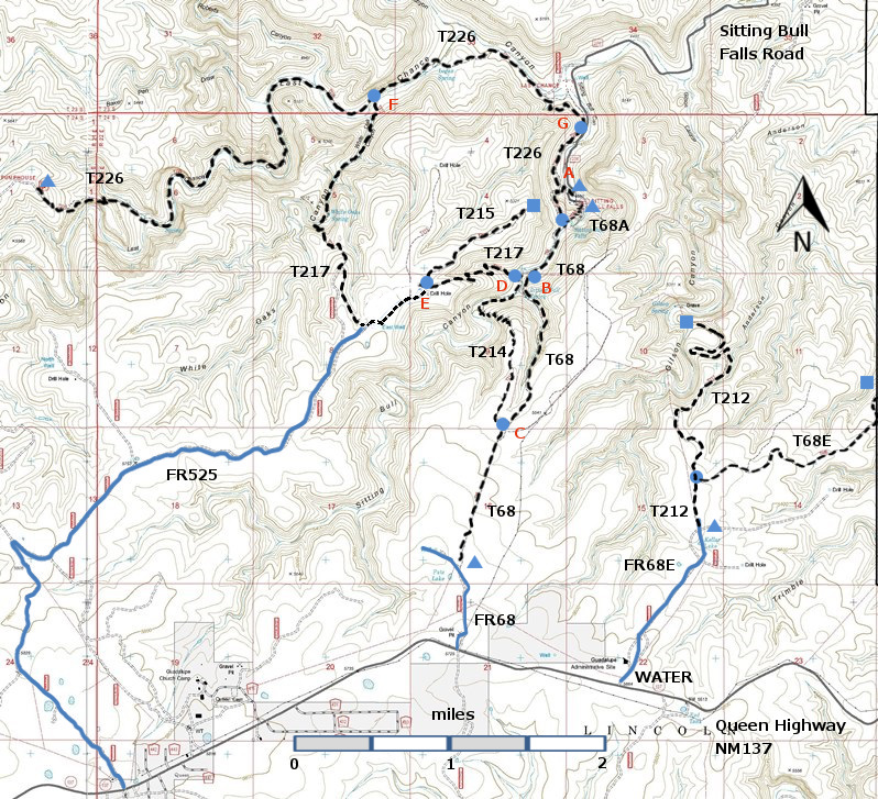
To reach the junction
of T68E with T212, take US285 northwest from Carlsbad (about 12 miles) to 0.6
mile beyond milepost 45 at its junction with NM137, Queen Highway. Turn left
and follow the paved road 32 miles to milepost 22. Then look for a turnoff (north) to Guadalupe
Ranger District Administrative Site and the public water hydrant. This is FR68E. After crossing the cattle guard, there is a
old 68E sign for a dirt road. Ignore this
road; it is in bad shape. Continue along
the west side of the admin buildings, past the service area to a barbed wire
gate. The trailhead for T212 is 1.1
miles along FR68E from NM137, just past a cattle guard. Hike T212 0.3 miles to the primitive road leading east. Hike along this primitive road 0.3 to the unmarked trailhead for
T68E. | 


