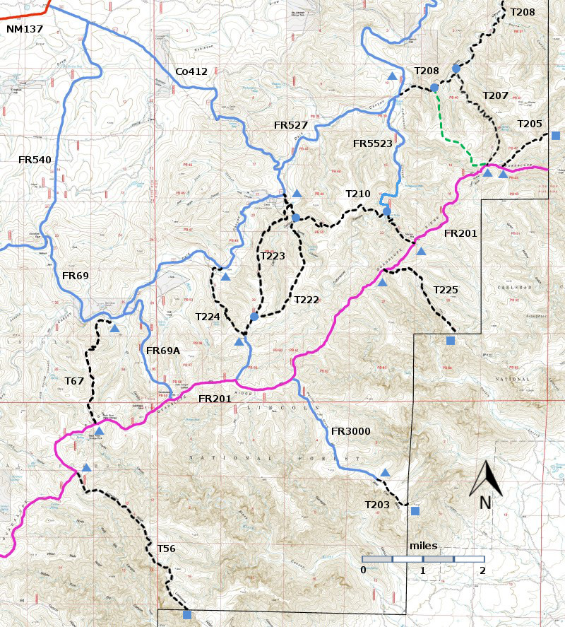
DESCRIPTION:
I
have not hiked T67, but I have been told that it is similar to T222, particularly
at its upper end. Starting from the
lower trailhead T67 ascends, in 0.7 miles, to a long ridge. The remainder of the trail follows along this
ridge. T222, which had only light
burning in the 2011 Ridge Fire, retains typical pinyon-juniper woodlands, with occasional
burned trees. There are open views of
the surrounding ridges, Even without
recent fires, in these arid uplands, these ridges may have few trees. T67 does not go to Black River Spring, which is across FR201.
ACCESS:
To
reach the lower trailhead for T67, take US285 northwest from Carlsbad (about 12
miles) to 0.6 mile beyond milepost 45 at its junction with NM137, Queen
Highway. Turn left and follow the paved road 32 miles to milepost
20. Continue along NM137 6.5 miles to the turnoff (left) for FR540
(which may also be signed as Klondike Gap Road). FR540 is a very good
gravel road. Follow it 4.3 miles to its intersection with FR69. Turn left and follow FR69 2.0 miles to the signed
T67 trailhead on the right.
To
reach the upper trailhead for T67, continue on FR69 0.3 miles to its junction
with FR69A. Turn right and follow FR69A
2.3 miles to its junction with FR201.
The upper trailhead for T67 is 1.3 miles west along FR201. FR201 is considered impassable for most high
clearance 4WD vehicles. | 


