DESCRIPTION:
In
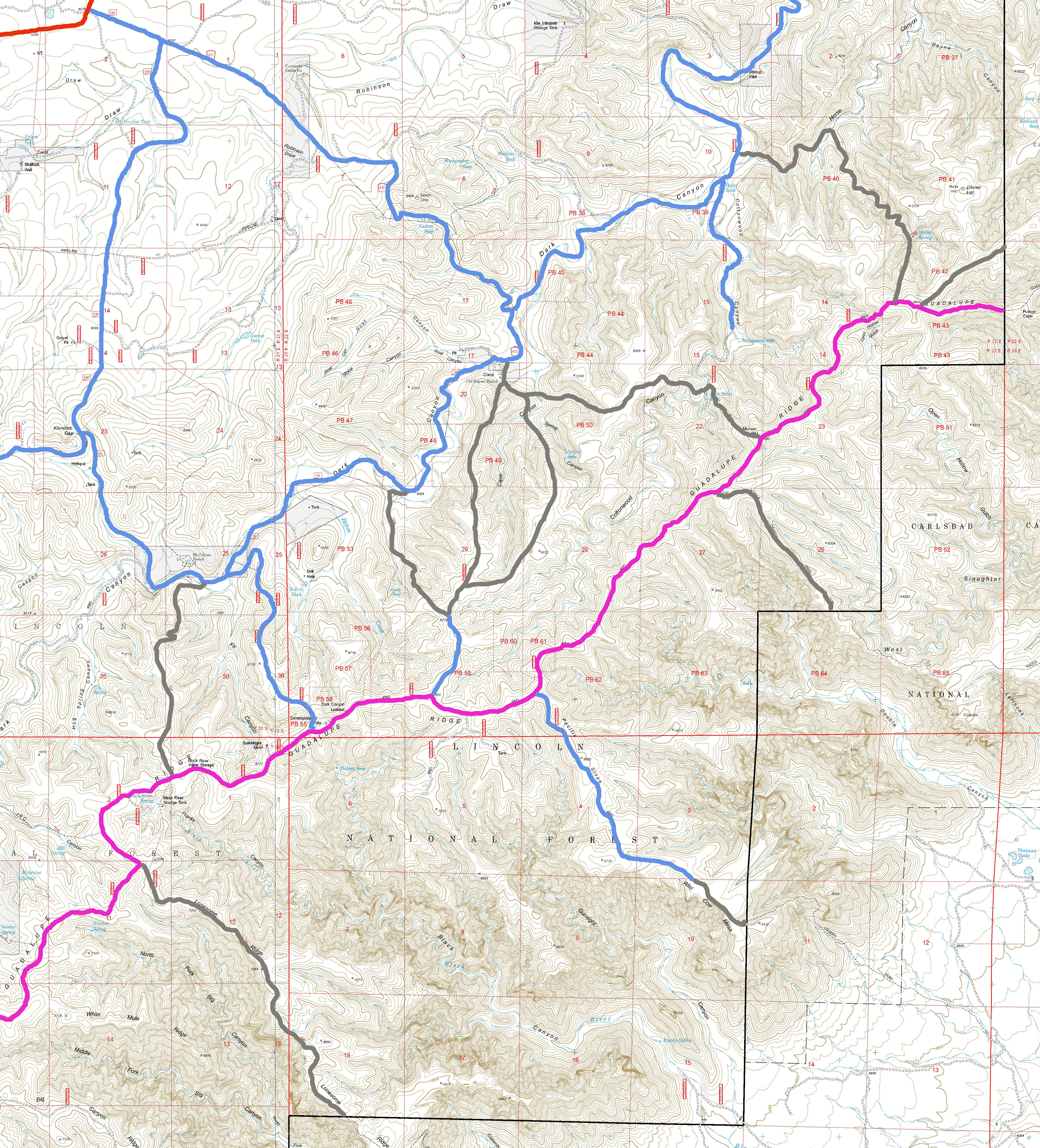
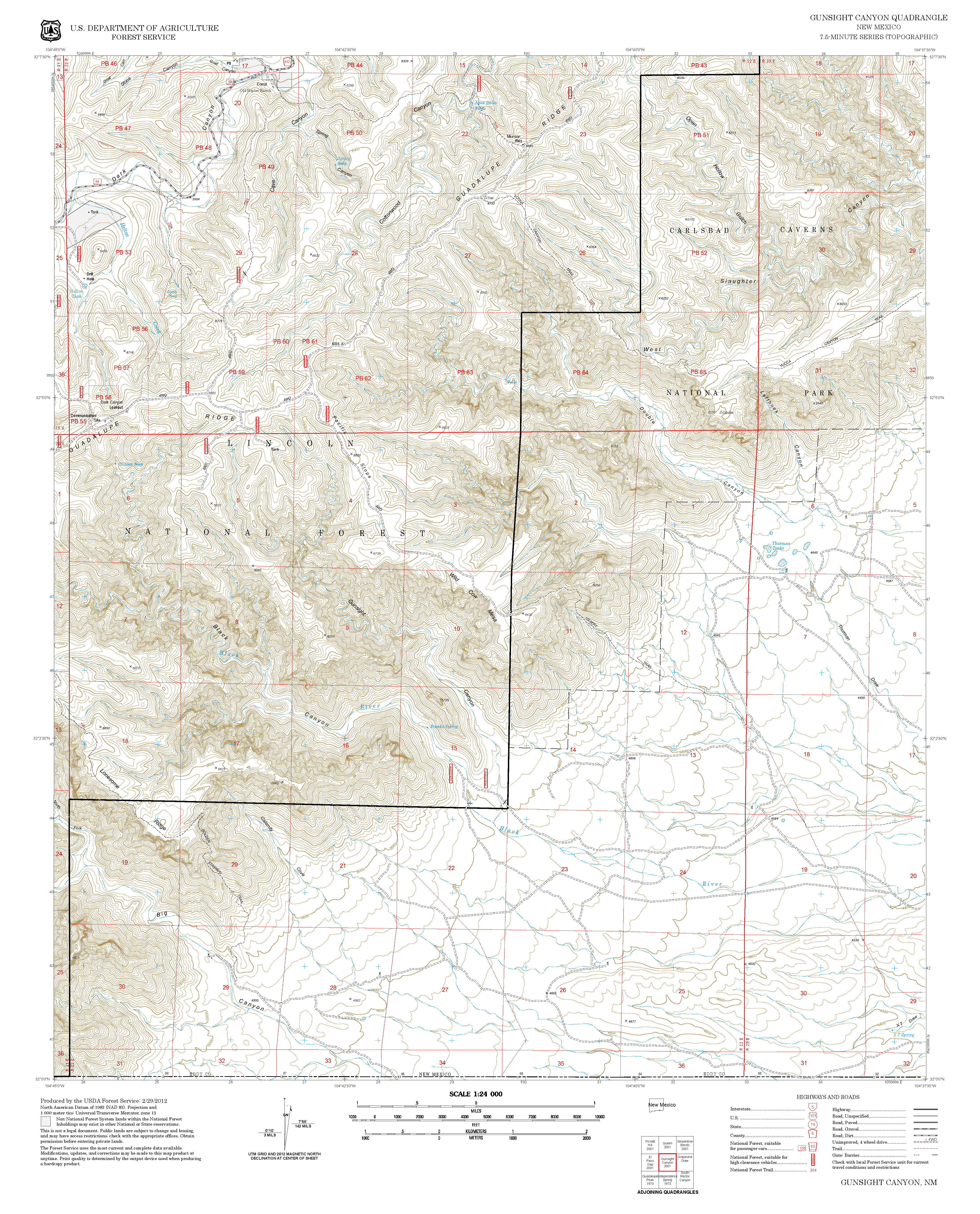
the National Park, the extension of T56 is labeled as the “Golden Staircase”,
a historic name. The trail zig-zags and
is not accurately represented by the Forest Service GPS track. The scenic views are probably not worth the
effort required to access and hike this trail.
ACCESS:
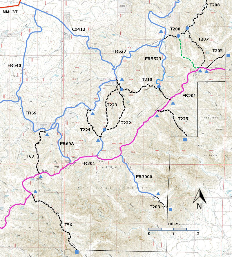
To reach T56, take US285 northwest from Carlsbad (about
12 miles) to 0.6 mile beyond milepost 45 at its junction with NM137, Queen
Highway. Turn left and follow the paved road 32 miles to milepost
20. Continue along NM137 6.5 miles to the turnoff (left) for FR540
(which may also be signed as Klondike Gap Road). FR540 is a very good
gravel road. Follow it 11.6 miles to its intersection with FR201. The upper
trailhead is 2.9 miles from the western end of FR201 and 2.6 miles from the
junction of FR69A and FR201. FR201 is considered impassable for most high
clearance 4WD vehicles. T56 begins at FR201
and descends to the boundary between the Guadalupe RD and Carlsbad Caverns
National Park. At present, access
through the National Park is uncertain and users who wish to access the lower
end of T56 should contact the National Park for that information.
| 


