| Download T223 GPS Track (as .GPX) | |||||||||||||||||||||||||||
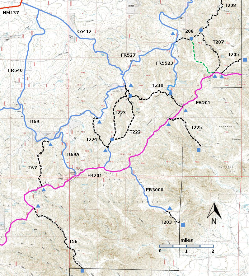
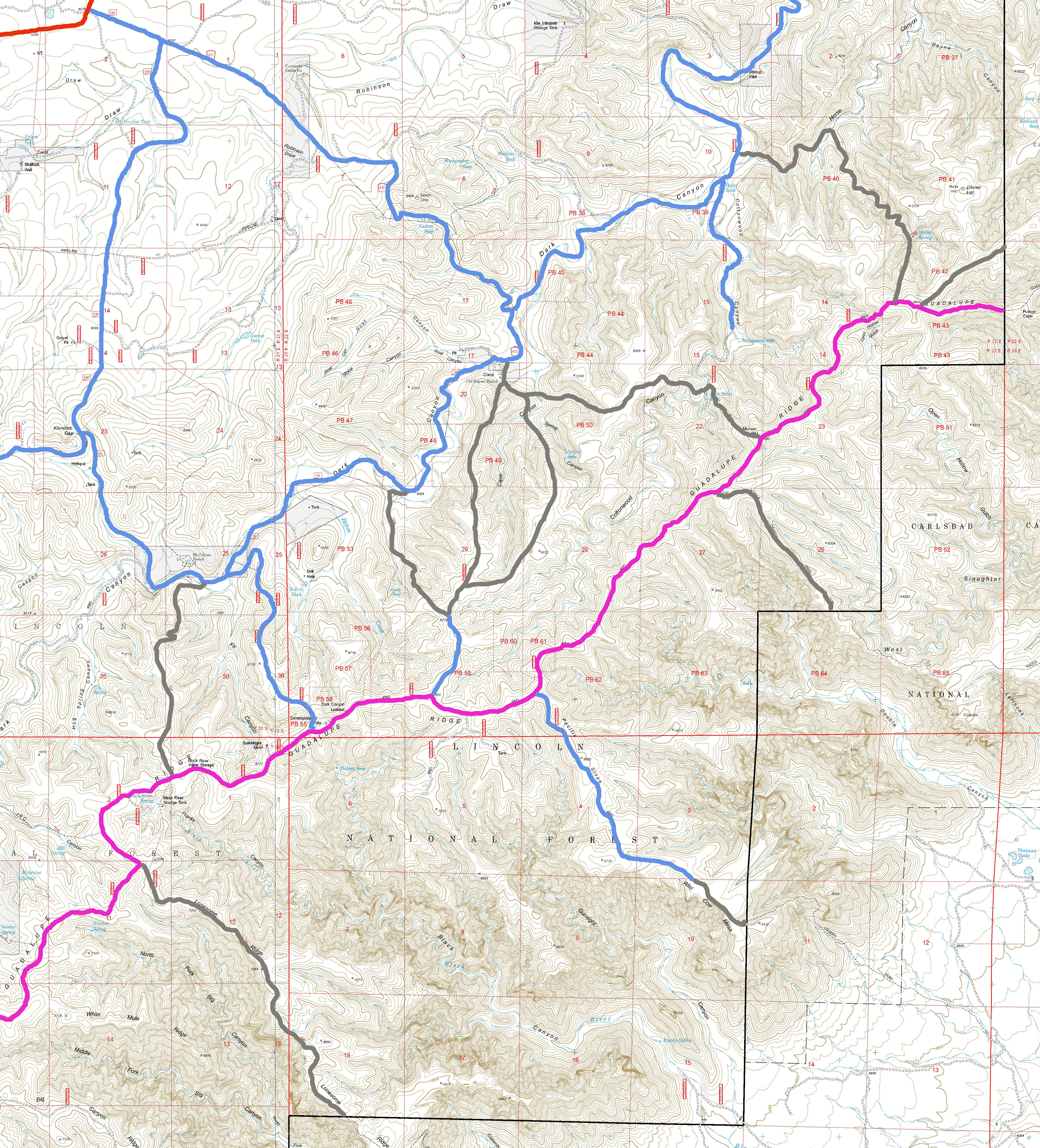
| T56, T67, T203, T205, T207, T208, T210, T222, T223, T224, and T225 are shown as black dashed lines on the map. FR201, shown in magenta, is considered to be impassable for most 4WD high clearance vehicles. | ||||||||||||||||||||||||||||
| LENGTH: 2.4 miles | |||||||||||||||||||||||||||
|
ELEVATION: 5800 - 6720 ft 920 ft difference | ||||||||||||||||||||||||||||
| DIFFICULTY: Moderate | ||||||||||||||||||||||||||||
| SCENIC RATING: 2 | ||||||||||||||||||||||||||||
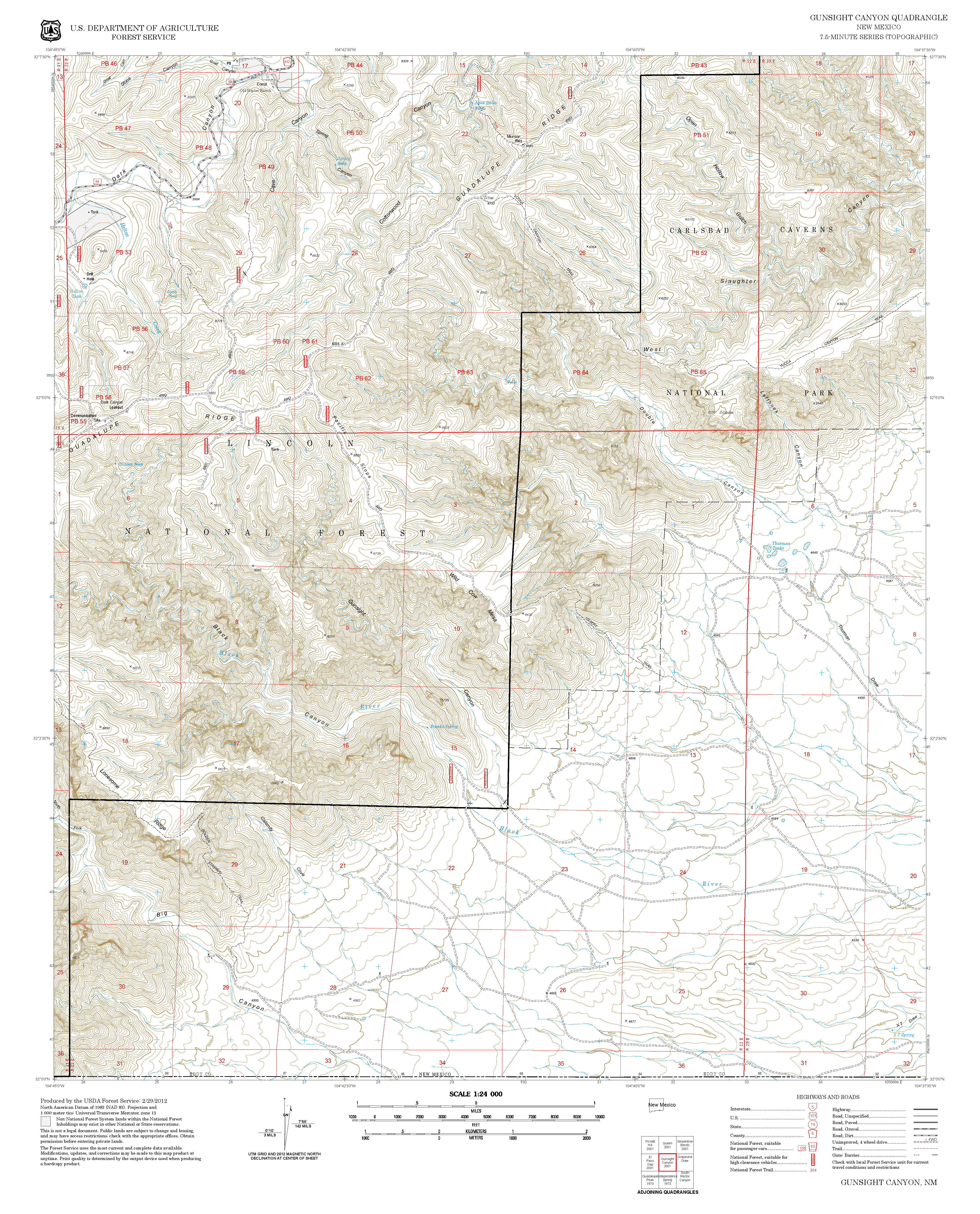
| Contour Interval: 40 feet Area Map (13 MB) Gunsight Canyon Topo Map | ||||||||||||||||||||||||||||
| ||||||||||||||||||||||||||||
DESCRIPTION: To
access the lower end of T223, follow the instructions for access to T222. The carsonite sign for T223 is past the green
gate, about 300 feet further along T222, just across the draw. | ||||||||||||||||||||||||||||
| LOCATION(S) OF ACCESS POINT(S) | ||||||||||||||||||||||||||||
| ||||||||||||||||||||||||||||
| ||||||||||||||||||||||||||||


