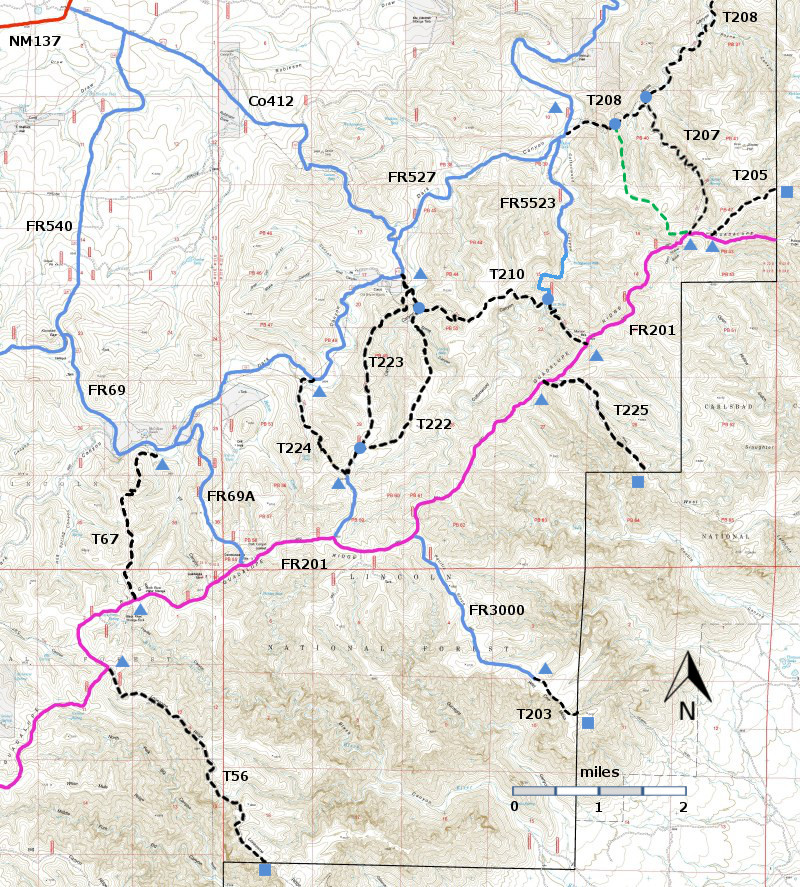
DESCRIPTION:
The
first segment of T208 makes use of seven switchbacks to climb out of
the canyon
bottom. The trail is well marked with cairns and hiker
signs, but there is no carsonite sign at the eastern end. The western
trailhead is at 5560 ft, the saddle 5880 ft and the eastern trailhead
5240 ft.
A
loop hike consisting of a part of T208, T207, T205, and return via the
connector [See T207 write up.] provides a hike that ascends, with switchbacks
from the canyon bottom along a ridge to FR201.
T205 itself has an easy gradient along a high ridge. Views of the surrounding canyon country
become available once T207 climbs out of the canyon.
ACCESS:
To
reach T208, take US285 northwest from Carlsbad (about 12 miles) to 0.6 mile
beyond milepost 45 at its junction with NM137, Queen Highway. Turn left and
follow the paved road 32 miles to milepost 20. You may want to look
for a turnoff on the north side of the road to Guadalupe Ranger District
Administrative Site and the public water hydrant. Continue along NM137 6.5 miles to the turnoff
(left) for FR540 (which may also be signed as Klondike Gap Road). FR540
is a good gravel road. Follow it 0.7 miles to its intersection with FR69 (same
as Co 412 and Cougar Road). Take the
left fork and follow FR69 4.5 miles to its junction with FR527 on the
left. Pass through the barbed wire gate
and close it. Drive 2.7 miles along
FR527 to the signed trailhead for T208.
Pass through the barbed wire gate and close it. Angle to the left to start on T208.
FR527
requires a 4WD high clearance vehicle.
It crosses the stream bed several times.
In one section, the road bed has eroded into a Vee, and the sides of the
Vee will be slick when the soil is damp.
Do not attempt to drive FR527 unless it is dry.
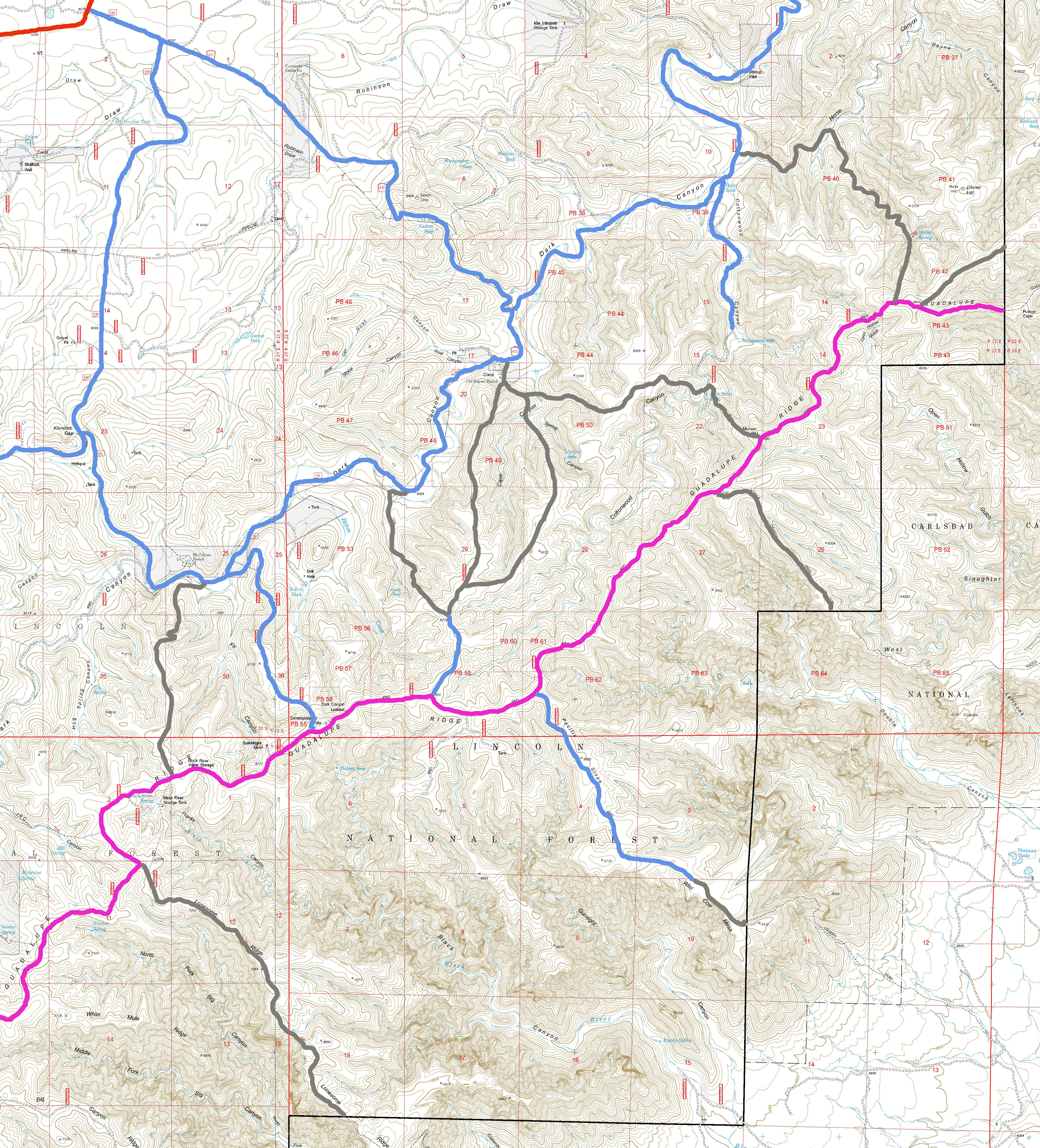
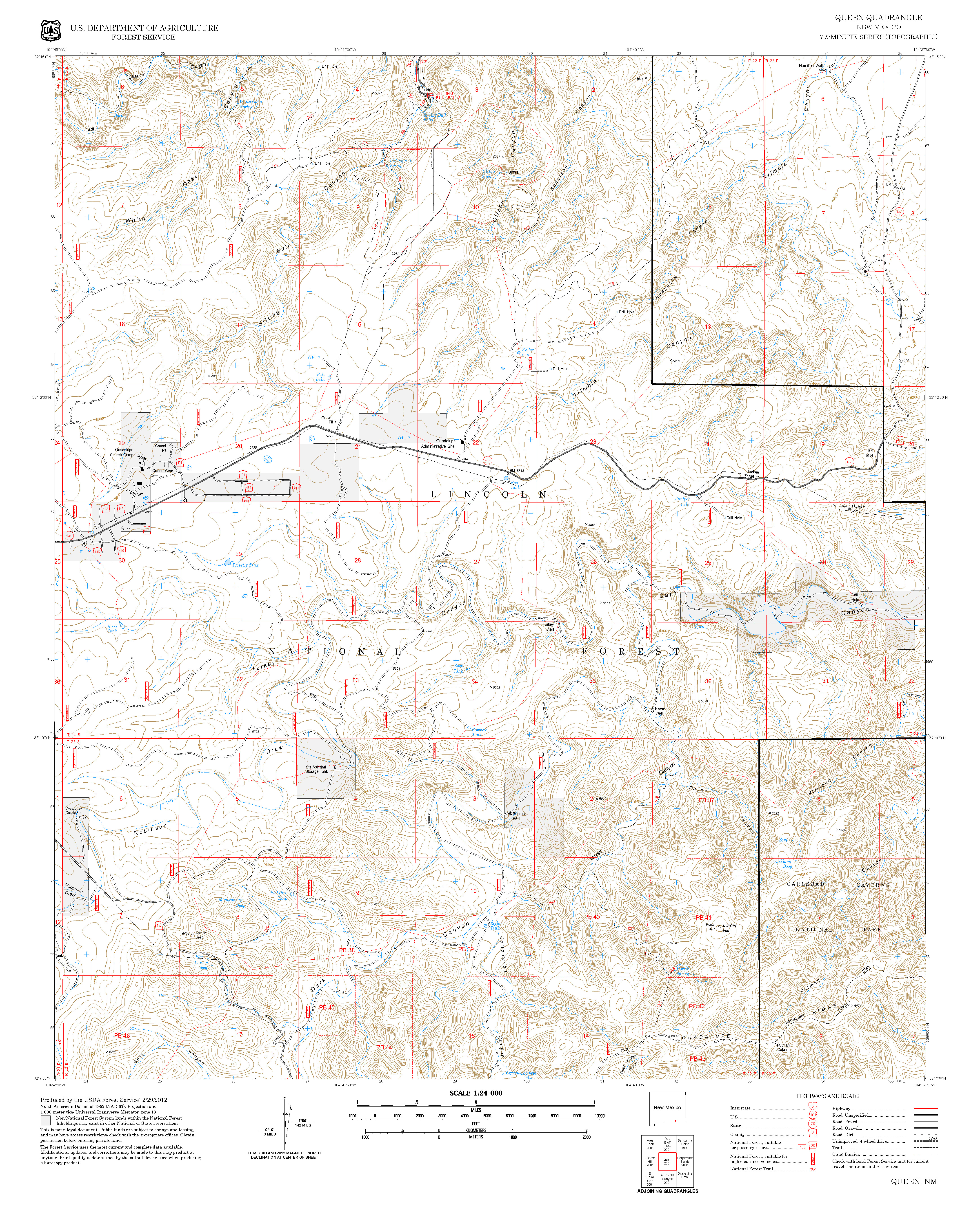
The
present T208 is a truncated version of the former T208, which is shown on the
Queen topo map. The full 3.3 miles length
of the former T208 is well-signed and can be followed. To reach the eastern trailhead of the former
T208, drive an additional 5.0 miles from the western trailhead along
FR527. When the Horse Well windmill
comes into view, do not drive to it, but rather continue along a primitive road
into a primitive camping area. Walk
ahead to the trailhead. No carsonite
sign is present, but there are adequate hiker signs and cairns.
For
those using T208 to connect to T205, hike T208
to T207, beginning at the western trailhead of T208 on
FR527. The
upper end of T208 is at FR201
and the trailhead for T205 is 0.2 miles east along FR201. An
alternative is to hike along T208 to the connector [See the
T207 write up] and use it to ascend to FR201. | 


