| Download T207 GPS Track (as .GPX) | |||||||||||||||||||||||||||
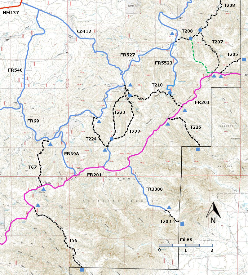
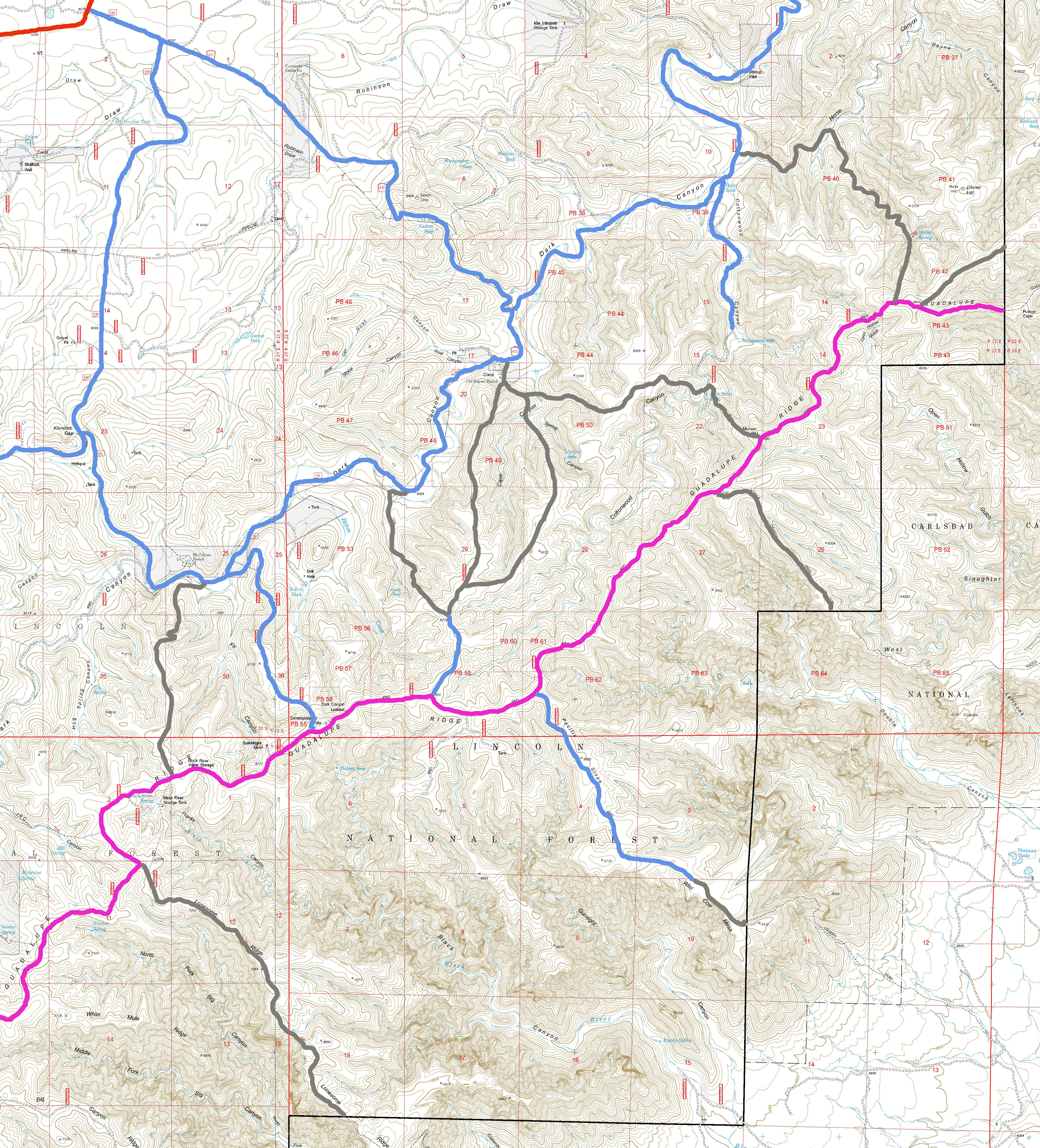
| T56, T67, T203, T205, T207, T208, T210, T222, T223, T224, and T225 are shown as black dashed lines on the map. FR201, shown in magenta, is considered to be impassable for most 4WD high clearance vehicles. | ||||||||||||||||||||||||||||
| LENGTH: 2.1 miles | |||||||||||||||||||||||||||
|
ELEVATION: 5520 - 6600 ft 1080 ft difference | ||||||||||||||||||||||||||||
| DIFFICULTY: Moderate | ||||||||||||||||||||||||||||
| SCENIC RATING: 2 | ||||||||||||||||||||||||||||
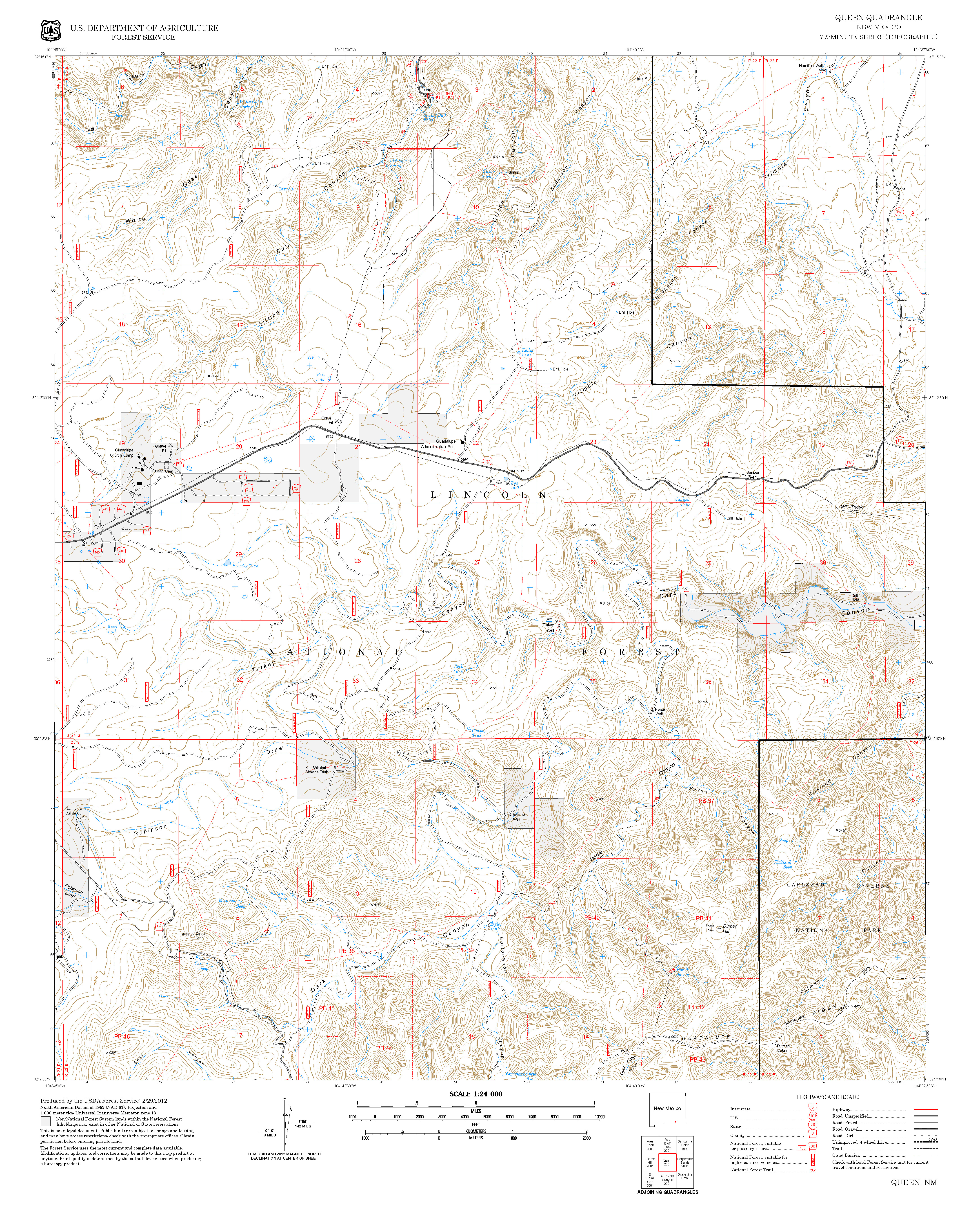
| Contour Interval: 40 feet Area Map (13 MB) Queen Topo Map | ||||||||||||||||||||||||||||
| ||||||||||||||||||||||||||||
DESCRIPTION: Down load GPS track for Connector as .gpx.
FR527 requires a 4WD high clearance vehicle. It crosses the stream bed several times. In one section, the road bed has eroded into a Vee, and the sides of the Vee will be slick when the soil is damp. Do not attempt to drive FR527 unless it is dry. | ||||||||||||||||||||||||||||
| LOCATION(S) OF ACCESS POINT(S) | ||||||||||||||||||||||||||||
| ||||||||||||||||||||||||||||
| ||||||||||||||||||||||||||||


